William H. Natcher Parkway
| |
|---|---|
| Route information | |
| Length: | 70.184 mi[1] (112.950 km) |
| Major junctions | |
| South end: |
|
| |
| North end: |
|
| Location | |
| Counties: | Warren, Butler, Ohio, Daviess |
| Highway system | |

The William H. Natcher Green River Parkway is a limited-access freeway from Bowling Green to Owensboro in the US state of Kentucky. The Natcher is one of nine highways that are part of Kentucky's parkway system. Conceived as the "Owensboro–Bowling Green Parkway," it was instead named the Green River Parkway when it opened on December 15, 1972. It received its current name in 1994 following the death of William H. Natcher, a United States Congressman who represented the Second District of Kentucky for three decades. Natcher is best known for his record-setting string of 18,401 roll call votes, even being wheeled in on a hospital gurney to vote shortly before his death.
The Natcher Parkway was a toll road from its opening until November 21, 2006.
In 2006, the old and new names were combined into the current name, in order to be consistent with most of the Commonwealth's other parkways, all of which (except for the Audubon Parkway) had their original names changed in the same manner to honor various Kentucky politicians. However, the newly designed marker signs that were installed on the Natcher Parkway in the summer of 2006 do not bear the words "Green River."
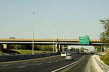
The parkway begins at an interchange with US Route 231 (US 231) south of Interstate 65 (I-65, exit 20) near Bowling Green. It travels along the west side of the city in a northwesterly direction, through rolling farmlands and near coal mines, for 72.184 miles (116.169 km) before meeting its northern terminus at an interchange with U.S. Route 60 in Owensboro. At exit 43, the parkway intersects with the Wendell H. Ford Western Kentucky Parkway, the longest and oldest road in the state's parkway system. The Natcher Parkway bypasses the cities of Morgantown, Beaver Dam and Hartford. The parkway carries the unsigned designation of Kentucky Route 9007 (WN 9007).[2]
History

Toll removal
On November 21, 2006, toll plazas on the Natcher were removed. Prior to their removal, toll plazas were located at Exit 7 (Current Exit 9)/Bowling Green (through cars 50 cents), Exit 34 (Current Exit 36)/Morgantown (40 cents), and Exit 48 (Current Exit 50)/Hartford (60 cents). Motorists travelling between the I-65 exit and Exit 7 in the Bowling Green area were not charged toll.
The Natcher and the nearby Audubon Parkway, were the last two roads in the Kentucky parkway system to have their tolls removed. Under Kentucky law, toll roads cease toll collection once their construction bonds are paid, either by collected tolls or other sources.
Interstate 66
The East-West Trans America Highway was proposed in the ISTEA of 1991 and was narrowed down to the I-66 Southern Kentucky Corridor in the National Highway Designation Act of 1995:
In 1995, the National Highway System Designation Act amended Section 1105 (c) (3) of ISTEA and in Kentucky listed I-66 as centered on the cities of Pikeville, Jenkins, Hazard, London, Somerset, Columbia, Bowling Green, Hopkinsville, Benton and Paducah. The Southern Kentucky Corridor (I-66) would connect with the proposed King Coal Highway (also called I-73 / 74 North-South Corridor) in West Virginia as listed in Section 1105 (c) (5) in ISTEA (1991).
The preferred I-66 route followed U.S. 68 between Bowling Green and Hopkinsville, however the I-66 "spur" along the Natcher Parkway eventually entered the highway plans. The Kentucky Transportation Cabinet finished its feasibility study of the I-66 project in 2005 and concluded that I-66 was not cost beneficial for the foreseeable future to justify its construction or any further study, thereby cancelling the state of Kentucky's participation in the I-66 project. The only remaining study of I-66 was conducted under the Federal Highway Administration and the Illinois Department of Transportation under the 66 Corridor Study, a Tier 1 Environmental Impact Study. This study was cancelled August 6, 2015 by the Illinois Department of Transportation and subsequently the FHWA announced the cancellation of the Tier 1 Environmental Impact Study in the Federal Register, ending the last I-66 project and therefore officially cancelling the I-66 Trans America Highway.
Future
Interstate 565
| |
|---|---|
| Location: | Owensboro–Bowling Green, Kentucky |
Although I-66 has been officially cancelled, the conversion of the William H. Natcher Parkway to a spur from I-66 created in the Safe, Accountable, Flexible, Efficient Transportation Equity Act: A Legacy For Users (SAFETEA-LU) was redefined to become a spur of I-65 in the Fixing America's Surface Transportation (FAST).[3]
Interstate 67
The William Natcher Parkway is part of the Interstate 67 concept proposed by the I-67 Development Corporation, an association of local businessmen in the Owensboro area advocating the building of a new Interstate from I-65 in Bowling Green to I-69 in Washington, Indiana. The city of Owensboro, Daviess County Fiscal Court, Greater Owensboro Economic Development Corporation and Greater Owensboro Chamber of Commerce support the I-67 concept. The Kentucky Transportation Cabinet (KYTC) and the Indiana Department of Transportation (INDOT) have never proposed building I-67 nor endorse the specific concept proposed by the I-67 Development Corporation. KYTC has little interest because the route involves building a new Ohio River Bridge that would be entirely the financial responsibility of the KYTC, and has given high priority to build and complete the Ohio River bridges for I-65/I-265 in Louisville, I-75 between Covington and Cincinnati, Ohio, and I-69 between Henderson and Evansville, Indiana. The only possible way for the I-67 concept to become a reality is if Congress were to create the Indiana section as an Interstate Corridor, and that will only occur if the Indiana Congressional delegation propose the Federal legislation. KYTC already plans to convert the Natcher Parkway to I-565 instead as already provided in the 2015 FAST Act, so this issue of changing this plan to I-67 would have to be resolved within the Kentucky government first, which would need to work with the Kentucky Congressional Delegation also.
Exit list
| County | Location | mi[1] | km | Exit | Destinations | Notes |
|---|---|---|---|---|---|---|
| Warren | Bowling Green | 0.000 | 0.000 | |||
| 1.5 | 2.4 | 1 | ||||
| 2.5 | 4.0 | 2 | Signed as exits 2A and 2B | |||
| 5.572 | 8.967 | 6 | To Western Kentucky University | |||
| 6.969 | 11.216 | 7 | ||||
| 9.422 | 15.163 | 9 | ||||
| Butler | Morgantown | 28.147 | 45.298 | 28 | ||
| 29.428 | 47.360 | 29 | ||||
| | 35.845 | 57.687 | 36 | |||
| Ohio | | 43.270 | 69.636 | 43 | Signed as exits 43A and 43B | |
| Hartford | 49.796 | 80.139 | 50 | |||
| Daviess | Owensboro | 72.184 | 116.169 | 72 | Signed as exits 72A and 72B; northbound only; to Ben Hawes Golf Course and Park | |
| 1.000 mi = 1.609 km; 1.000 km = 0.621 mi | ||||||
References
- 1 2 "Kentucky Transportation Cabinet — Division of Planning — Highway Information System Official Milepoint Route Log Extract". Retrieved April 8, 2007.
- ↑ Rand McNally. The 2014 Road Atlas (Map), p. 42.
- ↑ "Six Year Highway Plan" (PDF). Kentucky Transportation Cabinet. pp. 16, 30. Retrieved July 17, 2016.
External links
- Official Kentucky Transportation Cabinet website with information and toll schedules for the Natcher Parkway
- KentuckyRoads.com — William H. Natcher Parkway
- Exit Guide for Natcher Parkway
| ||