Wilkie Sugar Loaf
| Wilkie Sugar Loaf | |
|---|---|
 Wilkie Sugar Loaf | |
| Highest point | |
| Elevation | 411.8 m (1,351 ft) [1][2] |
| Prominence | 220 m (720 ft) [3] |
| Coordinates | 46°57′19″N 60°28′21″W / 46.95528°N 60.47250°WCoordinates: 46°57′19″N 60°28′21″W / 46.95528°N 60.47250°W |
| Geography | |
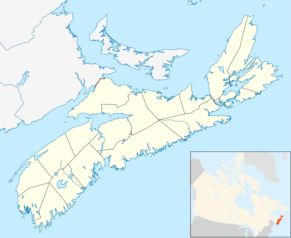
| Location | Victoria County, Nova Scotia |
| Parent range | Cape Breton Highlands |
| Topo map | NTS O11/K16 |
| Climbing | |
| Easiest route | Hike |
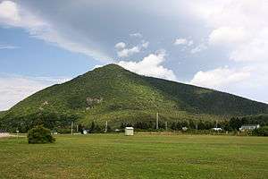
Wilkie Sugar Loaf[4] is a Canadian peak in the Cape Breton Highlands near the community of Sugar Loaf in the province of Nova Scotia.
Description
Wilkie Sugar Loaf is a forested pyramid rising from the shore of Aspy Bay, 10 kilometres (6.2 mi) north of the Cabot Trail. There are few stand-alone mountaintops in Nova Scotia, but one of these is Wilkie Sugar Loaf, climbing to more than 400 metres/yards above sea level in less than 1.5 kilometers (0.9 mi). This peak belongs to the North Mountain range of hills bordering the Aspy Fault but has been separated from the rest of the ridge by the deep ravines cut by Wilkie and Pollys brooks.[5]
The name
Wilkie Sugar Loaf has been the official name for this mountain since April 21, 1936.[4] The mountain's name is a combination of both "Wilkie," the family name of a pioneer family in who settled in the area in 1820,[2] James Wilkie Jr. was an original land grant recipient in the area in 1852,[6] and "Sugar Loaf", a descriptive name for the mountain's distinct pyramidial shape, which suggests a "sugarloaf". The name Wilkie Sugar Loaf was already in common use in official publications such as Admiralty Charts[7] and Sailing Directions by 1860.[8] The Mi'kmaq name for the mountain was "Squa-dichk," meaning "the highest point."[6][9]
Triangulation station
A Natural Resources Canada Geodetic Survey Division Station, Unique Number (Station Number): 23107,[10] Station Name "SUGAR LOAF 19659", is located near the summit, consisting of a copper bolt sunk about 1 inch in a standard concrete monument. The remains of an astronomic pier lie about 3 m (9.8 ft) away to the east. In the late 1960s there was a 6 m (20 ft) tall wooden tower on the summit, located over the survey station.[11] While the station can still be found, there are no remains of the tower.

The trail
Access to the summit is possible by hiking the Wilkie Sugar Loaf trail which leads from a trailhead on the west side of the Bay St Lawrence Road, 1.15 kilometres (0.71 mi) north of the entrance of Cabots Landing Provincial Park, to the peak of the mountain, offering views from two mountain top look-offs. One look-off faces toward the Aspy Fault plateau and Aspy Fault including the plateau of the national park in the distance to the south-west as well as the beach at Cabots Landing, Aspy Harbour and the villages of Cape North and Dingwall to the south and east. The second look-off presents a view of the hills to the north and to Bay St. Lawrence and the Gulf of St. Lawrence beyond. On a very clear day it is possible to see all the way to Newfoundland.

References
- ↑ "Geology - Dingwall- Cape Breton Island". Geological Survey of Canada - 1963. Retrieved May 5, 2012.
- 1 2 Patterson, George Geddie (1885/1978). "Chapter 13, FIRST SETTLERS AT ASPY BAY AND OTHER PLACES TO THE NORTH". Patterson's history of Victoria County, Cape Breton, Nova Scotia: With related papers (Hardcover). Sydney, NS: College of Cape Breton Press. p. 124. ISBN 978-0920336021. Check date values in:
|date=(help) - ↑ "Bivouac.com entry for "Wilkie Sugar Loaf Nova Scotia #31846"". Bivouac.com. Retrieved May 5, 2012.
- 1 2 Geographical Names of Canada - Wilkie Sugar Loaf
- ↑ Haynes, Michael (July 13, 2012). "Cape Breton Highlands Region". Hiking Trails of Cape Breton (2nd Edition) (Paperback). Fredericton, NB: Goose Lane Editions. p. 119. ISBN 978-0864926708.
- 1 2 "Place-Names and Places of Nova Scotia (1967)". Public Archives of Nova Scotia. Retrieved May 5, 2012.
- ↑ "The Gulf of St. Lawrence, Sheet X, Cape Breton Island (1860)". Lords Commissioners of the Admiralty. Retrieved September 2, 2014.
- ↑ "ST. LAWRENCE PILOT, COMPRISING SAILING DIRECTIONS FOR THE GULF AND RIVER, Vol. II (1860)". Lords Commissioners of the Admiralty. Retrieved September 2, 2014.
- ↑ "Place-names of the province of Nova Scotia (1922), by Thomas J Brown". Royal Print & Litho., Halifax, N.S. Retrieved May 5, 2012.
- ↑ Canadian Spatial Reference System Online Database, Natural Resources Canada, retrieved 2014-09-06
- ↑ SUGAR LOAF 19659 (PDF), GeoNova (Province of Nova Scotia), retrieved 2014-09-01
External links
- Nova Scotia Geographical Names Database entry for "Wilkie Sugar Loaf, County of Victoria" (includes map)
- Wilkie Sugarloaf on TrailPeak.com (with map and photos)
- Wilkie Sugarloaf on Geocaching.com