Wilkes-Barre, Pennsylvania
| Wilkes-Barre, Pennsylvania | |||||||
|---|---|---|---|---|---|---|---|
| City | |||||||
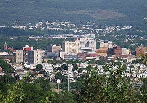
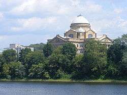
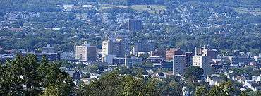
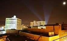
From top to bottom, left to right: Downtown Wilkes-Barre, looking west from Giants Despair, Downtown at night, Luzerne County Courthouse, Panorama of Wilkes Barre, and the Susquehanna River | |||||||
| |||||||
| Nickname(s): The Diamond City, Coal City, Dub City, The W-B | |||||||
| Motto: Pattern After Us | |||||||
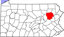
 Wilkes-Barre Location in Luzerne County, Pennsylvania | |||||||
| Coordinates: 41°14′40″N 75°52′41″W / 41.24444°N 75.87806°WCoordinates: 41°14′40″N 75°52′41″W / 41.24444°N 75.87806°W | |||||||
| Country |
| ||||||
| State |
| ||||||
| County | Luzerne | ||||||
| Founded | 1769 | ||||||
| Incorporated | 1806: Borough | ||||||
| 1871: City | |||||||
| Named for | John Wilkes, Isaac Barré | ||||||
| Government | |||||||
| • Type | Mayor-council | ||||||
| • Body | Wilkes-Barre City Council | ||||||
| • Mayor | Anthony George (D) | ||||||
| • City Council[1] |
Members
| ||||||
| Area | |||||||
| • City | 7.2 sq mi (18.6 km2) | ||||||
| • Land | 6.9 sq mi (17.7 km2) | ||||||
| • Water | 0.3 sq mi (0.9 km2) | ||||||
| Elevation | 525 ft (160 m) | ||||||
| Population (2013) | |||||||
| • City | 41,200 | ||||||
| • Density | 5,700/sq mi (2,200/km2) | ||||||
| • Metro | 562,037 (US: 95th) | ||||||
| Time zone | EST (UTC-5) | ||||||
| • Summer (DST) | EDT (UTC-4) | ||||||
| ZIP Codes[2] | 18701–18703, 18705, 18706, 18710, 18711, 18762, 18764–18767, 18769, 18773 | ||||||
| Area code | 570 and 272[3] | ||||||
| FIPS codes |
42-85152 (city) 42-079 (county) | ||||||
| Website | www.wilkes-barre.pa.us | ||||||

Wilkes-Barre (/ˈwɪlksˌbɛər/ or /-bɛəri/) is a city in the Commonwealth of Pennsylvania and the county seat of Luzerne County. It is one of the principal cities in the Scranton–Wilkes-Barre–Hazleton, PA Metropolitan Statistical Area. Located at the center of the Wyoming Valley, it is second in size only to the nearby city of Scranton. The Scranton–Wilkes-Barre–Hazleton, PA Metropolitan Statistical Area had a population of 563,631 as of the 2010 Census, making it the fourth-largest metro/statistical area in the state of Pennsylvania. Wilkes-Barre and the surrounding Wyoming Valley are framed by the Pocono Mountains to the east, the Endless Mountains to the west, and the Lehigh Valley to the south. The Susquehanna River flows through the center of the valley and defines the northwestern border of the city.
Wilkes-Barre was founded in 1769 and formally incorporated in 1806. The city grew rapidly in the 19th century after the discovery of nearby coal reserves and the arrival of hundreds of thousands of immigrants who provided a labor force for the local mines. The coal mining fueled industrialization in the city, which reached the height of its prosperity in the first half of the 20th century. Its population peaked at more than 86,000. However, Following World War II the city's economy declined due to the collapse of industry. The Knox Mine disaster accelerated this trend after large portions of the area's coal mines were flooded. Today the city has a population of 41,498, making it the 13th-largest city in Pennsylvania.
History
18th century
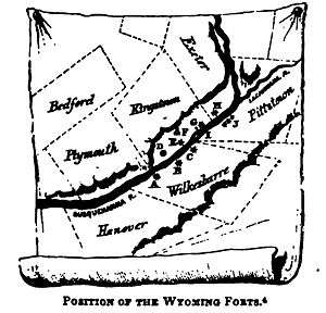
In the early 18th century, the Wyoming Valley had been long inhabited by the Shawanese and Delaware Indian (Lenape) tribes. By 1769, a group led by John Durkee were the first recorded Europeans to reach the area. They established a frontier settlement named Wilkes-Barre after John Wilkes and Isaac Barré, two British members of Parliament who supported colonial America.
The initial settlers were aligned with colonial Connecticut, which had a claim on the land that rivaled Pennsylvania's. Armed men loyal to Pennsylvania twice attempted to evict the residents of Wilkes-Barre in what came to be known as the Yankee-Pennamite Wars. After the American Revolution, the conflict was resolved between the states, and Connecticut gave up its claim. The settlers retained title to their lands but transferred their allegiance to Pennsylvania.
In 1797, several decades after the city's founding, Louis Philippe, later the King of France from 1830 to 1840, stayed in Wilkes-Barre while traveling to the French Asylum settlement.[4]
19th century (industrial foundations)

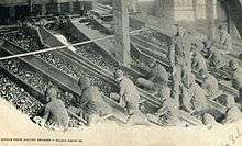
Wilkes-Barre's population exploded due to the discovery of anthracite coal in the 19th century; the economic boom resulted in the city being nicknamed "The Diamond City". Hundreds of thousands of immigrants flocked to the city, seeking jobs in the numerous mines and collieries that sprang up. New industries were established and the Vulcan Iron Works was a well-known manufacturer of railway locomotives from 1849 to 1954. Railroads were being constructed across the state and country.
During Wilkes-Barre's reign as an industrial and economic force in America, a number of major companies and franchises became based in the city, such as Woolworth's, Sterling Hotels, Planter's Peanuts, Miner's Bank, Bell Telephone, HBO, Luzerne National Bank, and Stegmaier. In addition, the demolished Old Fell House on Northampton St is believed to be the first place in the entire world where anthracite was burned for heat.[5]
20th century
It is said that Babe Ruth hit one of the longest home runs in history in Wilkes-Barre early in the 20th century. This statement is quoted from the Scranton/Wilkes-Barre RailRiders News page:
On October 12, 1926, Babe Ruth visited Wilkes-Barre's Artillery Park to play in an exhibition game between Hughestown and Larksville. Suiting up for Hughestown, the Yankee slugger challenged Larksville's hurler Ernie Corkran to throw him his "best stuff"—a fastball right down the heart of the plate. Corkran obliged and Ruth crushed the pitch into deep right field. When the ball cleared the fence, a good 400 feet away from home plate, it was still rising. It finally landed in Kirby Park on the far side of a high school running track. Ruth himself was so impressed by the feat that he asked for his homer to be measured. Originally estimated at 650 feet, the prodigious blast is considered to be the longest home run in baseball's storied history.[6]

Wilkes-Barre is the birthplace of the Planters Peanuts Company, which was founded in 1906 by Italian immigrants Amedeo Obici and partner Mario Peruzzi.
The coal industry survived several disasters, including an explosion at the Baltimore Colliery in 1919 that killed 92 miners. It could not survive the gradual switch in the country to other energy sources. Most coal operations left Wilkes-Barre by the end of World War II. The 1959 Knox Mine Disaster, resulting in the flooding of numerous mines, marked the end of King Coal's heyday. Industrial restructuring also caused the city to lose jobs and go into a decades-long decline. It suffered extensive damage from flooding during Hurricane Agnes in 1972.
In November 1972, 365 subscribers of Service Electric Cable were the first to receive HBO's service, making Wilkes-Barre the birthplace of modern cable TV programming.
Flooding
Manufacturing and retail remained Wilkes-Barre's strongest industries, but the city's economy took a major blow from Tropical Storm Agnes in 1972. The storm pushed the Susquehanna River to a height of nearly 41 feet (12 m), four feet above the city's levees, flooding downtown with nine feet of water. A total of 128 deaths were attributed to the storm, the majority of drowning deaths by persons trapped in their cars; almost 400,000 homes and businesses were destroyed; 220,000 Pennsylvanians were left homeless (as were hundreds of thousands in other areas). Damages were estimated to be $2.1 billion in PA alone. President Richard Nixon sent aid to the area, after flying over in his helicopter on his way to his Camp David, Maryland retreat, on June 24, 1972.[7][8]
Throughout the 1970s and 1980s, Wilkes-Barre attempted to repair the damage from Agnes by building a levee system that rises 41 feet. It has successfully resisted less threatening floods of 1996, 2004, and 2006. The Army Corps of Engineers has praised the quality of the levees. In 2006 the city made the front page of national newspapers when 200,000 residents were told to evacuate in the wake of flooding that was forecast to reach levels near that of 1972. Fortunately it fell short of predictions.
In late August 2011, Hurricane Irene off the New Jersey coast caused the Susquehanna River to rise to flood stage but was no cause for alarm for the city. However, from September 6 to September 8, heavy rains from the inland remnants of Tropical Storm Lee and Hurricane Katia offshore funneled heavy rain over the Wyoming Valley and into the Susquehanna River watershed. The Susquehanna swelled to record levels across the state. In Wilkes-Barre it crested on September 9 at an all-time record of 42.66 feet (13.00 m),[9] nearly two feet higher than water levels reached in 1972's Hurricane Agnes. The levees protected Wilkes-Barre, but nearby boroughs that did not have levees, such as West Pittston, Plymouth, and parts of Plains Township, were affected by extreme flooding and the subsequent water damage.
21st century
Revitalization and construction
On June 9, 2005, Mayor Thomas M. Leighton unveiled his I believe... campaign for Wilkes-Barre, which was intended to boost the city's spirits. Construction began on a planned downtown theatre complex which had a grand opening on June 30, 2006. Renovation of the landmark Hotel Sterling was being pursued by CityVest, a nonprofit developer. The expansion of Wilkes University and King's College took place. Also, the canopy and matching street lights in Public Square and across downtown were removed; the replacements are new green lampposts.
The City of Wilkes-Barre celebrated its 200th anniversary in 2006. Several events, including a Beach Boys concert, were planned but canceled due to extremely heavy rains. Most of the city's population was ordered to evacuate on June 28, 2006. The Bicentennial celebration was postponed to Labor Day weekend, September 3, 2006, and was attended by Pennsylvania Governor Ed Rendell and the Beach Boys.
The Riverfront revitalization project (River Common), broke ground in 2007 and was completed in early 2010. It has made the riverfront accessible to the public. The area also has a new amphitheater for live performances and improved access through ramps and sidewalks. Fountains and color-changing lights have been added underneath two bridges which carry pedestrian traffic across the normally-open levee breachings. The project stretches approximately four blocks from the Luzerne County Courthouse to the intersection of S. River Street and W. South Street. The River Common has since hosted concerts and charity events. Users have complained of insufficient parking close to the river.
Since completion of the River Common, additional improvements to city infrastructure have been progressing. New crosswalks have been installed downtown, including signage emphasizing that pedestrians have the right-of-way. The completion of the James F. Conahan Intermodal Transportation Facility has added parking and relocated Luzerne County buses from their former Public Square staging sites. This has reduced traffic congestion around the square. Private carrier Martz offers coach bus service from the terminal as well.[10]
The widening and realignment of Coal Street, a major road connecting Wilkes-Barre city with Wilkes-Barre Township, was completed in 2012. The new Coal Street provides four lanes over the original two lanes, making travel between the highly commercial Wilkes-Barre Township and the city much easier. The 2012 realignment also provides travelers with a spectacular view of the city center when traveling west into Wilkes-Barre City.
Government
Executive The city is headed by a mayor, elected to a four-year term. Anthony George, the current mayor, is a Democrat and has been in office since 2016. George served as a Wilkes-Barre Police officer, rising to command the Department as Chief.
Legislative The legislative branch of Wilkes-Barre is the City Council, comprising five members who are elected by single-member district to four-year terms. Current members of Council are Bill Barrett; Mike Belusko; Tony Brooks; Beth Gilbert; and Michael Merritt. Barrett is also a former Wilkes-Barre City Police chief.
Audit & Control The office of Audit and Control is the third branch of Wilkes-Barre City government. It is headed by the City Controller, elected to a four-year term. Darren G. Snyder, the current City Controller, is a Democrat and has been in office since 2016. The City Controller has the following powers and duties:
- Examine, audit and verify all books, records and accounts of the various administrative and legislative units, departments, offices or officials under the control or supervision of the Mayor or Council, and for this purpose have access to all such books, records and accounts at any time.
- Examine and approve for payment all contracts, purchase orders, and other documents by which the City incurs financial obligations, having ascertained before approval that monies have been duly appropriated or provided for and allotted to meet such obligations.
- Audit and approve all bills, invoices, payrolls and other evidence of claims, demands or charges paid from City funds.
- Submit reports to the City Council and the Mayor of any records deemed in violation of law or contrary to accepted accounting procedures.
- Prepare and submit to Council and the Mayor within sixty (60) days of the end of every fiscal year a complete financial statement of the affairs of the City with such comments as the Controller deems appropriate.
- Employ a Deputy and/or other personnel essential to the accomplishment of his duties.
- Delegate any duty and/or responsibility to the Deputy Controller that he shall deem necessary.
- Audit Authorities of the City as he deems appropriate and not contrary to law.
Judicial The City of Wilkes-Barre is served by two City Attorneys, Timothy Henry and Maureen Collins, who advise both the Mayor and City Council.
The Luzerne County Court of Common Pleas is the state trial court of general jurisdiction for Wilkes-Barre. Its probation system is divided into two divisions: adult and juvenile. The Court has ten judges: President Judge Thomas Burke; as well as Judges David Lupas, William H. Amesbury, Tina Polachek Gartley, Lesa Gelb, Richard Hughes III, Fred Pierantoni III, Jennifer Rogers, Joseph Sklarosky, Jr., and Michael Vough. Luzerne County senior judges are Hugh F. Mundy, and former President judges Joseph Augello, Chester Muroski, and Patrick Toole.
The U.S. Bankruptcy Court for the Middle District of Pennsylvania sits at the Max Rosenn United States Courthouse in downtown Wilkes-Barre on South Main Street. Bankruptcy Judge John J. Thomas is son of Thomas C. Thomas, a prominent produce dealer who has a major terminal that is part of the city's architecture.
Economy and infrastructure
Wilkes-Barre has the 4th-largest downtown workforce in the state of Pennsylvania.
Family Median Income in Wilkes-Barre is $44,430, compared to the national average of $64,585. Unemployment in June 2014 was 7%.[11] 49% of jobs were either in the sales, office, administrative support or production, transportation, material moving sectors. In 2009 31.9% of residents lived below the poverty line, nearly double the Pennsylvania average of 16.4%.[12] Large employers in the city include GUARD Insurance Group, and Lord & Taylor.
Transportation
Interstate 81 passes north–south near Wilkes-Barre, and the city is also located near the Northeast Extension of the Pennsylvania Turnpike and is about 10 miles (16 km) north of Interstate 80.
Public transportation is provided by the Luzerne County Transportation Authority. In addition to servicing the main arteries of the city, it provides transportation for the northern half of the county, as well as a connecting bus to Scranton via an interchange at Pittston with County of Lackawanna Transit System (COLTS), the public transit authority of Lackawanna County.
The city was at one time served by the Lehigh Valley Railroad, Central Railroad of New Jersey, the Delaware, Lackawanna and Western Railroad (later Erie Lackawanna Railway), Delaware and Hudson Railway, the Pennsylvania Railroad, the Wilkes-Barre and Eastern Railroad, and the Lackawanna and Wyoming Valley Railroad (known as the Laurel Line). The Wilkes-Barre Traction Company formed a streetcar line from Georgetown to Nanticoke and over the river into Plymouth ceasing operations in the mid-1940s. At present, the Canadian Pacific Railway (successor to the Delaware and Hudson) and the Luzerne and Susquehanna Railroad (designated-operator of a county-owned shortline) provide freight service within the city.
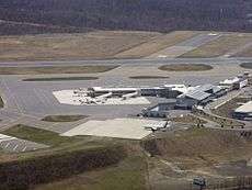
Airport
Five international airlines fly from the Wilkes-Barre/Scranton International Airport in nearby Pittston Township. Smaller, private planes may also use the Wilkes-Barre Wyoming Valley Airport in Forty Fort.
Geography

According to the United States Census Bureau, the city has a total area of 7.2 square miles (19 km2), of which 6.8 square miles (18 km2) is land and 0.3 square miles (0.78 km2), or 4.60%, is water. While the Susquehanna River has a wide floodplain that has necessitated the construction of floodwalls to protect a large percentage of the city, the areas away from the river increase in elevation approaching Wilkes-Barre Mountain. The elevation of the downtown is about 550 feet (170 m) above sea level.
Neighborhoods
Wilkes-Barre houses several neighborhoods, which are:
Central City The area now referred to as "Downtown", between South and North Streets, and bordered by River Street and Wilkes-Barre Boulevard to the West and East respectively, is the original foundation of Wilkes-Barre, the 16 blocks claimed by the Connecticut settlers who founded the city. Throughout the city's history, the area has remained a hub for all of Luzerne County. During the city's boom, this small area was home to the headquarters of more than 100 national corporations. Today, it still houses the NEPA Headquarters for Verizon, Citizen's Bank, Blue Cross, PNC Bank, Luzerne National Bank, Guard Insurance, and a number of other companies. An estimated 40,000 people live and/or work in Downtown Wilkes-Barre every day.
North End This is the area northeast of Downtown. It comprises a number of urban and suburban communities, and is renowned for its interesting and beautiful architecture.
Parsons This is a quiet part of town with a suburban atmosphere. It includes two city parks, a golf course, and a number of factories.
Miners' Mills Named after an early prominent local family, it is the last neighborhood on the northeastern border of the city.
South Wilkes-Barre This is the area directly southwest of Downtown. Home to the national headquarters of Planter's Peanuts and the Bell Telephone Company in the 20th Century. The tallest church in Luzerne County, St. Nicholas Roman Catholic Church, dominates the south end skyline at nearly 200'.
East End This is the area directly east of Downtown. East End, along with Heights and Mayflower, are fairly new areas compared to the rest of the city, having only been developed in the 20th Century. Old pictures of the Stegmaier Building (which is the oldest highrise in Wilkes-Barre and the last one on Downtown's eastern border) show that everything east of Downtown was forests and coal mines.
Heights This is the area southeast of Downtown centered between East End and Mayflower.
Mayflower This area is located south of Downtown. Once, a wealthy area home to many beautiful mansions owned by various "big wigs", the area is now a more affordable neighborhood, also housing the OKT, Lincoln Plaza, and Park Avenue residential housing communities. It can be argued that from the high streets of Mayflower, the best view of the downtown skyline can be seen.
Rolling Mill Hill This is the area located in the southwestern area of the city.
Goose Island This is the area located in the southwestern area of the city between Rolling Mill Hill and South Wilkes-Barre.
Iron Triangle This is the area just southwest of Downtown.
Other Neighborhoods and Sub-neighborhoods There are other smaller neighborhoods and sub-neighborhoods, such as Brookside, Upper Miners' Mills, Lower Miners' Mills, and Barney Farms to name a few.
Adjacent municipalities
- Wilkes-Barre Township (southeast)
- Plains Township (east and northeast)
- Kingston (north)
- Edwardsville (northwest)
- Larksville (west)
- Hanover Township (southwest)
- Bear Creek Township (southwest)
Tallest buildings
Wilkes-Barre is by no means a city characterized by tall buildings, but it has a large skyline for a city of its population and size, and it is home to more than 30 high rise buildings (Daniel J. Flood Tower is in Kingston and the VA Medical Center is in Plains Township, but they are part of the Wilkes-Barre skyline, being close enough to blend in), the tallest of which (from tallest to shortest) are as follows. Recently Wilkes Barre has had a trend of demolishing its historic buildings and replacing them with parking lots.[13]
- Luzerne Bank Building
- Hotel Sterling Plaza Tower (Demolished)
- Hotel Sterling (Demolished)
- Daniel J. Flood Tower (Kingston)
- Citizen's Bank Financial Center
- St. Nicholas RC Church
- PNC Bank Building
- Washington Square Apartments
- University Tower
- VA Medical Center (Plains Township)
- Lincoln Plaza Apartments
- Wilkes-Barre General Hospital
- Holy Cross Hall: King's College
- 15 South Franklin
- B'Nai B'Rith Apartments
- Valley View Terrace Apartments
- Geisinger Hospital (South End)
- Frontier: Wilkes-Barre Center
- Provincial Tower
- Hollenback Coal Exchange (Demolished)
- Woodlands Inn and Resort
- Blue Cross Operations Center
- Sherman Hills Apartments
- Ramada Plaza Hotel On-The-Square
- Luzerne County Correctional Facility
- City Heights Apartments
- Stegmaier Federal Building
- Geisinger Wyoming Valley Medical Center (Plains Township)
- Luzerne County Courthouse
- Verizon Building
- Allegheny Building
- Cumberland Apartments
- Wilkes-Barre City Hall
- Courthouse Square Tower
- The Twin Cubes (the brown & beige building located on the Northeastern block of Public Square)
- The Reddington
- Lion Brewery
- Guard Insurance Center[14]
Climate
Wilkes-Barre has a humid continental climate (Köppen climate classification Dfa/Dfb) with four distinct seasons. Winters are cold with a January average of 25.8 °F (−3.4 °C).[15] The surrounding mountains have an influence on the climate on both precipitation and temperatures, leading to wide variations within a short distance.[16] On average, temperatures below 0 °F (−17.8 °C) are infrequent, occurring 3 days per year and there are 36 days where the maximum temperature remains below 32 °F (0.0 °C).[16] The average annual snowfall is 46.2 inches (117 cm) during the winter in which severe snowstorms are rare.[16] However, when snowstorms do occur, they can disrupt normal routines for several days.[16] Summers are warm with a July average of 71.4 °F (21.9 °C).[15] In an average summer, temperatures exceeding 90 °F (32.2 °C) occur on 9 days and can occasionally exceed 100 °F (37.8 °C).[17] Spring and fall are unpredictable with temperatures ranging from cold to warm although they are usually mild. On average, Wilkes-Barre receives 38.2 inches (970 mm) of precipitation each year, which is relatively evenly distributed throughout the year though the summer months receive more precipitation.[17] Extreme temperatures range from −21 °F (−29.4 °C) on January 21, 1994, to 103 °F (39.4 °C) on July 9, 1936.[17] Wilkes-Barre averages 2303 hours of sunshine per year, ranging from a low of 96 hours in December (or 33% of possible sunshine) to 286 hours in July (or 62% of possible sunshine).[18]
| Climate data for Wilkes-Barre/Scranton Int'l Airport, Pennsylvania (1981–2010 normals,[lower-alpha 1] extremes 1901–present[lower-alpha 2]) | |||||||||||||
|---|---|---|---|---|---|---|---|---|---|---|---|---|---|
| Month | Jan | Feb | Mar | Apr | May | Jun | Jul | Aug | Sep | Oct | Nov | Dec | Year |
| Record high °F (°C) | 69 (21) |
74 (23) |
85 (29) |
93 (34) |
93 (34) |
99 (37) |
103 (39) |
102 (39) |
100 (38) |
91 (33) |
81 (27) |
71 (22) |
103 (39) |
| Mean maximum °F (°C) | 55.4 (13) |
56.4 (13.6) |
69.6 (20.9) |
81.3 (27.4) |
86.6 (30.3) |
89.8 (32.1) |
91.8 (33.2) |
90.0 (32.2) |
85.7 (29.8) |
77.3 (25.2) |
68.7 (20.4) |
57.5 (14.2) |
93.4 (34.1) |
| Average high °F (°C) | 33.2 (0.7) |
36.8 (2.7) |
46.2 (7.9) |
59.1 (15.1) |
69.7 (20.9) |
77.7 (25.4) |
81.9 (27.7) |
79.9 (26.6) |
72.3 (22.4) |
60.7 (15.9) |
49.4 (9.7) |
37.5 (3.1) |
58.8 (14.9) |
| Average low °F (°C) | 18.5 (−7.5) |
20.7 (−6.3) |
27.6 (−2.4) |
38.2 (3.4) |
47.6 (8.7) |
56.5 (13.6) |
60.9 (16.1) |
59.5 (15.3) |
52.1 (11.2) |
41.1 (5.1) |
33.3 (0.7) |
23.8 (−4.6) |
40.1 (4.5) |
| Mean minimum °F (°C) | −0.8 (−18.2) |
3.2 (−16) |
9.1 (−12.7) |
24.0 (−4.4) |
34.4 (1.3) |
43.1 (6.2) |
49.4 (9.7) |
47.1 (8.4) |
37.5 (3.1) |
28.3 (−2.1) |
18.9 (−7.3) |
5.9 (−14.5) |
−3.1 (−19.5) |
| Record low °F (°C) | −21 (−29) |
−19 (−28) |
−4 (−20) |
8 (−13) |
27 (−3) |
34 (1) |
43 (6) |
38 (3) |
29 (−2) |
19 (−7) |
6 (−14) |
−13 (−25) |
−21 (−29) |
| Average precipitation inches (mm) | 2.37 (60.2) |
2.03 (51.6) |
2.55 (64.8) |
3.33 (84.6) |
3.52 (89.4) |
4.03 (102.4) |
3.79 (96.3) |
3.41 (86.6) |
4.07 (103.4) |
3.34 (84.8) |
3.14 (79.8) |
2.68 (68.1) |
38.26 (971.8) |
| Average snowfall inches (cm) | 14.2 (36.1) |
9.3 (23.6) |
9.0 (22.9) |
3.3 (8.4) |
0 (0) |
0 (0) |
0 (0) |
0 (0) |
0 (0) |
0.1 (0.3) |
2.9 (7.4) |
7.4 (18.8) |
46.2 (117.3) |
| Average precipitation days (≥ 0.01 in) | 12.0 | 11.0 | 11.8 | 12.3 | 13.2 | 12.8 | 11.2 | 11.3 | 10.2 | 10.7 | 11.2 | 11.5 | 139.2 |
| Average snowy days (≥ 0.1 in) | 9.3 | 7.7 | 5.0 | 1.7 | 0 | 0 | 0 | 0 | 0 | 0.1 | 2.1 | 7.1 | 33.0 |
| Average relative humidity (%) | 70.1 | 67.5 | 63.3 | 60.4 | 64.6 | 70.5 | 71.1 | 73.8 | 75.2 | 71.6 | 71.8 | 72.5 | 69.4 |
| Mean monthly sunshine hours | 130.3 | 143.7 | 185.7 | 210.5 | 246.9 | 269.7 | 285.7 | 257.2 | 200.2 | 173.3 | 104.3 | 95.9 | 2,303.4 |
| Percent possible sunshine | 44 | 48 | 50 | 53 | 55 | 60 | 62 | 60 | 54 | 50 | 35 | 33 | 52 |
| Source: NOAA (relative humidity 1964–1990, sun 1961–1990)[17][15][18] | |||||||||||||
Demographics
| Historical population | |||
|---|---|---|---|
| Census | Pop. | %± | |
| 1800 | 835 | — | |
| 1810 | 1,225 | 46.7% | |
| 1820 | 755 | −38.4% | |
| 1840 | 1,718 | — | |
| 1850 | 2,723 | 58.5% | |
| 1860 | 4,253 | 56.2% | |
| 1870 | 10,174 | 139.2% | |
| 1880 | 23,339 | 129.4% | |
| 1890 | 37,718 | 61.6% | |
| 1900 | 51,721 | 37.1% | |
| 1910 | 67,105 | 29.7% | |
| 1920 | 73,833 | 10.0% | |
| 1930 | 86,626 | 17.3% | |
| 1940 | 86,236 | −0.5% | |
| 1950 | 76,826 | −10.9% | |
| 1960 | 63,068 | −17.9% | |
| 1970 | 58,856 | −6.7% | |
| 1980 | 51,551 | −12.4% | |
| 1990 | 47,523 | −7.8% | |
| 2000 | 43,123 | −9.3% | |
| 2010 | 41,498 | −3.8% | |
| Est. 2015 | 40,780 | [20] | −1.7% |
| U.S. Decennial Census[21] 2013 Estimate[22] | |||
The city's population has been in constant decline since the 1930s and is today less than half the size it was in 1940 and around two-thirds the size it was in 1970.
As of the 2010 census, the city was 79.2% White, 10.9% Black or African American, 0.3% Native American, 1.4% Asian, and 2.9% were two or more races. Of the population 11.3% were of Hispanic or Latino ancestry.[23] The Hispanic population was just 1.58% of the population as of the 2000 census.
As of the census of 2000, there were 43,123 people, 17,961 households, and 9,878 families residing in the city. The population density was 6,296.3 people per square mile (2,430.6/km2). There were 20,294 housing units at an average density of 2,963.1 per square mile (1,143.9/km2). The racial makeup of the city was 92.30% White, 5.09% African American, 0.11% Native American, 0.79% Asian, 0.03% Pacific Islander, 0.53% from other races, and 1.15% from two or more races. Hispanic or Latino of any race were 1.58% of the population.
Ethnic groups
The largest ethnic groups in Wilkes Barre as of recent estimates are:
- Italian 25.7%
- Polish 23.4%
- Irish 21.3%
- German 17.9%
- English 17.1%
- Welsh 16.2%
- Slovak 13.8%
- Russian 13.4%
- Ukrainian 12.8%
- Greek 11.4%
- Lithuanian 9.1%
- Mexican 7.0%
- Puerto Rican 6.4%
- African-American 5.1%
- Arab 1.0%
The average household size was 2.20, and the average family size was 2.96.
In the city the population was spread out, with 19.9% under the age of 18, 12.6% from 18 to 24, 26.1% from 25 to 44, 20.8% from 45 to 64, and 20.6% who were 65 years of age or older. The median age was 39 years. For every 100 females, there were 93.2 males. For every 100 females age 18 and over, there were 90.7 males.
The local accent of American English is Northeast Pennsylvania English.
Education
Wilkes-Barre has four high schools (James M. Coughlin High School, G.A.R. (Grand Army of the Republic) Memorial High School, Holy Redeemer High School and Elmer L. Meyers High School) and six tertiary education institutions (King's College, Wilkes University, Misericordia University, Luzerne County Community College, Penn State Wilkes-Barre, and The Commonwealth Medical College).
Sports and recreation
Parks
Wilkes-Barre has a Downtown Riverfront Park system that contains 91 acres of open space in Wilkes-Barre, Kingston, and Edwardsville.[24]
Kirby Park is a public park located along the western bank of the Susquehanna River. Kirby Park is one of the region's most valued recreational resources. Given to the City of Wilkes-Barre by the Kirby Family, the park welcomes hundreds of thousands each year. The park is the setting for the City of Wilkes-Barre's annual Cherry Blossom Festival, held during the last weekend of April and the city's Old Fashioned 4 July Celebration. Its amenities include tennis courts, a fitness trail, pond, walking paths, running track, softball fields, parking area, volleyball courts, pavilions and more.[25]
Nesbitt Park is a small public park located across Market Street from Kirby Park on the west side of the Susquehanna River. It has walking paths and areas for picnicking.
The River Common is located along the eastern bank of the Susquehanna River. The Market Street Bridge bisects the park. Its features include a 750-person amphitheater, paved walk-ways, gardens, ornamental trees, grand common and seating area, fishing pier, and two grand gateways connecting the city to the river.
Professional sports
| Club | League | Venue | Established | Parent Club | League Championships |
|---|---|---|---|---|---|
| Scranton/Wilkes-Barre RailRiders | IL, Baseball | PNC Field | 1989 | New York Yankees | 1 |
| Wilkes-Barre/Scranton Penguins | AHL, Ice hockey | Mohegan Sun Arena at Casey Plaza | 1999 | Pittsburgh Penguins | 0[26] |
Local media
The Times Leader and The Citizens' Voice are the two largest daily newspapers in Wilkes-Barre. There are several regional television affiliates (WNEP-TV, WBRE-TV, WYOU-TV, WVIA-TV, WQMY, and WSWB) although only WBRE-TV is licensed to Wilkes-Barre. Wilkes-Barre's radio market is ranked No. 69 by Arbitron's ranking system. There are news, adult alternative, and music radio stations which are receivable in the area.
In popular culture
- Wilkes-Barre's economic plight is featured in the movie Capitalism: A Love Story, directed by Michael Moore.[27]
- The Wilkes-Barre variation (or Traxler variation, as it is more commonly known) of the Two Knights' Defense is named for the Wilkes-Barre chess club.[28]
- In the TV series Supernatural episode 8.13 "Everyone Hates Hitler", the lead protagonists investigate a case in Wilkes-Barre.[29][30]
Notable people
- Hazel Barnes, philosopher
- Douglas Carter Beane, playwright[31]
- Al Bedner, NFL player
- Joe Biden, 47th Vice President of the United States under Barack Obama and longtime U.S. Senator from Delaware (1973-2009)
- David Bohm, quantum physicist
- Benjamin Burnley, lead singer and guitarist for rock band Breaking Benjamin
- Lilian Cahn, co-founder of Coach, Inc. and Coach handbag designer[32]
- George Catlin, artist
- Britton Chance, bio-physicist and Olympic sailor
- Mark Ciavarella, disgraced judge in kids for cash scandal
- Mark Cohen, street photographer
- Colleen Corby, 1960s fashion model[33]
- Amasa Dana, former US Congressman
- Charles B. Dougherty, Army National Guard major general who commanded the 28th Infantry Division
- Mark Duda, NFL player, Lackawanna College football head coach
- Francis A. "Mother" Dunn, football player for the Canton Bulldogs
- David Evans, Hollywood filmmaker most known for the movie The Sandlot
- Jesse Fell, early experimenter with anthracite coal
- Pat Finn, game show host whose shows include Lifetime's, The Family Channel's, and PAX's Shop 'til You Drop
- Ham Fisher, cartoonist
- Tess Gardella, actress
- William Harmatz, jockey, winner of 1959 Preakness Stakes
- George Washington Helme, businessman and founder of Helmetta, New Jersey
- Joe Hergert, former professional football player
- Raye Hollitt, bodybuilder, American Gladiators and actress, Skin Deep
- Qadry Ismail, former NFL wide receiver on the Baltimore Ravens
- Raghib Ismail, former NFL player and Heisman Trophy runner-up
- Florence Foster Jenkins, unconventional operatic soprano, subject of film starring Meryl Streep
- Candy Jones, fashion model, writer, radio personality[34]
- Dorothy Andrews Elston Kabis, Treasurer of the United States
- James Karen, actor
- Michael Kirwan, represented Youngstown, OH in Congress. 1938–1970
- Franz Kline, abstract expressionist painter
- Mike Konnick, former MLB player
- Mary Jo Kopechne, passenger killed in car driven by Ted Kennedy at Chappaquidick
- Harley Jane Kozak, actress and author
- Matthew Lesko, infomercial personality
- Edward B. Lewis, winner of the 1995 Nobel Prize in physiology and medicine
- Santo Loquasto, production designer
- Garrick Mallery, ethnologist
- Herman Mankiewicz, screenwriter of Citizen Kane
- Joseph L. Mankiewicz, Academy Award-winning director and producer
- Al Markim, actor (Tom Corbett, Space Cadet)[35]
- Mary McDonnell, actress twice nominated for Academy Award
- Patrick McGrath, professional hockey player
- Edward Peter McManaman, Roman Catholic bishop
- Edward Meneeley, painter
- Albert Mudrian, author and magazine editor
- Leo C. Mundy, Pennsylvania state senator and physician
- Jozef Murgas, radio pioneer
- Claudette Nevins, actress
- Amedeo Obici, founder of Planters Peanuts
- Jerry Orbach, Tony award-winning actor
- Phil Ostrowski, NFL player
- John Paluck, football player for Washington Redskins and Pro Bowl selection
- William Daniel Phillips, co-recipient of the 1997 Nobel Prize in Physics
- Mendy Rudolph, NBA referee from 1953 to 1975
- Sam Savitt, equestrian artist, author
- Michael Schoeffling, actor, played Jake Ryan in film Sixteen Candles
- M. Gerald Schwartzbach, California criminal defense attorney[36]
- Harriet Segal, novelist; born Harriet Feinberg, Wilkes-Barre
- Greg Skrepenak, former NFL player, convicted felon
- Jonathan Slavin, character actor
- Ron Solt, former NFL player
- Jacob Sullum, journalist and author, featured in Academy Award-nominated documentary Super Size Me[37]
- Bob Sura, basketball player, Houston Rockets
- Louis Teicher, pianist; member of the duo Ferrante & Teicher
- Alexis Toth (St. Alexis of Wilkes-Barre), a saint in the Eastern Orthodox Church
- Ed Walsh, Hall of Fame pitcher; major league baseball's all-time ERA leader
- Harry Welsh, World War II first lieutenant in Easy Company
- Michael Whalen, actor
- Ira W. Wood, represented New Jersey's 4th congressional district from 1904 to 1913[38]
- Frank Zane, bodybuilder, three-time Mr. Olympia, won Mr. America, Mr. Universe, Mr. World; donated gym at Wilkes University
Local attractions
- F. M. Kirby Center for the Performing Arts[39]
- Frederick Stegmaier Mansion[40]
- Little Theatre of Wilkes-Barre[41]
- Luzerne County Museum[42]
- Mohegan Sun at Pocono Downs, Pennsylvania's first slots casino
- Wyoming Monument
- Mohegan Sun Arena at Casey Plaza home of the Wilkes-Barre/Scranton Penguins
- Luzerne County Historical Society
- PNC Field, home of the Scranton/Wilkes-Barre RailRiders (in Moosic)
- Dorothy Dickson Darte Center for the Performing Arts, located on the campus of Wilkes University[43]
See also
Notes
- ↑ Mean monthly maxima and minima (i.e. the expected highest and lowest temperature readings at any point during the year or given month) calculated based on data at said location from 1981 to 2010.
- ↑ Official records for Avoca/Wilkes-Barre–Scranton kept at downtown Scranton from January 1901 to 17 April 1955 and at Wilkes-Barre/Scranton International Airport since 18 April 1955.[19]
References
- ↑ "City Council". Retrieved December 17, 2014.
- ↑ "ZIP Code(tm) Lookup". United States Postal Service. Retrieved December 17, 2014.
- ↑ "City of Wilkes Barre, PA Zip Codes". Retrieved December 17, 2014.
- ↑ ""A History of Wilkes-Barre, Luzerne County, Pennsylvania" Page 14, 1909". Mocavo.com. 2013-04-02. Retrieved May 12, 2014.
- ↑ Pennsylvania Historical Society
- ↑ "Scranton/Wilkes-Barre Yankees". Minorleaguebaseball.com. October 12, 1926. Retrieved June 24, 2010.
- ↑
- ↑ http://www.washingtonian.com/2012/06/19/deluge/
- ↑ "Advanced Hydrologic Prediction Service for the Susquehanna River at Wilkes-Barre". NOAA National Weather Service. Retrieved September 9, 2011.
- ↑ "W-B intermodal center opens today". Citizens Voice. July 6, 2010. Retrieved August 16, 2011.
- ↑ "Best Places, 2014," http://www.bestplaces.net/economy/city/pennsylvania/wilkes-barre
- ↑ City-data.com, 2009, http://www.city-data.com/poverty/poverty-Wilkes-Barre-Pennsylvania.html
- ↑ Peter Cameron (Staff Writer). "Firm using Sterling lot for parking - News - Citizens' Voice". citizensvoice.com. Retrieved September 13, 2014.
- ↑ "SkyscraperPage Forum". Skyscraperpage.com. Retrieved November 8, 2012.
- 1 2 3 "Station Name: PA WILKES-BARRE INTL AP". National Oceanic and Atmospheric Administration. Retrieved 2016-09-11.
- 1 2 3 4 "Local Climatological Data–Annual Summary with Comparative Data: Wilkes–Barre/Scranton" (PDF). National Oceanic and Atmospheric Administration. Retrieved September 30, 2015.
- 1 2 3 4 "NowData - NOAA Online Weather Data". National Oceanic and Atmospheric Administration. Retrieved 2012-01-27.
- 1 2 "NOAA". NOAA.
- ↑ ThreadEx
- ↑ "Annual Estimates of the Resident Population for Incorporated Places: April 1, 2010 to July 1, 2015". Retrieved July 2, 2016.
- ↑ United States Census Bureau. "Census of Population and Housing". Retrieved November 19, 2013.
- ↑ "Annual Estimates of the Resident Population: April 1, 2010 to July 1, 2013". Retrieved June 29, 2014.
- ↑ "Census 2010: Pennsylvania". USA Today. Retrieved December 6, 2011.
- ↑ "Wilkes-Barre River Common". Tour NEPA. Luzerne County Convention and Visitors Bureau. Retrieved 17 December 2014.
- ↑ "Resident Services". Wilkes-barre.pa.us. Retrieved May 12, 2014.
- ↑ "脱毛は、自宅でも簡単にできる! 脇、手足、ビキニラインも!". wbslacrosse.com. Retrieved September 13, 2014.
- ↑ "Capitalism: A Love Story - facts". Michaelmoore.com. Retrieved December 6, 2011.
- ↑ "Alex Dunne May 1998". uschess.org. Retrieved September 13, 2014.
- ↑ "8.13 Everybody Hates Hitler". supernaturalwiki.com.
- ↑ "A Golem on Supernatural". Congregation Rodfei Zedek.
- ↑ "Douglas Carter Beane: Interview". Oasis Journals. February 20, 2007. Retrieved December 6, 2011.
- ↑ Vitello, Paul (2013-03-07). "Lillian Cahn, Creator of the Coach Handbag, Dies at 89". New York Times. Retrieved April 2, 2013.
- ↑ Kahn, S. "Modeling: Money and Madness!", Teen, December 1963
- ↑ Flint, Peter B. "Candy Jones Dies; Ex-Model, Teacher, And Writer Was 64", The New York Times, January 19, 1990. Retrieved December 20, 2007.
- ↑ Barnes, Mike (2015-11-27). "Al Markim, Actor on the 1950s TV Serial 'Tom Corbett, Space Cadet,' Dies at 88". The Hollywood Reporter. Retrieved 2015-12-22.
- ↑ Andrew Blankstein (March 28, 2005). "Attorney Makes Mark by Taking Cases That Others Avoid". Los Angeles Times.
- ↑ Sullum, Jacob (2011-01-04) First Wine, Now Beer in (Some) Pennsylvania Supermarkets; Coming Soon: Cats and Dogs Living Together, Reason
- ↑ Ira Wells Wood, Biographical Directory of the United States Congress. Retrieved September 6, 2007.
- ↑ "The F.M. Kirby Center for the Performing Arts". Kirbycenter.org. Retrieved May 12, 2014.
- ↑ "The Frederick Stegmaier Mansion". Stegmaiermansion.com. 2011-05-26. Retrieved May 12, 2014.
- ↑ "Little Theatre of Wilkes-Barre". Ltwb.org. Retrieved May 12, 2014.
- ↑ Luzerne County Historical Society. "Welcome to the Luzerne County Historical Society website | NEPA Luzerne County Pennsylvania history". Luzernehistory.org. Retrieved May 12, 2014.
- ↑ "Wilkes Division of Performing Arts". Wilkes University. Retrieved May 12, 2014.
External links
| Wikimedia Commons has media related to Wilkes-Barre, Pennsylvania. |
| Wikivoyage has a travel guide for Wilkes-Barre. |
- City of Wilkes-Barre official website
- Osterhout Free Library
- Wilkes-Barre Bicentennial at the Wayback Machine (archived June 12, 2006)
- "Wilkes-Barre Preservation Society". Archived from the original on January 19, 2008.
- More interesting facts about Wilkes-Barre
- Wilkes-Barre at DMOZ
 |
Back Mountain | |
|
|
| |
|
| ||
| ||||
| | ||||
| |
|
Pinchot State Forest |