White Cloud, Michigan
| White Cloud, Michigan | |
|---|---|
| City | |
 Location of White Cloud, Michigan | |
| Coordinates: 43°33′4″N 85°46′21″W / 43.55111°N 85.77250°W | |
| Country | United States |
| State | Michigan |
| County | Newaygo |
| Area[1] | |
| • Total | 2.00 sq mi (5.18 km2) |
| • Land | 1.95 sq mi (5.05 km2) |
| • Water | 0.05 sq mi (0.13 km2) |
| Elevation | 876 ft (267 m) |
| Population (2010)[2] | |
| • Total | 1,408 |
| • Estimate (2012[3]) | 1,392 |
| • Density | 722.1/sq mi (278.8/km2) |
| Time zone | Eastern (EST) (UTC-5) |
| • Summer (DST) | EDT (UTC-4) |
| ZIP code | 49349 |
| Area code(s) | 231 |
| FIPS code | 26-86680[4] |
| GNIS feature ID | 1622135[5] |
White Cloud is a city in the U.S. state of Michigan. As of the 2010 census, the city population was 1,408. It is the county seat of Newaygo County.[6]
Geography
According to the United States Census Bureau, the city has a total area of 2.00 square miles (5.18 km2), of which 1.95 square miles (5.05 km2) is land and 0.05 square miles (0.13 km2) is water.[1]
Major highways
Demographics
| Historical population | |||
|---|---|---|---|
| Census | Pop. | %± | |
| 1880 | 440 | — | |
| 1890 | 743 | 68.9% | |
| 1900 | 595 | −19.9% | |
| 1910 | 648 | 8.9% | |
| 1920 | 618 | −4.6% | |
| 1930 | 615 | −0.5% | |
| 1940 | 811 | 31.9% | |
| 1950 | 977 | 20.5% | |
| 1960 | 1,001 | 2.5% | |
| 1970 | 1,044 | 4.3% | |
| 1980 | 1,101 | 5.5% | |
| 1990 | 1,147 | 4.2% | |
| 2000 | 1,420 | 23.8% | |
| 2010 | 1,408 | −0.8% | |
| Est. 2015 | 1,383 | [7] | −1.8% |
2010 census
As of the census[2] of 2010, there were 1,408 people, 467 households, and 294 families residing in the city. The population density was 722.1 inhabitants per square mile (278.8/km2). There were 537 housing units at an average density of 275.4 per square mile (106.3/km2). The racial makeup of the city was 83.7% White, 7.0% African American, 0.6% Native American, 0.5% Asian, 3.1% from other races, and 5.2% from two or more races. Hispanic or Latino of any race were 6.5% of the population.
There were 467 households of which 34.5% had children under the age of 18 living with them, 38.5% were married couples living together, 18.4% had a female householder with no husband present, 6.0% had a male householder with no wife present, and 37.0% were non-families. 30.2% of all households were made up of individuals and 12.7% had someone living alone who was 65 years of age or older. The average household size was 2.59 and the average family size was 3.20.
The median age in the city was 32.5 years. 25.9% of residents were under the age of 18; 11.3% were between the ages of 18 and 24; 29.1% were from 25 to 44; 22.1% were from 45 to 64; and 11.6% were 65 years of age or older. The gender makeup of the city was 53.8% male and 46.2% female.
2000 census
As of the census[4] of 2000, there were 1,420 people, 494 households, and 320 families residing in the city. The population density was 736.7 per square mile (284.1/km²). There were 553 housing units at an average density of 286.9 per square mile (110.6/km²). The racial makeup of the city was 86.41% White, 7.25% African American, 1.06% Native American, 0.28% Asian, 0.14% Pacific Islander, 1.90% from other races, and 2.96% from two or more races. Hispanic or Latino of any race were 4.65% of the population.
There were 494 households out of which 33.0% had children under the age of 18 living with them, 42.7% were married couples living together, 17.4% had a female householder with no husband present, and 35.2% were non-families. 30.8% of all households were made up of individuals and 14.8% had someone living alone who was 65 years of age or older. The average household size was 2.47 and the average family size was 3.07.
In the city the population was spread out with 26.9% under the age of 18, 11.1% from 18 to 24, 29.5% from 25 to 44, 19.1% from 45 to 64, and 13.4% who were 65 years of age or older. The median age was 34 years. For every 100 females there were 104.9 males. For every 100 females age 18 and over, there were 111.0 males.
The median income for a household in the city was $2,313, and the median income for a family was $31,797. Males had a median income of $2,417 versus $1,417 for females. The per capita income for the city was $11,369. About 19.1% of families and 21.8% of the population were below the poverty line, including 29.7% of those under age 18 and 13.0% of those age 65 or over.
External links
References
- 1 2 "US Gazetteer files 2010". United States Census Bureau. Retrieved 2012-11-25.
- 1 2 "American FactFinder". United States Census Bureau. Retrieved 2012-11-25.
- ↑ "Population Estimates". United States Census Bureau. Retrieved 2013-06-03.
- 1 2 "American FactFinder". United States Census Bureau. Retrieved 2008-01-31.
- ↑ "US Board on Geographic Names". United States Geological Survey. 2007-10-25. Retrieved 2008-01-31.
- ↑ "Find a County". National Association of Counties. Retrieved 2011-06-07.
- ↑ "Annual Estimates of the Resident Population for Incorporated Places: April 1, 2010 to July 1, 2015". Retrieved July 2, 2016.
- ↑ "Census of Population and Housing". Census.gov. Retrieved June 4, 2015.
Municipalities and communities of Newaygo County, Michigan, United States | ||
|---|---|---|
| Cities | 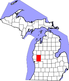 | |
| Village | ||
| Charter township | ||
| General law townships | ||
| Unincorporated communities | ||
| Footnotes | ‡This populated place also has portions in an adjacent county or counties | |
Coordinates: 43°33′01″N 85°46′19″W / 43.55028°N 85.77194°W