White City, Utah
| White City, Utah | |
|---|---|
| Township | |
 Location in Salt Lake County and the state of Utah. | |
| Coordinates: 40°34′2″N 111°51′42″W / 40.56722°N 111.86167°WCoordinates: 40°34′2″N 111°51′42″W / 40.56722°N 111.86167°W | |
| Country | United States |
| State | Utah |
| County | Salt Lake |
| Named for | Kenneth White |
| Area | |
| • Total | 0.9 sq mi (2.2 km2) |
| • Land | 0.9 sq mi (2.2 km2) |
| • Water | 0.0 sq mi (0.0 km2) |
| Elevation | 4,583 ft (1,397 m) |
| Population (2010) | |
| • Total | 5,407 |
| • Density | 6,912.5/sq mi (2,668.9/km2) |
| Time zone | Mountain (MST) (UTC-7) |
| • Summer (DST) | MDT (UTC-6) |
| ZIP code | 84070 |
| Area code(s) | 385, 801 |
| FIPS code | 49-84050[1] |
| GNIS feature ID | 1436628[2] |
White City is a township and census-designated place in Salt Lake County, Utah, United States. The township is an enclave of the City of Sandy. The population was 5,407 at the 2010 census,[3] a modest decrease from the 2000 population of 5,988.
Geography
White City is located at 40°34′2″N 111°51′42″W / 40.56722°N 111.86167°W (40.567198, -111.861748).[4]
According to the United States Census Bureau, the township has a total area of 0.9 square miles (2.3 km²), all of it land.
Demographics
| Historical population | |||
|---|---|---|---|
| Census | Pop. | %± | |
| 1980 | 7,188 | — | |
| 1990 | 6,506 | −9.5% | |
| 2000 | 5,988 | −8.0% | |
| 2010 | 5,407 | −9.7% | |
| source:[5] | |||
As of the census[1] of 2000, there were 5,988 people, 1,796 households, and 1,549 families residing in the township. The population density was 6,912.5 people per square mile (2,657.4/km²). There were 1,834 housing units at an average density of 2,117.2/sq mi (813.9/km²). The racial makeup of the township was 92.30% White, 0.47% African American, 0.67% Native American, 0.82% Asian, 0.82% Pacific Islander, 2.94% from other races, and 1.99% from two or more races. Hispanic or Latino of any race were 7.35% of the population.
There were 1,796 households out of which 41.3% had children under the age of 18 living with them, 69.8% were married couples living together, 11.5% had a female householder with no husband present, and 13.7% were non-families. 10.2% of all households were made up of individuals and 2.8% had someone living alone who was 65 years of age or older. The average household size was 3.33 and the average family size was 3.55.
In the township the population was spread out with 30.9% under the age of 18, 11.2% from 18 to 24, 29.2% from 25 to 44, 19.9% from 45 to 64, and 8.8% who were 65 years of age or older. The median age was 30 years. For every 100 females there were 102.4 males. For every 100 females age 18 and over, there were 99.2 males.
The median income for a household in the township was $49,103, and the median income for a family was $50,156. Males had a median income of $34,871 versus $25,743 for females. The per capita income for the township was $17,148. About 3.1% of families and 3.3% of the population were below the poverty line, including 1.9% of those under age 18 and 4.9% of those age 65 or over.
References
- 1 2 "American FactFinder". United States Census Bureau. Retrieved 2008-01-31.
- ↑ "US Board on Geographic Names". United States Geological Survey. 2007-10-25. Retrieved 2008-01-31.
- ↑ Utah Trend Report 2: State and Complete Places (Sub-state 2010 Census Data). Missouri Census Data Center. Accessed 2011-02-26.
- ↑ "US Gazetteer files: 2010, 2000, and 1990". United States Census Bureau. 2011-02-12. Retrieved 2011-04-23.
- ↑ "CENSUS OF POPULATION AND HOUSING (1790-2000)". U.S. Census Bureau. Retrieved 2010-07-31.
External links
Municipalities and communities of Salt Lake County, Utah, United States | ||
|---|---|---|
| Cities | 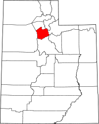 | |
| Town | ||
| Townships | ||
| CDPs | ||
| Unincorporated community | ||
| Ghost towns | ||
| Footnotes | ‡This populated place also has portions in an adjacent county or counties | |