Whippany River
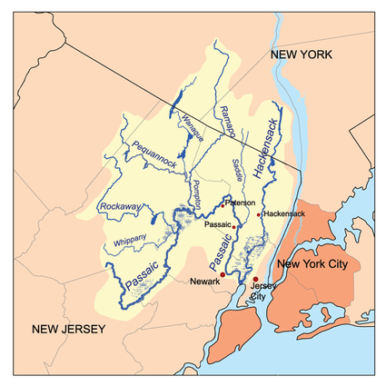
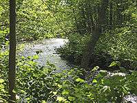
The Whippany River is a tributary of the Rockaway River, approximately 20 mi (30 km) long, in northern New Jersey in the United States.
It rises in Morris County, in Mendham Township west of Morristown, and flows generally ENE in a meandering course, through Morristown and the Whippany area of Hanover Township. It flows through the Troy Meadows and joins the Rockaway in the Hatfield Swamp in eastern Morris County, just above the confluence of the Rockaway with the Passaic River.
The river drainage area is 69 square miles (180 km2).
There are three USGS water gages on the river. The gage in Parsippany just before the Whippany River empties into the Rockaway River has an average flow of 178 cubic feet (5 m3) per second.
The river derives its name from the Whippanong Native Americans, a tribe that once inhabited the area. Whippanong meant "place of the willows", named for the trees growing along the banks of the river.[1]
See also
References
External links
- 40°49′16.31″N 74°25′55.11″W / 40.8211972°N 74.4319750°W
- NJ Skylands: Whippany River
- U.S. Geological Survey: NJ stream gaging stations
- Whippany River Watershed Action Committee