Whataroa
| Whataroa | |
|---|---|
|
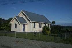
St Anne's Church in Whataroa | |
 Whataroa | |
| Coordinates: 43°15′42″S 170°21′32″E / 43.26167°S 170.35889°E | |
| Country | New Zealand |
| Region | West Coast |
| District | Westland District |
| Population (2006) | |
| • Total | 405 |
Whataroa is a small township in southern Westland on the West Coast of New Zealand's South Island. It is located on the western bank of the Whataroa River, with the village of Te Taho on the other side. State Highway 6 passes through Whataroa on its route from Ross to the Franz Josef Glacier. Hari Hari is 31 kilometres (19 mi) to the north-east, and Franz Josef is 32 km to the south-west.[1][2]
The population of Whataroa and its surrounding area was 405 in the 2006 Census, an increase of 81 from 2001.[3]
Whataroa is located in an agricultural area where dairying is the primary activity. The town contains establishments such as a school, two churches, and a Māori craft gallery. It is also a staging base for trips to a white heron sanctuary that is the only breeding location of white heron in New Zealand.[4]
Whataroa hosts the South Westland A&P Show annually in February. Founded in 1951, events include equestrian competitions, dairy cattle judging, dog trials, trade displays and various family entertainment.
The Woodham Shield is an annual rugby competition in which Whataroa and neighboring towns, Franz- Fox- Hast, Hari Hari and Ross, compete against each other for possession of the shield.[5]
History
Whataroa was the site of cattle sales twice a year from 1875, serving farmers from around South Westland.[6] The last mob of cattle was driven to Whataroa in 1961.[7]
A dairy factory was established at Whataroa before World War I.[8]
Education
Whataroa School is a coeducational full primary school (years 1-8), with a decile rating of 7[9] and a roll of 39[10](as at July 2016). The school was established in 1879[11] and celebrated its 125th reunion in 2004.[12]
References
- ↑ Peter Dowling (editor) (2004). Reed New Zealand Atlas. Reed Books. map 74. ISBN 0-7900-0952-8.
- ↑ Roger Smith, GeographX (2005). The Geographic Atlas of New Zealand. Robbie Burton. map 173. ISBN 1-877333-20-4.
- ↑ Quickstats about Whataroa
- ↑ "Whataroa - Westland District Council". Archived from the original on October 14, 2008. Retrieved 2008-08-10.
- ↑ Shield stays in Whataroa. Greymouth Star
- ↑ Rogers, Anna (2005). Illustrated History of the West Coast. Auckland: Reed Books. p. 66. ISBN 0-7900-1022-4.
- ↑ "Historic Haast to Paringa Cattle Track". Department of Conservation. Retrieved 2008-08-10.
- ↑ Rogers, p. 100.
- ↑ Te Kete Ipurangi schools database: Whataroa School
- ↑ "Directory of Schools - as at 2 August 2016". New Zealand Ministry of Education. Retrieved 2016-08-16.
- ↑ "About our school". Whataroa School. Retrieved 2008-08-10.
- ↑ "Whataroa District Schools 125th Reunion". Education Gazette New Zealand. 83 (3). 23 February 2004.
External links
Coordinates: 43°15′42″S 170°21′32″E / 43.26167°S 170.35889°E