Wharncliffe Side
| Wharncliffe Side | |
 The Blue Ball pub at Wharncliffe Side |
|
 Wharncliffe Side |
|
| Metropolitan borough | Sheffield |
|---|---|
| Metropolitan county | South Yorkshire |
| Region | Yorkshire and the Humber |
| Country | England |
| Sovereign state | United Kingdom |
| Post town | SHEFFIELD |
| Postcode district | S35 |
| Dialling code | 0114 |
| Police | South Yorkshire |
| Fire | South Yorkshire |
| Ambulance | Yorkshire |
| EU Parliament | Yorkshire and the Humber |
| UK Parliament | Penistone and Stocksbridge |
Coordinates: 53°27′00″N 1°33′14″W / 53.450°N 1.554°W
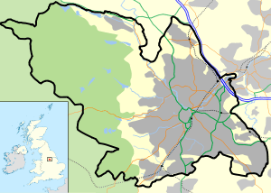
Wharncliffe Side is a village in South Yorkshire, England, northwest of Sheffield and within the city borough.
Wharcliffe Side is located on the west bank of the River Don, approximately 10 km northwest of Sheffield city centre, and 1 km northwest of Oughtibridge, south of the confluence of the Ewden beck and the River Don. The A6102 road passes through the village.[1]
The village has a population of 1355 (2011),[2] and is a commuter village for Sheffield and Stocksbridge.[3] The village is within the Stocksbridge and Upper Don electoral ward. There is a primary school on Brighthomelee Lane. Glen Howe Park is situated at the southern end of the village. The ancient farming hamlet of Brightholmlee lies 0.5 km to the west. a small village pub sits just on the edge of wharncliffe side, named 'The Wharncliffe Arms'.
See also
- Wharncliffe Crags, river Don valley landmark north of the village, associated with the legend of the Dragon of Wantley
References
- ↑ Ordnance survey. 1:25000. c.2012
- ↑ Wharncliffe Side is made up of 5 Output Areas in The Stocksbridge and Upper Don ward http://ukcensusdata.com/stocksbridge-and-upper-don-e05001063#sthash.3EoM4KJv.dpbs
- ↑ Long, Peter, ed. (2004) [1998], The Hidden Places Of England, Travel Publishing, p. 605, ISBN 1-904-434-12-6
External links
- http://www.wharncliffeside.org.uk/ - Wharncliffe Side Primary School Website
| Wikimedia Commons has media related to Wharncliffe Side. |
| About Sheffield | |||||||
|---|---|---|---|---|---|---|---|
| Electoral wards |
| ||||||
| Suburbs and estates |
| ||||||
| Towns and villages |
| ||||||
| Other areas | |||||||
| |||||||