Westville, Florida
| Westville, Florida | |
|---|---|
| Town | |
 Location in Holmes County and the state of Florida | |
 Westville, Florida Location in the United States | |
| Coordinates: 30°46′4″N 85°51′8″W / 30.76778°N 85.85222°WCoordinates: 30°46′4″N 85°51′8″W / 30.76778°N 85.85222°W | |
| Country |
|
| State |
|
| County | Holmes |
| Area | |
| • Total | 7.5 sq mi (19.3 km2) |
| • Land | 7.3 sq mi (18.8 km2) |
| • Water | 0.2 sq mi (0.5 km2) |
| Elevation | 69 ft (21 m) |
| Population (2010) | |
| • Total | 289 |
| • Density | 29.5/sq mi (11.5/km2) |
| Time zone | Central (CST) (UTC-6) |
| • Summer (DST) | CDT (UTC-5) |
| ZIP code | 32464 |
| Area code(s) | 850 |
| FIPS code | 12-76975[1] |
| GNIS feature ID | 0293152[2] |
Westville is a town in Holmes County, Florida, United States. As of the 2000 census, the town had a total population of 221. According to the U.S. Census Bureau's 2004 estimates, the town had a population of 225.According to Westville town Census 2010 results, the population of the area was approximately 289 people. From 2000 to 2010, the Westville town population growth percentage was 30.8% (or from 221 people to 289 people). 26.0% of the Westville town residents were under 18 years of age. Census 2010 race data for Westville town include the racial breakdown percentages of 0.3% black, 0.0% Asian and 1.7% Hispanic. Also, there were 137 housing units in Westville town, 80.3% of which were occupied housing units.
Geography
Westville is located at 30°46′4″N 85°51′8″W / 30.76778°N 85.85222°W (30.767681, -85.852302).[3]
According to the United States Census Bureau, the town has a total area of 7.4 square miles (19 km2), of which 7.3 square miles (19 km2) is land and 0.2 square miles (0.52 km2) (2.42%) is water.
Demographics
| Historical population | |||
|---|---|---|---|
| Census | Pop. | %± | |
| 1980 | 343 | — | |
| 1990 | 257 | −25.1% | |
| 2000 | 221 | −14.0% | |
| 2010 | 289 | 30.8% | |
| Est. 2015 | 275 | [4] | −4.8% |
As of the census[1] of 2000, there were 221 people, 94 households, and 64 families residing in the town. The population density was 30.4 people per square mile (11.7/km²). There were 107 housing units at an average density of 14.7 per square mile (5.7/km²). The racial makeup of the town was 98.64% White, 0.45% Asian, and 0.90% from two or more races. Hispanic or Latino of any race were 2.26% of the population.
There were 94 households out of which 30.9% had children under the age of 18 living with them, 50.0% were married couples living together, 13.8% had a female householder with no husband present, and 31.9% were non-families. 29.8% of all households were made up of individuals and 14.9% had someone living alone who was 65 years of age or older. The average household size was 2.35 and the average family size was 2.91.
In the town the population was spread out with 24.0% under the age of 18, 10.4% from 18 to 24, 27.1% from 25 to 44, 23.5% from 45 to 64, and 14.9% who were 65 years of age or older. The median age was 35 years. For every 100 females there were 82.6 males. For every 100 females age 18 and over, there were 78.7 males.
The median income for a household in the town was $27,000, and the median income for a family was $34,375. Males had a median income of $25,625 versus $20,500 for females. The per capita income for the town was $11,415. About 9.2% of families and 13.9% of the population were below the poverty line, including 9.5% of those under the age of eighteen and 22.2% of those sixty five or over.
Notable people
American author Laura Ingalls Wilder along with husband Almanzo and her daughter Rose lived here for a short time in 1891. Laura's cousin Peter lived here as well. Peter married and stayed in the region, but the Wilders quickly determined the move had been a mistake for them, and left the area after about a year, eventually settling in Mansfield, Missouri.[6]
References
- 1 2 "American FactFinder". United States Census Bureau. Retrieved 2008-01-31.
- ↑ "US Board on Geographic Names". United States Geological Survey. 2007-10-25. Retrieved 2008-01-31.
- ↑ "US Gazetteer files: 2010, 2000, and 1990". United States Census Bureau. 2011-02-12. Retrieved 2011-04-23.
- ↑ "Annual Estimates of the Resident Population for Incorporated Places: April 1, 2010 to July 1, 2015". Retrieved July 2, 2016.
- ↑ "Census of Population and Housing". Census.gov. Retrieved June 4, 2015.
- ↑ Westville, Florida information for Laura Ingalls Wilder
Municipalities and communities of Holmes County, Florida, United States | ||
|---|---|---|
| City | 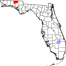 | |
| Towns | ||
| Unincorporated communities | ||