Westphalia, Texas
| Westphalia, Texas | |
|---|---|
| Unincorporated community | |
 Westphalia  Westphalia | |
| Coordinates: 31°7′8″N 97°6′54″W / 31.11889°N 97.11500°WCoordinates: 31°7′8″N 97°6′54″W / 31.11889°N 97.11500°W | |
| Country |
|
| State |
|
| County |
|
| Elevation | 574 ft (175 m) |
| Population (2000) | |
| • Total | 186 |
| Time zone | Central (CST) (UTC-6) |
| • Summer (DST) | CDT (UTC-5) |
| ZIP code | 76656 |
| Area code(s) | 254 |
|
Westphalia Rural Historic District | |
|
Church of the Visitation | |
|
| |
| Location | Roughly bounded by Co. Rt. 383, Pond Cr., Co. Rts. 377, 368, 372, 373, and the Falls Co. western boundary line, Westphalia, Texas |
| Area | 5,500 acres (2,225.8 ha) |
| Built | 1879 |
| Architectural style | Bungalow/craftsman |
| NRHP Reference # | 96000524[1] |
| Added to NRHP | May 15, 1996 |

Westphalia is a small unincorporated community in Falls County, Texas, United States located 35 miles (56 km) south of Waco on state highway 320. Westphalia has a strong German and Catholic background. The Church of the Visitation was, until recently, the largest wooden church west of the Mississippi River. Westphalia is mainly noted for its historic church and convents, but also for its meat market and for its annual Church Picnic, which is one of the largest in the area.[2] Westphalia is also known for the Westphalia Waltz.[3]
The Westphalia Independent School District serves area students.
References
- ↑ National Park Service (2010-07-09). "National Register Information System". National Register of Historic Places. National Park Service.
- ↑ WESTPHALIA, TEXAS Handbook of Texas Online
- ↑ Westphalia Waltz by Clay Coppedge, Texas Escapes
External links
Municipalities and communities of Falls County, Texas, United States | ||
|---|---|---|
| Cities | 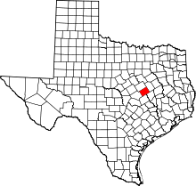 | |
| CDP | ||
| Other unincorporated communities | ||
| Ghost towns | ||
| Footnotes | ‡This populated place also has portions in an adjacent county or counties | |


This article is issued from Wikipedia - version of the 11/27/2016. The text is available under the Creative Commons Attribution/Share Alike but additional terms may apply for the media files.