Westlink M7
| Westlink M7 New South Wales | |
|---|---|
 | |
 | |
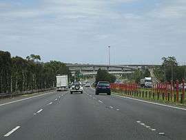
| Westlink M7 heading southbound | |
| General information | |
| Type | Motorway |
| Length | 41 km (25 mi) |
| Opened |
July 2003 (Completed December 2005) |
| Route number(s) |
|
| Major junctions | |
| North end | |
| South end | |
| Location(s) | |
| Major suburbs / towns | |
| Highway system | |
|
Highways in Australia National Highway • Freeways in Australia Highways in New South Wales | |
| |
Westlink M7 - formerly Western Sydney Orbital - is one of Sydney, Australia's urban motorways and a part of the Sydney Orbital Network. It is a tolled motorway that is operated by Transurban and connects three motorways: M5 South Western Motorway at Prestons, M4 Western Motorway at Eastern Creek and M2 Hills Motorway at Baulkham Hills. It opened on 16 December 2005, eight months ahead of schedule.
History
Western Sydney is the fastest growing part of the Sydney metropolitan area. The Ring Road 5 and State Route 55 - and later State Route 77 - originally meant to bypass Sydney, had instead become primary arteries for the western suburbs.
By the late 1990s and first decade of the 21st century Western Sydney had become the third biggest producer of Australia's GDP, after the Sydney CBD and Melbourne. The growth of industrial and residential areas brought about a massive increase in traffic on its local roads. This led to the planning of the Western Sydney Orbital which, among its original purposes, was to serve the stillborn second international airport at Badgerys Creek.
In January 2001 the federal government made a commitment to progressively contribute A$356 million to the M7 project, with the remaining A$1.5 billion required for the design and construction provided by the private sector. The NSW Minister for Planning authorised the undertaking in February 2002.[1][2]
The M7 Motorway was privately funded through an innovative construction contract method known as a "deed" to facilitate the expedition of the tendering phase; several deeds were drawn up based on the contractors proposals. The deed was for the full design, construction, operation and maintenance of the motorway including more than 40 kilometres (25 mi) of continuously reinforced concrete (CRCP) and asphalt roads, upgrading of local roads, the longest free-flowing (no toll booths) toll road in the world at the time. More than 90 bridges (of four different types) and the largest shared path network in the southern hemisphere. The design, construct, operate and maintain contract worth at least A$2.0 billion was awarded to WSO (Western Sydney Orbital Pty Ltd) by the Roads & Traffic Authority. The design and construct portion of the contract valued at A$1.8 billion was awarded to a joint venture between ABI Group and Leighton Contractors (ALJV) with design work undertaken by a further joint venture by Maunsell Australia and SMEC (Snowy Mountains Engineering Corporation) with further subcontracting to other designers (Arup) and independent verification by Sinclair Knight Merz (SKM). The motorway was opened to traffic in 2005. WSO (commonly known as Westlink) operate the motorway with maintenance subcontracted to Westlink Services and tolling to ROAM. With its opening, Metroad 7 between Liverpool and Beecroft was transferred from Cumberland Highway to Westlink M7. Westlink M7 was the first Sydney motorway to be marked with an alphanumeric shield rather than the hexagonal Metroad shield.
On 25 December 2005, just 9 days after opening, the M7 suffered its first fatality: a 12-year-old boy died at Cecil Park when the four-wheel drive he was travelling in rolled down an embankment and onto Elizabeth Drive, almost crushing another car.
Route
The M7 originates at the Roden Cutler Interchange, a Y-junction with the M31 Hume Motorway and M5 South Western Motorway at Prestons, and weaves to the west of Liverpool to the junction of Elizabeth Road and Wallgrove Road in Abbotsbury. From then on it runs parallel to Wallgrove Road north towards the Great Western Highway and the Light Horse interchange, a stack junction with the M4. Continuing north, it leads to Minchinbury and follows alongside Rooty Hill Road up to Dean Park at an exit with Rooty Hill Road North and Richmond Road. From this junction the M7 turns eastward through Quakers Hill and Kings Langley up to the interchange with Old Windsor Road to Norwest Business Park and continues southeast to reconcile with the existing M2 Hills Motorway in Baulkham Hills. It is 4 lanes (2 lanes each way) for its entire length.
Light Horse Interchange
The Light Horse Interchange is the junction of the M4 and M7 motorways. The stack interchange is the largest of its type in the southern hemisphere. It was named in honour of an Australian World War One formation, the Australian Light Horse.[3]
Tolls
The Westlink was built as a fully tolled, gateless motorway employing electronic payment, with an initial toll-free period that ended on 15 January 2006. The toll was originally 29.91 cents per kilometre, capped after 20 kilometres (12 mi) at $5.98. On 1 April 2006, this increased to 30.07 cents per kilometre, capped after 20 kilometres (12 mi) at $6.01. As of 2015, the toll was 38.31 cents per kilometre, capped at $7.66, and adjusted quarterly according to the CPI.[4]
Exits and interchanges
| LGA | Location | km | mi | Destinations | Notes |
|---|---|---|---|---|---|
| The Hills Shire | Winston Hills – Baulkham Hills boundary | 0 | 0.0 | North-eastern terminus: continues as Hills Motorway | |
| Bella Vista | 2 | 1.2 | Westbound exit and eastbound entrance | ||
| Blacktown | Glenwood | 3 | 1.9 | Norwest Boulevard to Old Windsor Road – Bella Vista, Castle Hill | Eastbound exit and westbound entrance |
| Glenwood – Kings Langley – Kings Park – Acacia Gardens quadripoint | 5 | 3.1 | Sunnyholt Road – Blacktown, Glenwood | ||
| Quakers Hill | 9 | 5.6 | Quakers Hill Parkway – Doonside, Quakers Hill | Westbound exit and eastbound entrance | |
| Colebee – Dean Park – Glendenning – Oakhurst quadripoint | 12 | 7.5 | Richmond Road – Richmond, Blacktown, Rooty Hill | Northbound exit via Rooty Hill Road North | |
| Glendenning–Plumpton boundary | 14 | 8.7 | Power Street – Plumpton, Woodcroft | Southbound exit and northbound entrance | |
| Glendenning – Plumpton – Rooty Hill tripoint | 15 | 9.3 | Woodstock Avenue – Rooty Hill, Glendenning | Northbound exit and southbound exit | |
| Eastern Creek | 18 | 11 | Southbound exit and northbound entrance | ||
| 19 | 12 | Stack interchange | |||
| 21 | 13 | Wallgrove Road – Horsley Park, Rooty Hill | |||
| Fairfield | Horsley Park | 25 | 16 | The Horsley Drive – Horsley Park, Fairfield | |
| Fairfield–Liverpool boundary | Abbotsbury – Cecil Park – Cecil Hills tripoint | 30 | 19 | Elizabeth Drive – Liverpool, Luddenham | Northbound entry via Wallgrove Road |
| Liverpool | Middleton Grange – Len Waters Estate – Hoxton Park tripoint | 36 | 22 | Cowpasture Road – Cecil Hills, Horningsea Park | |
| Prestons | 38 | 24 | Bernera Road – Prestons, Hinchinbrook | ||
| Prestons–Casula boundary | 40 | 25 |
| Southern terminus | |
See also
References
- ↑ "RTA Annual Report 2005" (PDF). Roads and Traffic Authority. Retrieved 17 May 2011.
- ↑ "Sydney's new motorway opens". The Sydney Morning Herald. 16 December 2005. Retrieved 17 May 2011.
- ↑ Light Horse Interchange at Westlink
- ↑ Westlink M7 Toll Calculator, Westlink M7, 1 October 2011, retrieved 9 October 2011