Western Nebraska Regional Airport
| Western Nebraska Regional Airport William B. Heilig Field (former Scottsbluff Army Airfield) | |||||||||||||||
|---|---|---|---|---|---|---|---|---|---|---|---|---|---|---|---|
|
| |||||||||||||||
|
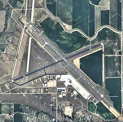
USGS 2006 orthophoto | |||||||||||||||
| Summary | |||||||||||||||
| Airport type | Public | ||||||||||||||
| Owner | Airport Authority of Scotts Bluff County | ||||||||||||||
| Serves | Scottsbluff, Nebraska | ||||||||||||||
| Location | Scotts Bluff County, Nebraska | ||||||||||||||
| Elevation AMSL | 3,967 ft / 1,209 m | ||||||||||||||
| Coordinates | 41°52′26″N 103°35′44″W / 41.87389°N 103.59556°WCoordinates: 41°52′26″N 103°35′44″W / 41.87389°N 103.59556°W | ||||||||||||||
| Website | flyscottsluff.com | ||||||||||||||
| Map | |||||||||||||||
 BFF Location in Nebraska | |||||||||||||||
| Runways | |||||||||||||||
| |||||||||||||||
| Statistics (2011) | |||||||||||||||
| |||||||||||||||
Western Nebraska Regional Airport (IATA: BFF, ICAO: KBFF, FAA LID: BFF) (William B. Heilig Field) is three miles east of Scottsbluff, in Scotts Bluff County, Nebraska.[1] The airport is owned by the Airport Authority of Scotts Bluff County.[1] It sees one passenger airline, subsidized by the Essential Air Service program.
The airport is named after William B. Heilig. Known as "Scottsbluff's Mr. Aviation," he was a World War II United States Army Air Force primary flight instructor, a civilian flight instructor, and manager of the city’s airport.[2]
Federal Aviation Administration records say the airport had 10,608 passenger boardings (enplanements) in calendar year 2008,[3] 9,221 in 2009 and 9,864 in 2010.[4] The National Plan of Integrated Airport Systems for 2011–2015 categorized it as a primary commercial service airport based in enplanements in 2008 (over 10,000)[5] but it is non-primary commercial service based in enplanements in 2009 and 2010.
History
Western Nebraska Regional Airport opened in 1934; it had a hangar, commercial airline connections, air mail service, lighted fields, a weather bureau station, and was a pilot training facility .
With the United States entry into World War II Scottsbluff promoted its municipal airport for military/defense purposes. On September 5, 1942 Scottsbluff was selected as one of seven satellite air bases in Nebraska. Twenty-eight farms were vacated so construction could begin at a cost of 5.5 million dollars. The original Scottsbluff Municipal Airport closed to make way for the new airfield; the old airport later became a prisoner of war camp.
Construction began on September 7, 1942. A temporary railroad spur was constructed and some 600,000 cubic yards (460,000 m3) of concrete for three runways was poured in forty-five days. There were about 108 buildings on the ground including barracks, mess halls, officers' quarters, warehouses, a hangar, a camouflage instruction building, and a bombsight storage building.
Scottsbluff Army Airfield
The base was occupied as early as 11 October 1942 and was assigned to Second Air Force. Initially, Scottsbluff Army Airfield was a satellite to Casper Army Air Field, Wyoming. The first troops arrived December 4, 1942. The 4190th Army Air Force Base Unit was the host organization at Scottsbluff AAF.
The original mission was to train crews of Boeing B-17 Flying Fortresses and Consolidated B-24 Liberators bombers. Crews based at Casper AAF Wyoming final training at Scottsbluff. All training aircraft at the airfield were assigned to the 4190th AAFBU.
In 1944 base command was transferred from Second Air Force to the 1st Troop Carrier Command, and became a satellite field of Alliance Army Airfield. The 1st TCC used the facility training Douglas C-47 Skytrain and glider crews. Aircraft and radio maintenance personnel also trained here.
Civil use
The airfield closed on December 31, 1945 and the War Department handed over control to the City of Scottsbluff in 1947. Buildings and structures which were not part of the transfer were sold by the U.S. Government in separate agreements and most were removed. The USAF continued to use the airport for training until 1950.
Western Airlines DC-3s were at Scottsbluff by 1945 and United appeared in 1953-54; both left in 1959, replaced by Frontier, which remained until 1984-85.
In July 1970 Scotts Bluff County took control and has had it since. The county continues to operate the facility as the William B. Heilig Field.
In the summer of 2003 the county created an Airport Authority Board which has made major improvements around the airport property. New improvements include a new terminal building, wildlife fence, fire equipment, and remodeling the fire station. Future projects include runway lighting and resurfacing. The board is currently working with local law enforcement and the TSA for security screening.
Facilities and aircraft
The airport covers 1,806 acres (731 ha) at an elevation of 3,967 feet (1,209 m). It has two asphalt runways: 12/30 is 8,279 by 150 feet (2,523 x 46 m) and 5/23 is 8,002 by 150 feet (2,439 x 46 m).[1]
In the year ending May 31, 2011 the airport had 28,138 aircraft operations, average 77 per day: 89% general aviation, 8% airline, 2% air taxi, and 1% military. 43 aircraft were then based at this airport: 86% single-engine, 12% multi-engine, and 2% jet.[1]
Airlines and destinations
| Airlines | Destinations |
|---|---|
| PenAir | Denver |
See also
References
- 1 2 3 4 5 FAA Airport Master Record for BFF (Form 5010 PDF). Federal Aviation Administration. Effective May 31, 2012.
- ↑ "William B. Heilig". Nebraska Department of Aeronautics.
- ↑ "Enplanements for CY 2008" (PDF, 1.0 MB). faa.gov. Federal Aviation Administration. December 18, 2009.
- ↑ "Enplanements for CY 2010" (PDF, 189 KB). faa.gov. Federal Aviation Administration. October 4, 2011.
- ↑ "2011–2015 NPIAS Report, Appendix A" (PDF, 2.03 MB). faa.gov. Federal Aviation Administration. October 4, 2010.
Other sources
-
 This article incorporates public domain material from the Air Force Historical Research Agency website http://www.afhra.af.mil/.
 - Maurer, Maurer (1983). Air Force Combat Units Of World War II. Maxwell AFB, Alabama: Office of Air Force History. ISBN 0-89201-092-4.
- Essential Air Service documents (Docket DOT-OST-2003-14535) from the U.S. Department of Transportation:
- Order 2004-5-15 (May 20, 2004): selecting Great Lakes Aviation, Ltd., to provide essential air service with subsidy support at Grand Island, Kearney, McCook, North Platte, and Scottsbluff, Nebraska, for two years at a total annual subsidy of $5,233,287.
- Order 2006-6-26 (June 21, 2006): selecting Great Lakes Aviation, Ltd.. to provide essential air service with subsidy support at Kearney, North Platte, and Scottsbluff, Nebraska, for two years, beginning when Mesa Air Group d/b/a Air Midwest inaugurates service at Grand Island and McCook, at a total annual subsidy of $2,393,305 ($897,142 for Kearney; $976,026 for North Platte; and $520,137 for Scottsbluff). Each community will receive three nonstop round trips to Denver each weekday and weekend (18 total round trips per week) with Beech 1900-D aircraft.
- Order 2008-7-33 (July 29, 2008): selecting Great Lakes Aviation, Ltd. to provide subsidized essential air service (EAS) at Kearney, North Platte, and Scottsbluff, Nebraska, for the two-year period beginning November 1, 2008, at a combined annual subsidy of $5,373,700 with 19-seat Beech 1900D aircraft.
- Order 2010-9-10 (September 8, 2010): re-selecting Great Lakes Aviation, Ltd., operating as both a United Airlines and Frontier Airlines code share-partner (Great Lakes), to provide essential air service (EAS) at Kearney, North Platte, and Scottsbluff, Nebraska, for a combined annual subsidy of $5,344,690 for the two-year period from November 1, 2010 to October 31, 2012.
External links
- Western Nebraska Regional Airport, official site
- Aerial image as of May 1999 from USGS The National Map
- FAA Airport Diagram (PDF), effective December 8, 2016
- FAA Terminal Procedures for BFF, effective December 8, 2016
- Resources for this airport:
- FAA airport information for BFF
- AirNav airport information for KBFF
- ASN accident history for BFF
- FlightAware airport information and live flight tracker
- NOAA/NWS latest weather observations
- SkyVector aeronautical chart, Terminal Procedures