West Trenton, New Jersey
| West Trenton, New Jersey | |
|---|---|
| Unincorporated community | |
|
Homes along Grand Avenue | |
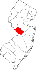
 West Trenton, New Jersey  West Trenton, New Jersey  West Trenton, New Jersey Location of West Trenton in Mercer County Inset: Location of county within the state of New Jersey | |
| Coordinates: 40°15′50″N 74°49′07″W / 40.26389°N 74.81861°WCoordinates: 40°15′50″N 74°49′07″W / 40.26389°N 74.81861°W | |
| Country |
|
| State |
|
| County | Mercer |
| Township | Ewing |
| Elevation[1] | 164 ft (50 m) |
| GNIS feature ID | 881731[1] |

West Trenton is a section of Ewing Township in Mercer County, New Jersey, United States. It is a suburban area located adjacent to the northwestern portion of the city of Trenton, from which it derives its name.[2] Located at the intersection of Bear Tavern Road/Grand Avenue and West Upper Ferry Road, it is one of the oldest settlements in Ewing Township.
History
The community was known as Birmingham and then Trenton Junction before adopting its current name.[3] Today, West Trenton is primarily a residential neighborhood consisting of a mixture of detached, single-family homes and semi-attached, half-duplexes, the majority of which were built from the early 1900s through the 1950s.[4]
Main sights
It is home to the New Jersey State Police Headquarters, Trenton-Mercer Airport, Trenton Country Club,[5] New Jersey Manufacturers Insurance Company, The Homasote Company, The Marie H. Katzenbach School for the Deaf,[6] and the nearby Villa Victoria Academy, a Catholic primary and secondary school for girls. Religious institutions include Our Lady of Good Counsel Church (Roman Catholic),[7] West Trenton Presbyterian Church, and Calvary Chapel of Mercer County (Evangelical). Interstate 95 is just northwest of the community and is linked to it by Bear Tavern Road. West Trenton Train Station is the outermost stop on the SEPTA Regional Rail West Trenton Line.
West Trenton was the site of the General Motors Inland Fisher Guide Plant owned by its Fisher Body division. During World War II, the TBM version of the Grumman TBF Avenger torpedo bomber was produced here for the United States Navy. Women were employed to fly the bombers from the nearby airport to their deployment sites. The facility was demolished and the site is awaiting final environmental remediation and redevelopment.
The Naval Air Warfare Center Trenton was also located in West Trenton from 1953 to 1997.
References
- 1 2 "West Trenton". Geographic Names Information System. United States Geological Survey.
- ↑ Locality Search, State of New Jersey. Accessed January 7, 2015.
- ↑ Jo Ann Tesauro (2002). Images of America: Ewing Township. Arcadia Publishing. pp. 7–8. ISBN 0-7385-1040-8.
Birmingham/Trenton Junction/West Trenton was a village whose main intersection was located at today's Bear Tavern and West Upper Ferry Roads. It contained a blacksmith shop, a cobbler, and several homesteads. Birmingham was renamed Trenton Junction in 1882. The Trenton Junction Station was built in the late 1880s, and c. 1930 it was renamed West Trenton Station.
- ↑ "West Trenton, Ewing Township, New Jersey". livingplaces.com. Retrieved 2015-01-18.
West Trenton is a residential neighborhood of semi-attached twins and detached singles built from the early 1900s through the 1950s. Median age is ca. 1953. Median lot size is approximately 1/4 acre. Typical homes have 3 to 4 bedrooms with 1 to 2 baths; most of the homes have full basements; about half have 1-car, attached garages. The neighborhood is generally centered around the intersection of Upper Ferry Road West with Bear Tavern Road/Grand Avenue.
- ↑ Trenton Country Club website
- ↑ Marie H. Katzenbach School for the Deaf website
- ↑ Our Lady of Good Counsel Church website
External links
 Media related to West Trenton, New Jersey at Wikimedia Commons