West Siang district
| West Siang district | |
|---|---|
| District of Arunachal Pradesh | |
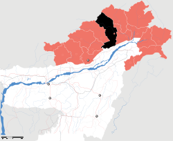 Location of West Siang district in Arunachal Pradesh | |
| Country | India |
| State | Arunachal Pradesh |
| Headquarters | Aalo |
| Area | |
| • Total | 8,325 km2 (3,214 sq mi) |
| Population (2011) | |
| • Total | 112,272[1] |
| Demographics | |
| • Literacy | 67.6%[1] |
| • Sex ratio | 916[1] |
| Website | Official website |
West Siang (Pron:/ˈsjæŋ or ˈsɪæŋ/) is an administrative district in the state of Arunachal Pradesh in India.
History
In 1989 territory was given from West Siang to the East Siang district.[2] Since 1999, this territory has been in the new Upper Siang district.[2] Archaeological finds from Malinithan site in West Siang are on displayed at the Jawaharlal Nehru Museum, Itanagar. west siang is now been divided into upper siang and lower siang.
Geography
The district headquarters are located at Aalo. West Siang district occupies an area of 8,325 square kilometres (3,214 sq mi),[3] comparatively equivalent to Crete.[4]
Transport
The 2,000-kilometre-long (1,200 mi) proposed Mago-Thingbu to Vijaynagar Arunachal Pradesh Frontier Highway along the McMahon Line,[5][6][7][8] (will intersect with the proposed East-West Industrial Corridor Highway) and will pass through this district, alignment map of which can be seen here and here.[9]
Divisions
There are seven Arunachal Pradesh Legislative Assembly constituencies in this district: Liromoba, Likabali, Basar, Along West, Along East, Rumgong, and Mechuka. The first six are part of Arunachal West Lok Sabha constituency, while Mechuka is part of Arunachal East Lok Sabha constituency.[10]
Demographics
Population
According to the 2011 census West Siang district has a population of 112,272,[11] roughly equal to the nation of Grenada.[12] This gives it a ranking of 612th in India (out of a total of 640).[11] The district has a population density of 13 inhabitants per square kilometre (34/sq mi).[11] Its population growth rate over the decade 2001–2011 was 8.04%.[11] West Siang has a sex ratio of 916 females for every 1000 males,[11] and a literacy rate of 67.62%.[11]
Various tribal groups of the Adi people, Memba and Khamba tribes live in the district. The Adi follow generally follow Donyi-Polo, although some have embraced Baptist Christianity in recent years. The Memba and Khamba are followers of Tibetan Buddhism. A well-known Tibetan Buddhist temple, Mechuka Gompa, is located in the western part of the Memba-speaking Mechuka district of West Siang.
Languages
Languages spoken include Adi, a Sino-Tibetan tongue with approximately 140 000 speakers, written in both the Tibetan and Latin scripts;[13] and Galo, an endangered language with 30 000 speakers, also in the Sino-Tibetan language family.[14]
Flora and fauna
The district is rich in wildlife. Rare mammals such as Mishmi takin, Snow leopard, Red panda and Musk deer occurs while among birds there is the rare Blyth's Tragopan.[15] A flying squirrel, new to science has been recently discovered from this district. It has been named as Mechuka Giant Flying Squirrel Petaurista mechukaensis.[16]
In 1991 West Siang district became home to the Kane Wildlife Sanctuary, which has an area of 55 km2 (21.2 sq mi).[17]
References
- 1 2 3 "District Census 2011". Census2011.co.in.
- 1 2 Law, Gwillim (25 September 2011). "Districts of India". Statoids. Retrieved 2011-10-11.
- ↑ Srivastava, Dayawanti et al. (ed.) (2010). "States and Union Territories: Arunachal Pradesh: Government". India 2010: A Reference Annual (54th ed.). New Delhi, India: Additional Director General, Publications Division, Ministry of Information and Broadcasting (India), Government of India. p. 1113. ISBN 978-81-230-1617-7.
- ↑ "Island Directory Tables: Islands by Land Area". United Nations Environment Program. 18 February 1998. Retrieved 2011-10-11.
Crete 8,350km2
- ↑ "Top officials to meet to expedite road building along China border". Dipak Kumar Dash. timesofindia.indiatimes.com. Retrieved 27 October 2014.
- ↑ "Narendra Modi government to provide funds for restoration of damaged highways". http://www.dnaindia.com. Retrieved 27 October 2014. External link in
|publisher=(help) - ↑ "Indian Government Plans Highway Along Disputed China Border". Ankit Panda. thediplomat.com. Retrieved 27 October 2014.
- ↑ "Govt planning road along McMohan line in Arunachal Pradesh: Kiren Rijiju". Live Mint. Retrieved 2014-10-26.
- ↑ "China warns India against paving road in Arunachal". Ajay Banerjee. tribuneindia.com. Retrieved 2014-10-26.
- ↑ "Assembly Constituencies allocation w.r.t District and Parliamentary Constituencies". Chief Electoral Officer, Arunachal Pradesh website. Retrieved 21 March 2011.
- 1 2 3 4 5 6 "District Census 2011". Census2011.co.in. 2011. Retrieved 2011-09-30.
- ↑ US Directorate of Intelligence. "Country Comparison:Population". Retrieved 2011-10-01.
Grenada 108,419 July 2011 est.
- ↑ M. Paul Lewis, ed. (2009). "Adi: A language of India". Ethnologue: Languages of the World (16th ed.). Dallas, Texas: SIL International. Retrieved 2011-09-28.
- ↑ M. Paul Lewis, ed. (2009). "Galo: A language of India". Ethnologue: Languages of the World (16th ed.). Dallas, Texas: SIL International. Retrieved 2011-09-28.
- ↑ Choudhury, Anwaruddin (2008) Survey of mammals and birds in Dihang-Dibang biosphere reserve, Arunachal Pradesh. Final report to Ministry of Environment & Forests, Government of India. The Rhino Foundation for nature in NE India, Guwahati, India. 70pp.
- ↑ Choudhury,Anwaruddin (2007).A new flying squirrel of the genus Petaurista Link from Arunachal Pradesh in north-east India. The Newsletter and Journal of the RhinoFoundation for nat. in NE India 7: 26–34, plates.
- ↑ Indian Ministry of Forests and Environment. "Protected areas: Arunachal Pradesh". Retrieved 25 September 2011.
External links
| Wikimedia Commons has media related to West Siang district. |
- Official website
- List of places in West-Siang
 |
|
Upper Siang district | | |
| Upper Subansiri district | |
East Siang district | ||
| ||||
| | ||||
| Lower Subansiri district | Dhemaji district, Assam |
Coordinates: 28°24′N 94°33′E / 28.400°N 94.550°E