West Mani
| West Mani Δυτική Μάνη | |
|---|---|
|
Dytiki Mani municipality | |
 West Mani | |
|
Location within the region  | |
| Coordinates: 36°51′N 22°16′E / 36.850°N 22.267°ECoordinates: 36°51′N 22°16′E / 36.850°N 22.267°E | |
| Country | Greece |
| Administrative region | Peloponnese |
| Regional unit | Messenia |
| Area | |
| • Municipality | 402.8 km2 (155.5 sq mi) |
| Population (2011)[1] | |
| • Municipality | 6,945 |
| • Municipality density | 17/km2 (45/sq mi) |
| Time zone | EET (UTC+2) |
| • Summer (DST) | EEST (UTC+3) |
West Mani (Greek: Δυτική Μάνη - Dytiki Mani) is a municipality in the Messenia regional unit, Peloponnese, Greece. The seat of the municipality is the town Kardamyli.[2] The municipality has an area of 402.809 km2.[3] It comprises the western part of the Mani Peninsula. The eastern part of Mani is covered by the municipality East Mani, in Laconia.
Municipality
The municipality West Mani was formed at the 2011 local government reform by the merger of the following 2 former municipalities, that became municipal units:[2]
References
- ↑ "Απογραφή Πληθυσμού - Κατοικιών 2011. ΜΟΝΙΜΟΣ Πληθυσμός" (in Greek). Hellenic Statistical Authority.
- 1 2 Kallikratis law Greece Ministry of Interior (Greek)
- ↑ "Population & housing census 2001 (incl. area and average elevation)" (PDF) (in Greek). National Statistical Service of Greece.
| Regional unit of Arcadia | 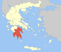 | |
|---|---|---|
| Regional unit of Argolis | ||
| Regional unit of Corinthia | ||
| Regional unit of Laconia | ||
| Regional unit of Messenia | ||
| ||
This article is issued from Wikipedia - version of the 11/17/2016. The text is available under the Creative Commons Attribution/Share Alike but additional terms may apply for the media files.