West End of London

The West End of London (commonly referred to as the West End) is an area of Central and West London containing many of the city's major tourist attractions, shops, businesses, government buildings and entertainment venues, including the West End theatres.
Use of the term began in the early 19th century to describe fashionable areas to the west of Charing Cross.[1] The West End covers much of the boroughs of Westminster and Camden.[2]
While the City of London, or the Square Mile, is the main business and financial district in London, the West End is the main commercial and entertainment centre of the city. It is the largest central business district in the United Kingdom, comparable to Midtown Manhattan in New York City, the Gangnam District in Seoul, Shibuya in Tokyo, Sol in Madrid or the 8th arrondissement in Paris and EUR in Rome. It is one of the most expensive locations in the world in which to rent office space, just behind Silicon Valley's Sand Hill Road.[3]
History
Lying to the west of the historic Roman and Medieval City of London, the West End was long favoured by the rich elite as a place of residence because it was usually upwind of the smoke drifting from the crowded City.[4] It was also close to the royal seat of power at Westminster, and is largely contained within the City of Westminster (one of the 32 London boroughs).
Developed in the 17th, 18th and 19th centuries, it was originally built as a series of palaces, expensive town houses, fashionable shops and places of entertainment. The areas closest to the City around Holborn, Seven Dials, and Covent Garden historically contained poorer communities that were cleared and redeveloped in the 19th century.
Boundaries
As the West End is a term used colloquially by Londoners and not an official geographical or municipal definition, its exact constituent parts are up for debate. The districts falling within the West End according to one chronicler are: Mayfair, Soho, Covent Garden, Fitzrovia and Marylebone.[5] By this definition, the West End borders Temple, Holborn and Bloomsbury to the east, Regent's Park to the north, Paddington, Hyde Park and Knightsbridge to the west, and Victoria and Westminster to the south.
One of the local government wards within the City of Westminster is called 'West End'. This covers a largely similar definition of Mayfair, Soho, and parts of Fitzrovia and Marylebone.[6] The population of this ward at the 2011 Census was 10,575.[7]
Activities

Taking a fairly broad definition of the West End, the area contains the main concentrations of most of London's metropolitan activities apart from financial services, which are concentrated primarily in the City of London. There are major concentrations of the following buildings and activities in the West End:
- Art galleries and museums
- Company headquarters outside the financial services sector (although London's many hedge funds are based mainly in the West End)
- Educational institutions
- Embassies
- Government buildings (mainly around Whitehall)
- Hotels
- Institutes, learned societies and think tanks
- Legal institutions
- Media establishments
- Places of entertainment: theatres; cinemas; nightclubs; bars and restaurants
- Shops
The annual New Year's Day Parade takes place on the streets of the West End.
New West End Company
The New West End Company (NWEC) is a business improvement district and runs services including street cleaning and security on Oxford Street, Regent Street and Bond Street. NWEC also runs the Red Caps service.
Notable streets
- Albemarle Street
- Baker Street
- Bond Street
- Carnaby Street
- Charing Cross Road
- Denmark Street
- Gower Street
- Great Marlborough Street
- Great Portland Street
- Harley Street
- Haymarket
- High Holborn
- King's Road
- Kingsway
- Old Compton Street
- Oxford Street
- Park Lane
- Piccadilly
- Regent Street
- Savile Row
- Shaftesbury Avenue
- The Strand
- Tottenham Court Road
- Wardour Street
Notable squares and circuses
The West End is laid out with many notable public squares and circuses, the latter being the original name for roundabouts in London.
- Berkeley Square
- Cambridge Circus
- Grosvenor Square
- Hyde Park Corner
- Leicester Square
- Manchester Square
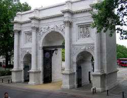
- Marble Arch
- Oxford Circus
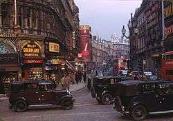
- Piccadilly Circus
- Russell Square
- Soho Square
- St Giles Circus
- Trafalgar Square
Transport
London Underground stations in the West End include:
- Baker Street
- Bond Street
- Charing Cross
- Covent Garden
- Embankment
- Goodge Street
- Great Portland Street
- Green Park
- Holborn
- Hyde Park Corner
- Leicester Square
- Marble Arch
- Oxford Circus
- Piccadilly Circus
- Regent's Park
- Russell Square
- St. James Park
- Temple
- Tottenham Court Road
- Victoria
- Warren Street
- Westminster
References
- ↑ Mills, A., Oxford Dictionary of London Place Names, (2001)
- ↑ Greater London Authority, The London Plan: The Sub Regions
- ↑ "Venture Capital: Sand Hill Road Rules the Valley". Bloomberg News. 4 December 2014. Retrieved 19 April 2015.
- ↑ Robert O. Bucholz and Joseph P. Ward: London: A Social and Cultural History, 1550-1750. Cambridge: Cambridge University Press 2012, p. 333
- ↑ E Gilnert, West End Chronicles (Penguin, 2006)
- ↑ Westminster City Council ward boundary information
- ↑ "City of Westminstee ward population 2011". Neighbourhood Statistics. Office for National Statistics. Retrieved 15 October 2016.
External links
| Wikimedia Commons has media related to West End of London. |
- London's West End Theatres Information and archive material on London's historic West End Theatres.
- London West End Things to do General overview of what to do in the West End
Coordinates: 51°30′48″N 0°07′43″W / 51.51333°N 0.12861°W