Wescosville, Pennsylvania
| Wescosville | |
|---|---|
| census-designated place | |
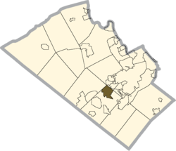 Location within Lehigh County | |
 Wescosville Location within the state of Pennsylvania | |
| Coordinates: 40°34′00″N 75°33′11″W / 40.56667°N 75.55306°WCoordinates: 40°34′00″N 75°33′11″W / 40.56667°N 75.55306°W | |
| Country | United States |
| State | Pennsylvania |
| County | Lehigh |
| Population (2010) | |
| • Total | 5,872 |
| Time zone | Eastern (EST) (UTC-5) |
| • Summer (DST) | EDT (UTC-4) |
| ZIP codes | 18103, 18104, 18106 |
| Area code(s) | 610 & 484 |
| [1] | |
Wescosville is a census-designated place located in Lehigh County, Pennsylvania, United States. The town is located between Allentown, Pennsylvania and Trexlertown, Pennsylvania in Lower Macungie Township. It is split between the Allentown ZIP codes of 18103, 18104, and 18106. As of the 2010 census the population was 5,872 residents.
The primary business district of Wescosville runs along Hamilton Boulevard and is bisected by the Pennsylvania Turnpike Northeast Extension (I-476). Hamilton Boulevard was part of U.S. Route 222 until the Trexlertown-Wescosville Bypass was opened in 2007.
Education
Wescosville is part of the East Penn School District. Students in grades nine through 12 attend Emmaus High School in the district. Students in grades six through eight attend either Eyer Middle School or Lower Macungie Middle School in the district. .
References
External links
 |
Fogelsville | Kuhnsville | Cetronia | |
| Trexlertown | |
Dorneyville | ||
| ||||
| | ||||
| Alburtis ; Ancient Oaks | Macungie | Emmaus |
Municipalities and communities of Lehigh County, Pennsylvania, United States | ||
|---|---|---|
| Cities |  | |
| Boroughs | ||
| Townships | ||
| CDPs | ||
| Unincorporated communities |
| |
| Footnotes | ‡This populated place also has portions in an adjacent county or counties | |