Werowocomoco
|
Werowocomoco Archaeological Site | |
|
Powhatan in a longhouse at Werowocomoco (detail of John Smith map, 1612) | |
  | |
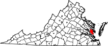
| Location | 3051 Ginny Hill Rd., Gloucester, Virginia |
|---|---|
| Coordinates | 37°24′43″N 76°38′56″W / 37.412°N 76.649°WCoordinates: 37°24′43″N 76°38′56″W / 37.412°N 76.649°W |
| Area | 45 acres (18 ha) |
| Built | 1607 |
| NRHP Reference # | 06000138[1] |
| VLR # | 036-5049 |
| Significant dates | |
| Added to NRHP | March 15, 2006 |
| Designated VLR | December 7, 2005[2] |

Werowocomoco was a town that served as the headquarters of the Powhatan, a Virginia Algonquian political and spiritual leader when the English founded Jamestown in 1607. While residing at Werowocomoco, Powhatan received tribute from several Virginia Algonquian tribes in return for providing food in times of famine, military protection, and spiritual powers. Additionally, he distributed sacred materials such as copper and certain colors of shell beads. This site had been occupied by American Indian peoples since 1200 CE.
"Werowocomoco" was documented by English settlers in 1608 as located near the north bank of the York River in what is now Gloucester County. It was separated by that river and the narrow Virginia Peninsula from the English settlement of Jamestown, located on the James River. Powhatan's Chimney, a site of historical ruins associated with a house purported to have been built for Powhatan, was earlier thought to have been the site of this capital.
In 1977, an archaeologist found ground-surface artifacts at a site further west on the York River on Purtan Bay, about 7 miles (11 km) west of Gloucester. He determined they indicated a late Woodland/early European contact-era settlement.
In 2002 current landowners of this site permitted an archaeological survey of their property. It revealed extensive artifacts on what may have been a 50-acre (200,000 m2) settlement, with habitation from the 13th into the 17th century. Archaeologists and anthropologists believe this is the site of Werowocomoco.[3]
Since 2003, a team of archaeologists and related researchers has been working at this site. They and the landowners initiated consultation with the Virginia Council on Indians to plan and execute excavations on the site. Representatives of local Virginia Indian tribes, some of whom are descendants of the tributary tribes of Powhatan, continue to advise the research.[3][4] Excavations at the site since 2003 have revealed evidence of a large town, including two 200-foot (61 m)-long, curved, earthwork ditches built 1,000 feet (300 m) from the river bank about 1400, two hundred years before the English first visited the area.[5] In 2006 the Werowocomoco Archeological Site was listed on the National Register of Historic Places (NRHP). In the future, scholars hope to find more evidence about the political nature of the Powhatan polity.
In 2014, President Barack Obama proposed future federal budget funding to acquire this site in Gloucester County to make it part of the National Park System. Under this proposal, Werowocomoco would be formally opened to public visitation under the management of the National Park Service.[6] The National Park Service completed acquisition of the property in the summer of 2016.[7][8]
Powhatan became the title associated with the paramount chief when Wahunsenacawh (sometimes spelled Wahunsonacock) was selected for the position. He came from a small village named Powhatan, meaning the falls of the river, at the fall line of the James River. His people were known by that geographic name as well. The present-day Powhatan Hill neighborhood of Richmond, Virginia was developed at the site of the former Native American village.
The name Werowocomoco comes from the Powhatan werowans (weroance), meaning "leader" in English; and komakah (-comoco), "settlement". It is unknown when Powhatan moved there. He may have wanted to live in a place associated with Native American leaders.
In 2002–2003 a comprehensive archaeological survey and excavations revealed an extensive settlement on the York River which researchers believe was Werowocomoco.[9] Excavation has revealed that the settlement was inhabited since 1200 CE, and complex earthworks were built about 1400 CE.[5] Powhatan may have made use of a site already well-known to his people as a regional center.
Pocahontas and Captain John Smith
Werowocomoco was the site of several interactions between Powhatan and the English colonists from Jamestown. It is best known as the site where John Smith was taken to meet Powhatan in December 1607. He had been captured by Powhatan's brother Opechancanough while foraging along the Chickahominy River.
According to Smith's 1624 account, now disputed by most scholars, Pocahontas, daughter of Powhatan, prevented her father from executing Smith in December 1607. Historians have been somewhat skeptical of this account, and a few believe Smith may have misinterpreted a ritual intended to adopt Smith into a tribal family. Smith did not refer to this purported incident in earlier accounts (1608 and 1612) of his interaction with the Powhatan. He wrote about it in 1624 for the first time, some 17 years later.
Headquarters relocated from Werowocomoco
In the early years of the colony, the English suffered severely during the winter, a period known as the Starving Time. In December 1608, Powhatan offered to sell them an entire "shipload of corn in exchange for a grindstone, fifty swords, some guns, a cock and a hen, copper and beads, and some men to build him an English-style house."[10] Smith accepted this proposal but, instead of giving Powhatan weapons, the settler planned to surprise him and take the corn by force. Sending four "Dutchmen" (Germans) ahead by land to work on the house, Smith headed for Werowocomoco by sea on December 29 with a small force. While en route, at Warraskoyack he received a report that Powhatan was plotting an ambush of his party.
After many stops, Smith arrived at the village on January 12, 1609. The next day he was taken to see progress on Powhatan's new house in the vicinity. As it happened, Smith's men and Powhatan's men, after failing to persuade each other to disarm, tried to ambush each other simultaneously during the negotiations. After these feints, the English had their corn. Smith's party travelled up the Pamunkey River to trade with Powhatan's brother, Opechancanough. They threatened him at gunpoint to gain food supplies. When they returned to Werowocomoco a few days later, they were surprised to find the house unfinished and the entire town abandoned, for which they blamed the Germans.[11] Powhatan's Chimney was long thought to have been the remains of this uncompleted house. The discovery of major archaeological remains of a more substantial settlement on Purtan Bay makes this unlikely.
Powhatan moved his headquarters to Orapakes, located in a swamp at the head of the Chickahominy River (near the modern-day interchange of Interstate 64 and Interstate 295). Sometime between 1611 and 1614, he moved further north to Matchut, in present-day King William County on the north bank of the Pamunkey River. After Powhatan's death in 1618, Opechancanough succeeded him as paramount chief. He used nearby Youghtanund as his capital, the place where he accepted tribute from a smaller number of tribes than Powhatan had ruled.
Smith describes location
The location of Werowocomoco was lost from English memories during the 17th century. Scholars believed West Point (a town established at the confluence of the Pamunkey and Mattaponi rivers at the headwaters of the York River) seemed to meet a description of the Powhatan village in the writings of colonist John Smith:
"Fourteene myles from the river Powhatan is the river Pamunkee, which is navaginable 60 or 70 myles, but with Cathes and small Barkes 30 or 40 myles further. At the ordinary flowing of the salt water, it divideth itself into two gallent branches. On the South side inhabited the people Toughtamand[?], who haue about 60 men for warres. On the North branch Mattapoment [Mattaponi], who has 30 men. Where the river is divided the Country is called Pamaunkee [Pamunkey], and nourisheth neare 300 able men. About 25 myles lower on the North side of this river is Werawocomoco, where their great king inhabited when I was delivered him prisoner; yet there are not past 40 able men."(sic)
Powhatan's Chimney
In the following years, local people thought that Werowocomoco was located near Powhatan's Chimney in the area of Timberneck Bay, slightly upstream on the York River from Gloucester Point. By local legend, a chimney on the site remained from a house built by John Smith for Powhatan at the latter's regional village. It is about 25 miles (40 km) east of present-day West Point, Virginia.
For this reason, English settlers and their descendants called the area Werowocomoco. Its name was changed to a shorter version, Wicomico, by the US Post Office for ease of use when a post office was established at the village.[12]
Werowocomoco archeological site
In 1977, Daniel Mouer, an archaeologist at Virginia Commonwealth University (VCU), identified a site further west along the York River at Purtan Bay as the possible location of Werowocomoco. When he collected artifacts from the surface of plowed fields and along the beach, he found fragments of Indian ceramics ranging in time from the Late Woodland Period up to European contact. These indicated that this area was the "possible site of 'Werowocomoco'."[13] Based on his findings, the area was designated a Virginia Historic Site.
In 2002 the Ripleys, then the landowners, authorized additional archaeological exploration of their property. They had already found many ancient projectile points on the surface. Between March 2002 and April 2003, archaeologists conducted a comprehensive survey of a portion of the property. Initial testing included digging 603 test holes, each 12 to 16 inches (410 mm) deep and 50 feet (15 m) apart. They found thousands of artifacts throughout the site, meaning that it had integrity and had not been much disturbed. These finds included a blue bead possibly made in Europe for trading.[14]
Together with historical descriptions, because these findings showed substantial, extended settlement, they suggested this farm was the former site of Werowocomoco. "We believe we have sufficient evidence to confirm that the property is indeed the village of Werowocomoco", said Randolph Turner, director of the Virginia Department of Historic Resources' Portsmouth Regional Office in 2003. [9] The Purtan Bay site is less than 25 miles (40 km) from West Point and 15 miles (24 km) from Jamestown. Studies of the early mapping evidence also support scholars' conclusions.
Thane Harpole and David Brown, two Gloucester-based archaeologists, have been instrumental in the work at the Purtan Bay site since 2002.[15] Starting that year, the Werowocomoco Research Group was formed to begin excavations. The Research Group is a collaborative effort of the College of William and Mary, and the Virginia Department of Historic Resources, advised by eastern Virginia tribes.
The excavations revealed a dispersed community of about 50 acres (200,000 m2), occupied from the 13th through the early 17th century (Woodland to early Contact). Artifacts recovered include Native pottery and stone tools, as well as floral and faunal remains from a large residential community. The Research Group has also recovered numerous English trade goods, produced from glass, copper, and other metals, which came from Jamestown. This conforms to colonists' accounts of trading at Werowocomoco; they noted that Powhatan was very interested in English objects, particularly copper, during the early days of the Jamestown colony.
In 2004, researchers discovered two large earthworks: curving ditches, each more than 200 feet (61 m) in length and located about 1,000 feet (300 m) from the river. They may be part of a D-shaped construction noted on John Smith's 1612 map. The researchers have determined the ditches dated from about 1400 CE, indicating Virginia Indians had established long-term settlement at this site more than 200 years prior to the English arrival at Jamestown.[5] Earthwork constructions were often integral to ceremonial centers, and these may have defined or separated a sacred area. Continuing discoveries from excavations are helping scholars understand Virginia Indian-European relations. The period of interaction at this site was brief in relation to the many hundreds of years of prior indigenous settlement.
This project is notable because archaeologists and other researchers have carefully incorporated consultation about planning and executing the excavations with members of the local recognized Virginia Indian tribes. These include the Mattaponi, Pamunkey, and Upper Mattaponi, some of whose people consider such sites sacred, as they include burial artifacts of their ancestors.
- "When I step on this site folks...I just feel different. The spirituality just touches me and I feel it." Stephen R. Adkins, chief of the Chickahominy Tribe and a member of the Virginia Indian advisory board.[5]
Because of the significance of the excavations, in 2006 the Werwomocomo Archaeological Site was listed on the National Register of Historic Places (NRHP).[1]
Gloucester County
Both the newly identified site on Purtan Bay and the site of Powhatan's Chimney at Wicomico are located within an area that the Native Americans may have considered Werowocomoco. The Gloucester County Board of Supervisors noted that the village of the chief in the Algonquian language was not a place name, but more correctly translated as a reference to the lands where he lived. The culture frequently relocated quarters within a general area.[16]
References
- 1 2 National Park Service (2010-07-09). "National Register Information System". National Register of Historic Places. National Park Service.
- ↑ "Virginia Landmarks Register". Virginia Department of Historic Resources. Retrieved 5 June 2013.
- 1 2 JOHN NOBLE WILFORD, "Virginia Site Is Considered Possible Home Of Pocahontas", New York Times, 7 May 2003, accessed 22 Aug 2009
- ↑ "Werowocomoco: Seat of Power Special Exhibition". Historyisfun.org. Jamestown-Yorktown Foundation. Retrieved 1 August 2016.
- 1 2 3 4 Suzanne Seurattan, "Werowocomoco ditches date back to at least early 1400s", College of William and Mary, 9 Aug 2004, accessed 22 Sep 2009
- ↑ Springston, Rex (2014-05-19). "Effort seeks to add Werowocomoco to national park system". Richmond Times-Dispatch: Science & Technology. Retrieved 2014-05-26.
- ↑ "Werowocomoco Planning". Nps.gov. U.S. National Park Service. Retrieved 1 August 2016.
- ↑ Hubbard, Frances (27 June 2016). "Powhatan Village becoming National Park". Daily Press. Retrieved 1 August 2016.
- 1 2 Bootie Cosgrove-Mather (2003-05-07). "Powhatan's Tribal Village Found, 17th Century Indian Chief Was Father Of Pocahontas". CBS News. Retrieved 2009-02-17.
- ↑ Rountree 1990 p. 49, citing Smith's 1612 account.
- ↑ Rountree p.50-51, citing Smith [1612].
- ↑ "Werowocomoco renamed to Wicomico", Pocahontas Foundation Archived January 18, 2007, at the Wayback Machine.
- ↑ "Werowocomoco". College of William and Mary. Retrieved 2009-02-17.
- ↑ "Werowocomoco". Powhatan.wm.edu. Retrieved 2009-02-17.
- ↑ "Topic Galleries - dailypress.com". Daily Press. 14 January 2007. Archived from the original on February 16, 2007. Retrieved 2009-02-17.
- ↑ "Minutes, Gloucester Co. Board of Supervisors; Wednesday, November 8, 2006" (PDF). 8 November 2006. Archived from the original (PDF) on 21 February 2007.
External links
- Werowocomoco Research Project, College of William and Mary
- The Anglo-Powhatan Wars, Virginia Places
- "John Smith's map of Virginia", Maryland State Archives
- "Werowocomoco field work increases understanding of European-Indian contact", College of William and Mary, 22 Aug 22 2007

