Wenchuan County
Coordinates: 31°29′1.64″N 103°35′18.25″E / 31.4837889°N 103.5884028°E
| Wenchuan County 汶川县 | |
|---|---|
| County | |
| Chinese transcription(s) | |
| • Simplified | 汶川县 |
| • Traditional | 汶川縣 |
| • Pinyin | Wènchuān Xiàn |
| • Tibetan | ལུང་དགུ་རྫོང་། |
|
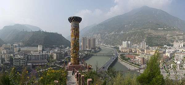
Street view of Yingxiu town, July 2005 | |
.png) Wenchuan (red) in Ngawa Prefecture (yellow), Sichuan province, and the PRC | |
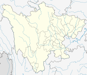 Wenchuan Location in Sichuan | |
| Coordinates: 31°29′1.64″N 103°35′18.25″E / 31.4837889°N 103.5884028°E | |
| Country | People's Republic of China |
| Province | Sichuan |
| Prefecture | Ngawa |
| County seat | Weizhou |
| Area | |
| • Total | 4,084 km2 (1,577 sq mi) |
| Population (2005) | |
| • Total | 106,119 |
| • Density | 26/km2 (67/sq mi) |
| • Major nationalities |
Han - 46% Qiang - 34% Tibetan - 18.6% |
| Time zone | China Standard (UTC+8) |
| Postal code | 623000 |
| Area code(s) | 0837 |

Wenchuan County (Chinese: 汶川县; pinyin: Wènchuān Xiàn, Tibetan: ལུང་དགུ་རྫོང༌།, ZYPY: Lunggu Zong ) is a county in Ngawa Tibetan and Qiang Autonomous Prefecture, Sichuan, People's Republic of China.
This county has an area of 4,084 square kilometres (1,577 sq mi) and a population of 106,119 as of 2005.[1]
Wolong National Nature Reserve is a protected area located in Wenchuan County, which houses more than 150 highly endangered giant pandas. The Wolong Special Administrative Region is also located here.
The area was the site of the epicentre and one of the most severely hit areas of the 2008 Sichuan earthquake (or Wenchuan earthquake).
Wenchuan earthquake
On May 12, 2008, the area was the site of the epicentre and one of the most severely hit areas of the great Sichuan, or Wenchuan, earthquake (汶川地震). In Chinese, the earthquake is named after the county, making its name resonate across the nation. In the county, 15,941 people were dead, 34,583 injured, and 7,474 still missing as of June 6, 2008.[2][3]
Wenchuan was at the center of one of two areas where seismic intensity were the highest at XI liedu during this earthquake.[4] Since the earthquake, the central government has increased fortification intensity for seismic design for this area from VII to VIII.[5]
Subdivisions
Wenchuan County has six towns and eight townships:[6]
- Towns:
- Townships:
Transport
References
- ↑ (Chinese) Profile of Wenchuan County, official website of Wenchuan County Government, visited on May 12, 2008.
- ↑ "Casualties in Wenchuan Earthquake" (in Chinese). Sina.com. 2008-06-02. Retrieved 2008-06-02.
- ↑ "Death Toll in Ngawa Prefecture Rose to 20,258 as of June 6, 18:00 CST" (in Chinese). Official website of Ngawa Prefecture Government. 2008-06-07. Archived from the original on 2008-06-09. Retrieved 2008-06-07.
- ↑ "Seismic intensity map of the M8.0 Wenchuan earthquake (汶川8.0级地震烈度分布图)" (in Chinese). CEA. 2008-08-29. Retrieved 2008-09-10.
- ↑ XU, Zhengzhong; WANG, Yayong; et al. (徐正忠、王亚勇等) (2001). "Code for seismic design of buildings (GB 500011-2001) (partially revised in 2008), Appendix A ( 《建筑抗震设计规范》(GB 500011-2001) (2008 年局部修订) 附录 A 我国主要城镇抗震设防烈度、设计基本地震加速度和设计地震分组)" (in Chinese). Ministry of Housing and Urban-Rural Development of PRC (MOHURD, 中华人民共和国住房和城乡建设部). Retrieved 2008-09-29.
- ↑ (Chinese) Profile of Wenchuan County, visited on May 25, 2008.
External links
| Wikivoyage has a travel guide for Wenchuan. |