Weld County, Colorado
| Weld County, Colorado | |
|---|---|
 Weld County Courthouse | |
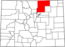 Location in the U.S. state of Colorado | |
 Colorado's location in the U.S. | |
| Founded | November 1, 1861 |
| Seat | Greeley |
| Largest city | Greeley |
| Area | |
| • Total | 4,017 sq mi (10,404 km2) |
| • Land | 3,987 sq mi (10,326 km2) |
| • Water | 30 sq mi (78 km2), 0.7% |
| Population (est.) | |
| • (2015) | 285,174 |
| • Density | 63/sq mi (24/km²) |
| Congressional district | 4th |
| Time zone | Mountain: UTC-7/-6 |
| Website |
www |
Weld County is one of the 64 counties of the U.S. state of Colorado. As of the 2010 census, the population was 252,825.[1] The county seat is Greeley.[2]
Weld County comprises the Greeley, CO Metropolitan Statistical Area, which is also included in the Denver-Aurora, CO Combined Statistical Area.[3]
History

On May 30, 1854, the Kansas-Nebraska Act created the Nebraska Territory and the Kansas Territory, divided by the Parallel 40° North (Baseline Road or County Line Road or Weld County Road 2 in the future Weld County). Present-day Weld County, Colorado, lay in the southwestern portion of the Nebraska Territory, bordering the Kansas Territory.
In July 1858, gold was discovered along the South Platte River in Arapahoe County, Kansas Territory. This discovery precipitated the Pike's Peak Gold Rush. Many residents of the mining region felt disconnected from the remote territorial governments of Kansas and Nebraska, so they voted to form their own Territory of Jefferson on October 24, 1859. The following month, the Jefferson Territorial Legislature organized 12 counties for the new territory, including St. Vrain County. St. Vrain County was named in honor of Ceran de Hault de Lassus de St. Vrain, the French trader who established the first trading post on the upper South Platte River. St. Vrain County encompassed much of what is today Weld County.
The Jefferson Territory never received federal sanction, but on February 28, 1861, U.S. President James Buchanan signed an act organizing the Territory of Colorado.[4] On November 1, 1861, the Colorado General Assembly organized 17 counties, including Weld County, for the new Colorado Territory. Weld County was named for Lewis Ledyard Weld, a lawyer and territorial secretary. He died while serving in the Union Army during the Civil War.[5] Until February 9, 1887, Weld County's boundaries included the area now comprising Weld County, Washington County, Logan County, Morgan County, Yuma County, Phillips County, and Sedgwick County.
Weld County was thrust into the media spotlight on the evening of November 1, 1955, when United Airlines Flight 629, a Douglas DC-6B airliner flying from Denver to Portland, Oregon, exploded in midair and crashed, killing all 44 persons on board the plane and scattering bodies, wreckage and debris over a six-square-mile area of the county. The subsequent investigation of the accident revealed that Denver resident John Gilbert Graham had secretly placed a time bomb composed of 25 sticks of dynamite in a suitcase belonging to his mother, who was a passenger on the airplane. Graham was tried and convicted of the crime, and executed in 1957.
In northeastern Weld County, Minuteman III missile silo "N-8",[6] one of the many unmanned silos there, was the target of symbolic vandalism by Catholic peace activists in 2002.[7][8]
In 2013, conservative Weld County commissioners began a campaign to secede from the State of Colorado and a state ballot measure regarding the issue was put on the November 2013 ballot. The legality of this initiative has been questioned by local attorneys.[9] On Nov 5th, 2013, 6 out of 11 Colorado counties voted no for secession, including Weld County. Elbert, Lincoln, Logan, Moffat, Sedgwick, and Weld counties voted no, while Cheyenne, Kit Carson, Phillips, Washington, and Yuma counties voted yes. "Weld County voters said this is an option we shouldn't pursue and we won't pursue it," said Weld County Commissioner Sean Conway, "But we will continue to look at the problems of the urban and rural divide in this state."[10]
Weld County also holds the distinction of having the most confirmed tornado sightings in the U.S. from 1950-2011, with 252 confirmed reports.[11]
Geography


According to the U.S. Census Bureau, the county has a total area of 4,017 square miles (10,400 km2), of which 3,987 square miles (10,330 km2) is land and 30 square miles (78 km2) (0.7%) is water.[12] It is the third-largest county in Colorado by area.
Weld County lies within the relatively flat eastern portion of Colorado; the northeastern portions of the county contain the extensive Pawnee National Grassland and the Pawnee Buttes, which jut 350 feet (110 m) above the surrounding terrain and are surrounded by many small canyons and outcroppings. Along the western border hilly areas betray the presence of the foothills of the Rocky Mountains further west.
The county is served by two interstate highways: I-25 (US 87) runs through the southwestern corner and I-76 from the south central edge northeastward to the Morgan county border. Other major roads include US 85 and US 34, which intersect near Greeley, and State Highway 14, which runs through Ault.
Adjacent counties
- Kimball County, Nebraska - northeast
- Logan County - east
- Morgan County - east
- Adams County - south
- City and County of Broomfield - southwest
- Boulder County - west
- Larimer County - west
- Laramie County, Wyoming - northwest
National protected area

State protected area
Trails and byways
- American Discovery Trail
- Pawnee Pioneer Trails
- Poudre River National Recreation Trail
- South Platte Trail
Demographics
| Historical population | |||
|---|---|---|---|
| Census | Pop. | %± | |
| 1870 | 1,636 | — | |
| 1880 | 5,646 | 245.1% | |
| 1890 | 11,736 | 107.9% | |
| 1900 | 16,808 | 43.2% | |
| 1910 | 39,177 | 133.1% | |
| 1920 | 54,059 | 38.0% | |
| 1930 | 65,097 | 20.4% | |
| 1940 | 63,747 | −2.1% | |
| 1950 | 67,504 | 5.9% | |
| 1960 | 72,344 | 7.2% | |
| 1970 | 89,297 | 23.4% | |
| 1980 | 123,438 | 38.2% | |
| 1990 | 131,821 | 6.8% | |
| 2000 | 180,936 | 37.3% | |
| 2010 | 252,825 | 39.7% | |
| Est. 2015 | 285,174 | [13] | 12.8% |
| U.S. Decennial Census[14] 1790-1960[15] 1900-1990[16] 1990-2000[17] 2010-2015[1] | |||
As of the census[18] of 2000, there were 180,936 people, 63,247 households, and 45,221 families residing in the county. The population density was 45 people per square mile (18/km²). There were 66,194 housing units at an average density of 17 per square mile (6/km²). The racial makeup of the county was 81.71% White, 0.56% Black or African American, 0.87% Native American, 0.83% Asian, 0.08% Pacific Islander, 13.29% from other races, and 2.65% from two or more races. 27.05% of the population were Hispanic or Latino of any race.
There were 63,247 households out of which 37.20% had children under the age of 18 living with them, 57.60% were married couples living together, 9.40% had a female householder with no husband present, and 28.50% were non-families. 21.00% of all households were made up of individuals and 6.90% had someone living alone who was 65 years of age or older. The average household size was 2.78 and the average family size was 3.25.
In the county the population was spread out with 28.20% under the age of 18, 13.20% from 18 to 24, 29.70% from 25 to 44, 20.00% from 45 to 64, and 9.00% who were 65 years of age or older. The median age was 31 years. For every 100 females there were 100.60 males. For every 100 females age 18 and over, there were 98.00 males.
The median income for a household in the county was $42,321, and the median income for a family was $49,569. Males had a median income of $35,037 versus $25,757 for females. The per capita income for the county was $18,957. About 8.00% of families and 12.50% of the population were below the poverty line, including 14.60% of those under age 18 and 8.50% of those age 65 or over.
Economy
Weld County is Colorado's leading producer of cattle, grain and sugar beets, and is the richest agricultural county in the United States east of the Rocky Mountains, and the fourth richest overall nationally. It is also becoming more important as a milk producing county, with close to half of the state's cattle.[19] Weld County is also an important area of oil and natural gas production in the Denver-Julesburg Basin.
Communities

Cities
Towns
CDP
Unincorporated communities
‡ means a populated place has portions in an adjacent county or counties
Politics
| Year | Republican | Democratic |
|---|---|---|
| 2012 | 54.8% 63,775 | 42.2% 49,050 |
| 2008 | 53.4% 56,526 | 44.7% 47,292 |
| 2004 | 62.7% 55,591 | 36.0% 31,868 |
| 2000 | 58.0% 37,409 | 36.3% 23,436 |
| 1996 | 49.7% 26,518 | 39.9% 21,325 |
| 1992 | 38.8% 20,958 | 35.7% 19,295 |
| 1988 | 55.4% 26,497 | 43.0% 20,548 |
| 1984 | 68.5% 31,293 | 30.3% 13,863 |
| 1980 | 58.8% 23,901 | 28.1% 11,433 |
| 1976 | 55.4% 21,976 | 41.6% 16,501 |
| 1972 | 66.3% 24,695 | 31.4% 11,690 |
| 1968 | 57.3% 17,101 | 34.9% 10,420 |
| 1964 | 41.1% 12,204 | 58.2% 17,268 |
| 1960 | 61.0% 17,558 | 38.8% 11,179 |
Weld County has voted Republican in every presidential election since 1968.
See also
- Outline of Colorado
- Index of Colorado-related articles
- St. Vrains County, Jefferson Territory
- Colorado census statistical areas
- Fort St. Vrain Generating Station
- Front Range Urban Corridor
- National Register of Historic Places listings in Weld County, Colorado
References
- 1 2 "State & County QuickFacts". United States Census Bureau. Retrieved June 11, 2014.
- ↑ "Find a County". National Association of Counties. Retrieved 2011-06-07.
- ↑ "OMB Bulletin No. 10-02: Update of Statistical Area Definitions and Guidance on Their Uses" (PDF). United States Office of Management and Budget. December 1, 2009. Retrieved April 19, 2012.
- ↑ "An Act to provide a temporary Government for the Territory of Colorado" (PDF). Thirty-sixth United States Congress. 1861-02-28. Retrieved 2007-11-26.
- ↑ "Weld County, Colorado County Information". ePodunk. Retrieved November 5, 2013.
- ↑ "Warren AFB Minuteman Missile Site Coordinates". Asuwlink.uwyo.edu. Retrieved November 5, 2013.
- ↑ Archived July 7, 2007, at the Wayback Machine.
- ↑ Archived September 27, 2007, at the Wayback Machine.
- ↑ Romano, Analisa (October 9, 2013). "Greeley Attorneys Question Legality Of Weld Commissioners Advocating For 51st State". The Greeley Tribune (via Huffington Post). Retrieved 11 October 2013.
- ↑ Whaley, Monte (5 Nov 2013). "51st state question answered "no" in 6 of 11 counties contemplating secession". www.denverpost.com. The Denver Post. Retrieved 6 March 2014.
- ↑ http://www.ustornadoes.com/2012/05/22/map-u-s-tornadoes-by-county-1950-2011/
- ↑ "US Gazetteer files: 2010, 2000, and 1990". United States Census Bureau. 2011-02-12. Retrieved 2011-04-23.
- ↑ "County Totals Dataset: Population, Population Change and Estimated Components of Population Change: April 1, 2010 to July 1, 2015". Retrieved July 2, 2016.
- ↑ "U.S. Decennial Census". United States Census Bureau. Retrieved June 11, 2014.
- ↑ "Historical Census Browser". University of Virginia Library. Retrieved June 11, 2014.
- ↑ "Population of Counties by Decennial Census: 1900 to 1990". United States Census Bureau. Retrieved June 11, 2014.
- ↑ "Census 2000 PHC-T-4. Ranking Tables for Counties: 1990 and 2000" (PDF). United States Census Bureau. Retrieved June 11, 2014.
- ↑ "American FactFinder". United States Census Bureau. Retrieved 2011-05-14.
- ↑ "Weld County: About Weld". Co.weld.co.us. Retrieved November 5, 2013.
External links
- Weld County Government website
- Colorado County Evolution by Don Stanwyck
- Colorado Historical Society
- Greeley/Weld Economic Development Action Partnership, Inc. (EDAP)
 |
Laramie County, Wyoming | Kimball County, Nebraska | | |
| Boulder County and Larimer County | |
Logan County and Morgan County | ||
| ||||
| | ||||
| City and County of Broomfield | Adams County |
Municipalities and communities of Weld County, Colorado, United States | ||
|---|---|---|
| Cities | | |
| Towns | ||
| CDP | ||
| Unincorporated communities | ||
| Ghost towns | ||
| Footnotes | ‡This populated place also has portions in an adjacent county or counties | |

Coordinates: 40°32′N 104°24′W / 40.54°N 104.40°W