Weissfluhjoch
| Weissfluhjoch | |
|---|---|
|
The Weissflujoch | |
| Highest point | |
| Elevation | 2,693 m (8,835 ft) |
| Prominence | 64 m (210 ft) [1] |
| Parent peak | Weissfluh |
| Coordinates | 46°50′00″N 09°48′23″E / 46.83333°N 9.80639°ECoordinates: 46°50′00″N 09°48′23″E / 46.83333°N 9.80639°E |
| Geography | |
 Weissfluhjoch Location in Switzerland | |
| Location | Graubünden, Switzerland |
| Parent range | Plessur Alps |
| Climbing | |
| Easiest route | Funicular |
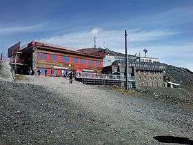
The Weissfluhjoch (2,693 m (8,835 ft)) is a summit southeast of the Weissfluh (2,843 m (9,327 ft)) situated in the Plessur Range in Graubünden. Since 1932, a funicular railway (the Parsennbahn) leads to its summit from Davos.
On the Weissflujoch are located several laboratories of the Institute for Snow and Avalanche Research.[2]
Climate
| Climate data for Weissfluhjoch (1981-2010) | |||||||||||||
|---|---|---|---|---|---|---|---|---|---|---|---|---|---|
| Month | Jan | Feb | Mar | Apr | May | Jun | Jul | Aug | Sep | Oct | Nov | Dec | Year |
| Average high °C (°F) | −5.3 (22.5) |
−6.1 (21) |
−4.7 (23.5) |
−2.3 (27.9) |
2.6 (36.7) |
6.3 (43.3) |
9.9 (49.8) |
9.9 (49.8) |
6.5 (43.7) |
3.6 (38.5) |
−2.1 (28.2) |
−4.6 (23.7) |
1.1 (34) |
| Daily mean °C (°F) | −7.9 (17.8) |
−8.7 (16.3) |
−7.3 (18.9) |
−4.9 (23.2) |
−0.1 (31.8) |
3.1 (37.6) |
5.9 (42.6) |
6.0 (42.8) |
2.9 (37.2) |
0.3 (32.5) |
−4.8 (23.4) |
−7.2 (19) |
−1.9 (28.6) |
| Average low °C (°F) | −10.7 (12.7) |
−11.4 (11.5) |
−10.0 (14) |
−7.3 (18.9) |
−2.5 (27.5) |
0.4 (32.7) |
2.9 (37.2) |
3.1 (37.6) |
0.4 (32.7) |
−2.2 (28) |
−7.3 (18.9) |
−9.9 (14.2) |
−4.5 (23.9) |
| Average precipitation mm (inches) | 99 (3.9) |
90 (3.54) |
96 (3.78) |
83 (3.27) |
115 (4.53) |
165 (6.5) |
182 (7.17) |
193 (7.6) |
119 (4.69) |
78 (3.07) |
97 (3.82) |
95 (3.74) |
1,411 (55.55) |
| Average snowfall cm (inches) | 137.8 (54.25) |
126 (49.6) |
132.1 (52.01) |
109.3 (43.03) |
64.2 (25.28) |
45.7 (17.99) |
16.9 (6.65) |
15.1 (5.94) |
32.8 (12.91) |
52.4 (20.63) |
119.2 (46.93) |
128.7 (50.67) |
980.2 (385.91) |
| Average precipitation days (≥ 1.0 mm) | 10.5 | 9.5 | 13.0 | 12.4 | 14.6 | 15.5 | 15.0 | 14.8 | 11.4 | 9.6 | 11.1 | 10.8 | 148.2 |
| Average snowy days (≥ 1.0 cm) | 13.4 | 11.8 | 15.6 | 14.5 | 10.9 | 7 | 3 | 2.1 | 5.3 | 7.9 | 13 | 14.1 | 118.6 |
| Average relative humidity (%) | 67.1 | 68.4 | 72.3 | 78.4 | 79.1 | 79.6 | 76.4 | 75.9 | 71.8 | 64.5 | 66.7 | 64.3 | 72.0 |
| Mean monthly sunshine hours | 134 | 140 | 150 | 141 | 158 | 153 | 180 | 168 | 156 | 163 | 124 | 116 | 1,782 |
| Source: MeteoSwiss [3] | |||||||||||||
See also
References
- ↑ Retrieved from the Swisstopo topographic maps. The key col is the Wasserscheidi (2,629 m).
- ↑ "Weissfluhjoch test site". sfl.ch. Retrieved 24 February 2014.
- ↑ "Climate Norm Value Tables". Climate diagrams and normals from Swiss measuring stations. Federal Office of Meteorology and Climatology (MeteoSwiss). Retrieved 23 January 2013. The weather station elevation is 2690 meters above sea level.
External links
This article is issued from Wikipedia - version of the 5/8/2016. The text is available under the Creative Commons Attribution/Share Alike but additional terms may apply for the media files.