Wea Township, Tippecanoe County, Indiana
| Wea Township | |
|---|---|
| Township | |
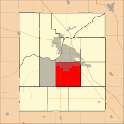 Location in Tippecanoe County | |
| Coordinates: 40°20′34″N 86°52′02″W / 40.34278°N 86.86722°WCoordinates: 40°20′34″N 86°52′02″W / 40.34278°N 86.86722°W | |
| Country | United States |
| State | Indiana |
| County | Tippecanoe |
| Government | |
| • Type | Indiana township |
| Area | |
| • Total | 36.06 sq mi (93.4 km2) |
| • Land | 36.04 sq mi (93.3 km2) |
| • Water | 0.02 sq mi (0.05 km2) 0.06% |
| Elevation | 630 ft (192 m) |
| Population (2010) | |
| • Total | 31,660 |
| • Density | 878.5/sq mi (339.2/km2) |
| ZIP codes | 47905, 47909 |
| GNIS feature ID | 454043 |
Wea Township is one of thirteen townships in Tippecanoe County, Indiana, United States. As of the 2010 census, its population was 31,660 and it contained 13,022 housing units.[1]
Geography
According to the 2010 census, the township has a total area of 36.06 square miles (93.4 km2), of which 36.04 square miles (93.3 km2) (or 99.94%) is land and 0.02 square miles (0.052 km2) (or 0.06%) is water.[1]
Cities, towns, villages
- Lafayette (south quarter)
Unincorporated towns
(This list is based on USGS data and may include former settlements.)
Adjacent townships
- Fairfield Township (north)
- Perry Township (northeast)
- Sheffield Township (east)
- Lauramie Township (southeast)
- Randolph Township (southwest)
- Union Township (west)
Cemeteries
The township contains these cemeteries: Conarroe, Fink, Kenny, Meadow View, O'Neall, Provault, Shoemaker, Sickler, Spring Grove and Wildcat.
Major highways
School districts
- Lafayette School Corporation
- Tippecanoe School Corporation
Political districts
- Indiana's 4th congressional district
- State House District 26
- State House District 27
- State House District 41
- State Senate District 22
References
- United States Census Bureau 2007 TIGER/Line Shapefiles
- United States Board on Geographic Names (GNIS)
- United States National Atlas
- 1 2 "Population, Housing Units, Area, and Density: 2010 - County -- County Subdivision and Place -- 2010 Census Summary File 1". United States Census. Retrieved 2013-05-10.
External links
Municipalities and communities of Tippecanoe County, Indiana, United States | ||
|---|---|---|
| Cities | ||
| Towns | ||
| Townships | ||
| CDPs | ||
| Other unincorporated communities |
| |
| Ghost towns | ||
| Footnotes | ‡This populated place also has portions in an adjacent county or counties | |
This article is issued from Wikipedia - version of the 7/26/2016. The text is available under the Creative Commons Attribution/Share Alike but additional terms may apply for the media files.