Waverly Air Force Station
| Waverly Air Force Station | |
|---|---|
| Part of Air Defense Command (ADC) | |
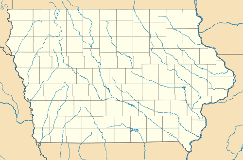 Waverly AFS Location of Waverly AFS, Iowa | |
| Coordinates | 42°41′24″N 092°29′04″W / 42.69000°N 92.48444°W |
| Type | Air Force Station |
| Site information | |
| Controlled by |
|
| Site history | |
| Built | 1951 |
| In use | 1951-1969 |
| Garrison information | |
| Garrison | 788th Aircraft Control and Warning (later Radar) Squadron |
Waverly Air Force Station (ADC ID: P-83, NORAD ID: Z-83) is a closed United States Air Force General Surveillance Radar station. It is located 2.5 miles (4.0 km) south of Waverly, Iowa. It was closed in 1969.
History
Waverly Air Force Station was one of twenty-eight stations built as part of the second segment of the Air Defense Command permanent radar network. Prompted by the start of the Korean War, on July 11, 1950, the Secretary of the Air Force asked the Secretary of Defense for approval to expedite construction of the permanent network.
Receiving the Defense Secretary’s approval on July 21, the Air Force directed the Corps of Engineers to proceed with construction. 87.66 acres were acquired, when the Air Force constructed and operated Waverly Air Force Station, which included 84 structures, a firing range, a septic system, fuel storage tanks, and electrical power. It is noted that the Air Force had a year-to-year lease for this area beginning April 1950, but the leased area was not identical to the eventual property acquired by fee. Northwestern Bell was granted a 50-year lease on the installation to furnish communication services.
The 788th Aircraft Control and Warning Squadron was activated at Waverly on 10 April 1951. By early 1952, the squadron had activated a pair of AN/FPS-10 radars at this station, and initially the station functioned as a Ground-Control Intercept (GCI) and warning station. As a GCI station, the squadron's role was to guide interceptor aircraft toward unidentified intruders picked up on the unit's radar scopes. The AN/FPS-10 search radars continued operating until replaced in the 1960s with an AN/FPS-27. In 1959 an AN/FPS-6 and 6A replaced the other AN/FPS-10 height-finder radar.
During 1959 Waverly AFS joined the Semi Automatic Ground Environment (SAGE) system, feeding data to DC-07 at Truax Field, Wisconsin. After joining, the squadron was redesignated as the 788th Radar Squadron (SAGE) on 1 November 1959. The radar squadron provided information 24/7 the SAGE Direction Center where it was analyzed to determine range, direction altitude speed and whether or not aircraft were friendly or hostile. By 1963 one of the height-finder radars was replaced by an AN/FPS-90, and the station was re-designated as NORAD ID Z-83 on 31 July.
In addition to the main facility, Waverly operated three AN/FPS-18 Gap Filler sites:
- La Motte AFS, IA (P-81B) 42°19′24″N 090°39′27″W / 42.32333°N 90.65750°W
- La Crescent AFS, MN (P-81C) 43°51′35″N 091°18′59″W / 43.85972°N 91.31639°W
- Washington, IA (P-81E) 41°16′17″N 091°44′41″W / 41.27139°N 91.74472°W
Routine operations were performed until the late 1960s when the Air Force inactivated the 788th and Waverly AFS on 30 September 1969. After its inactivation, the Air Force demolished one of the radar buildings (building 310), leaving the foundation intact. Building 309, another radar building, had its stainless steel dome removed, leaving the walls, foundation, and stairways intact.
The radar station was excessed by the Air Force to GSA in April 1971, which in August transferred 8.63 acres, which included the 3.94-acre family housing area, to the Dept. of the Navy. 4.13 acres had previously been transferred to the Army in May 1968, for use by the Iowa National Guard and known as the Waverly Army National Guard Training Facility.
Today it is abandoned. The station buildings are in various states of use or decay, the radar towers still standing.
Air Force units and assignments

Units
- Constituted as the 788th Aircraft Warning and Control Squadron
- Activated on 10 April 1951
- Redesignated as 788th Radar Squadron (SAGE) on 1 November 1959
- Inactivated on 30 September 1969
Assignments
- 543d Aircraft Control and Warning Group, 10 April 1951
- 31st Air Division, 6 February 1952
- 20th Air Division, 1 March 1956
- 37th Air Division, 15 October 1958
- 30th Air Division, 1 April 1959
- Chicago Air Defense Sector, 1 June 1959
- 20th Air Division, 1 April 1966
- 30th Air Division, 1 December 1967
- 29th Air Division, 1 July 1968 - 30 September 1969
See also
- List of USAF Aerospace Defense Command General Surveillance Radar Stations
- List of United States Air Force aircraft control and warning squadrons
References
![]() This article incorporates public domain material from the Air Force Historical Research Agency website http://www.afhra.af.mil/.
This article incorporates public domain material from the Air Force Historical Research Agency website http://www.afhra.af.mil/.
- Cornett, Lloyd H; Johnson, Mildred W (1980). A Handbook of Aerospace Defense Organization, 1946 - 1980 (PDF). Peterson AFB, CO: Office of History, Aerospace Defense Center.
- Winkler, David F.; Webster, Julie L (1997). Searching the skies : the legacy of the United States Cold War defense Radar Program (PDF). Champaign, IL: US Army Construction Engineering Research Laboratories. LCCN 97020912.
- Information for Waverly AFS, IA
