Waterloo, Sierra Leone
| Waterloo, Sierra Leone | |
|---|---|
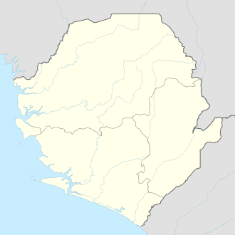 Waterloo, Sierra Leone Location in Sierra Leone | |
| Coordinates: 8°20′N 13°04′W / 8.333°N 13.067°W | |
| Country |
|
| Region | Western Area |
| District | Western Area Rural District |
| Government | |
| • Type | Town council |
| • Town Head | Dennis Omojowo Browne |
| Population | |
| • Total | 48,079 |
| Time zone | GMT (UTC-5) |
Waterloo is a city in the Western Area of Sierra Leone and the capital of the Western Area Rural District. The city is the second largest in the Western Area (after Freetown) and lies about 20 miles (by road) east of Freetown . The city had a population of 34,079 in the 2004 census [1] and a recent estimate of 48,079 . Waterloo is part of Freetown metropolitan area.
Waterloo is a major transport hub and lies on the main highway linking Freetown to the country's provinces. Waterloo is an urban area and lies within close proximity between Freetown and Port Loko District in the Northern Province.
Waterloo is one of Sierra Leone's most ethnically diverse cities, as it is home to many of Sierra Leone's ethnic groups, with no single ethnic group forming the majority of the population. The Krio people are the principal inhabitant of Waterloo and they are politically influential in the city. The Krio language is by far the most widely spoken language in the city.
Although Waterloo is part of the larger Western Area Rural district council, the city has its own directly elected town council headed by a town head. The current Town Head of Waterloo is Dennis omojowo Browne, who was elected in the 2013 Waterloo Town Head municipal election.
History
Waterloo was founded in 1819 as a settlement for liberated Africans. Incorporated into the parish system under the tutelage of the Church Missionary Society (CMS), Waterloo was settled by soldiers from the second and fourth West India Regiment from Jamaica and Barbados. The town was named after the Anglo-Allied army victory over Napoleon Bonaparte in the Battle of Waterloo in present-day Belgium.
The ex-military men settled in "Soja Town" bordering King Street, an artery leading to King Yard which housed the police station, courthouse, and jailhouse. The settlers were later joined by several groups of Recaptives, whose integration into the village community was facilitated by Governor MacCarthy's insistence on education and religion via schools, personages and churches. Several Christian denominations, primarily of Anglican, Countess of Huntingdon, and Wesleyan persuasions established churches and schools throughout the fast-growing populace.
Following the establishment of the Mixed Commissions in Freetown in 1819 (primarily to set recaptured slaves free), the number of Recaptives in Freetown grew. This growth resulted in a corresponding increase in the Recaptives population in Waterloo. Unlike the original settlers from Jamaica and Barbados, the Recaptives had made minimal sustained contact with Western languages and cultures. In efforts to restore some lifestyle stability in their new environment, the Recaptives settled along ethnic or tribal lines. Thus, the Yoruba settled in Aku Town, the Igbo in Ibo Town, the ex-military Recaptives in Soja Town, etc.
The community which emerged established social welfare institutions and secret societies such as Osusu, Ojeh, Hunting, Geledeh, and Akanja as measures to perpetuate their culture, provide a framework for social stability, and increase their independence. With the inculcation of Christian values and Western education, and under the supervision of the village headman (who enforced the rule of law), Waterloo evolved as a stable economic, cultural, and socio-political centre.
In less than half a century since its inception, Waterloo emerged as an important economic hub buffering Sierra Leone’s provincial capitals and the nation’s capital. Throughout the 19th and 20th Centuries, the city continued to serve as a gateway to and from the hinterland and blossomed as a trading centre into which goods and services from Freetown and the Sierra Leone peninsula converged. Its economic prosperity coupled with its proximity to the city brought together diverse people from different parts of the nation.
Geography
The town of Waterloo is located some 20 miles from Freetown at 8.33833 degree latitude, -13.0719 degree longitude at an elevation of 40 meters. With a population estimated at approximately 40,000. It is the second largest city in the Western Area and an important crossroad where roads connecting provincial capitals and the Sierra Leone peninsula to the nation’s capital meet. The prosperity which reigned in Waterloo throughout the 19th and 20th centuries was shattered by the outbreak of the Sierra Leone Civil War in the 1990s, during which rebel soldiers pillaged and ravaged homes, schools, churches, offices, and government buildings, with many inhabitants fleeing the town.
People
Intermarriages between the newly arrived ex-servicemen from Barbados and Jamaica and the Africans liberated from slavery generously enriched elements of culture in the town. The language that resulted from the fusion of these cultures evolved into Krio language, which retained its English base while absorbing other linguistic elements from a variety of African and European languages and dialects which is evident in words such as boku (beaucoup), encore (French); otutu, alakpa, joko (Yoruba); sabi, pikin (Jamaican Maroon Creole and Portuguese); kapu (Mende), etc.
The descendants of these repatriated soldiers and the liberated Africans formed a nucleus of the Krio society in Waterloo. In addition, the skills, knowledge and attitudes that the new settlers acquired facilitated their integration into the new settlement and provided the foundation for cultural adaptation and socio-economic reconstruction. Prominent people from Waterloo include: Justice C.O. E. Cole (the first president of the Republic of Sierra Leone), Bishop T. S. Johnson, (religion), Rev. Dr. David A. Shodeke (religion), Edward P. Nicol (education, organ music & religion), S.B. Nicol-Cole (banking/civil service), Christiana Thorpe (religion & civil service), S.D. King (organ music), Edward Taylor (civil service & organ music), Marcus Grant (Trade Union), Alex M.T Sesay (Pharm.D, Pharmacist), C.R.A. Cole (education & civil service), J.C.O Crowther (business), Latelewa Doherty (civil service), Rev. Dr. Moses & Rev. Sensi & Rev. Eustace Renner (religion & civil service), Rev. Nathaniel Pabs-Garnon (civil service & religion), Abu Kargbo (politics), Claudius Taylor (medical), Mani Garber (business), J. Akparah-Williams (civil service & business), Tabitha Williams (business), Rev. Thomas A. Nicol (religion), Pastor Jonathan Leigh (religion), Norman/Pastor Joseph R. Terry (religion), Dunstance Yayomi Alongo-Coker (civil service), Samuel Balogun-Palmer (Social activist), Taiwo M’Carthy (religion & organ music), Johnny Sawyerr (civil service), Mary Renner (religion), Marcus Gurvey (business & education), Dowu Kamara (trade union), Ashekpa Kainde MacCarthy (herbal medicine), Abayomi Cole (medical), Oguntayo Young (education, civil service), Emmanuel Taiwo Cole (business), Edward Coker (education & organ music), Sarah Farmer (Civil Service), Manfred Onike Cole (civil service), Agba Sulay Kamara (herbal medicine), Koni Davies (civil service), Alhaji O. Jalloh (business), Victor Chukuma Johnson (politics), and Ibrahim Turay (Olympic sprinter).
Links with Liverpool
A British charity, the Waterloo Partnership, fundraises in Waterloo and Crosby areas of Liverpool for its Sierra Leone namesake.[2]
References
- ↑ Republic of Sierra Leone: 2004 Population and Housing Census: Analytical Report on Population Distribution, Migration and Urbanisation in Sierra Leone.
Ibrahim Mohamed Sesay, Andrew A. Karam, Jinnah J. Ngobeh. Published November 2006. - ↑ The Waterloo Partnership. Two Waterloos, One Hope
- Ali, J.A. D. (1990) A New History of Sierra Leone, London, U.K. Macmillan Education.
- Boahen, A; Ajayi, A; and Tidy, M. ( 1969) Topics in West African History, England, Longmans
- Nicol, E.P. (1970) A Brief History of St. Mark’s Church (Countess of Huntingdon Connexion), *Waterloo, Sierra Leone, University of Aberdeen (Dept. of Church History), Aberdeen, Scotland.
- Sumner, D.L (1963) Education in Sierra Leone, Freetown, Sierra Leone Government Printer
- Wyse, Akintola (1989) The Krio of Sierra Leone: An Interpretive History, London, Hurst
External links
Coordinates: 8°20′N 13°04′W / 8.333°N 13.067°W