Warfield
| Warfield | |
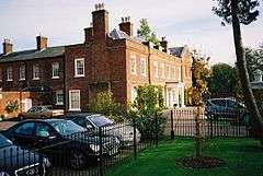 Newell Hall |
|
 Warfield |
|
| Population | 9,226 (2001) 10,088 (2011 Census including Nuptown)[1] |
|---|---|
| OS grid reference | SU8772 |
| Civil parish | Warfield |
| District | Bracknell Forest |
| Shire county | Berkshire |
| Region | South East |
| Country | England |
| Sovereign state | United Kingdom |
| Post town | BRACKNELL |
| Postcode district | RG42 |
| Dialling code | 01344 |
| Police | Thames Valley |
| Fire | Royal Berkshire |
| Ambulance | South Central |
| EU Parliament | South East England |
| UK Parliament | Windsor |
Coordinates: 51°26′31″N 0°44′13″W / 51.442°N 0.737°W
Warfield is a village and civil parish in the English county of Berkshire and the Borough of Bracknell Forest.
Geography
Warfield is a mostly rural parish made up of a number of small settlements. Warfield Village consists of the few houses around the parish church in the centre of the parish, but the West End, Newell Green, Warfield Street and Hayley Green area just to the south is generally referred to as 'Warfield'. To the north are the hamlets of Hawthorn Hill, Jealott's Hill, Moss End and Nuptown. In the south of the old parish, Wick Hill and Priestwood were amongst the earliest suburbs of the new town of Bracknell, in which parish they now lie. The High Street area of Bracknell itself was originally in Warfield parish. Warfield Park is an area of residential park homes. New housing developments in Warfield have taken place since the 1980s and include Whitegrove, Quelm Park and Lawrence Hill.
The stream known as The Cut runs through the centre of the parish, eventually joining the River Thames at Bray. The Bull Brook runs into The Cut, just south-east of the church. There are a number of small ponds and other bodies of water in the parish, notably the ominously named 'Drown Boy Pond' at Jealott's Hill and the lake at Warfield Park. There were springs in the Holly Spring area. Cabbage Hill is perhaps the largest hill in the parish, from which there are excellent views of Bracknell.
Local government
As well as being administered by the unitary authority of Bracknell Forest, Warfield has a parish council consisting of thirteen councillors. There is also a Warfield Action Group.
History
Warfield was originally an Anglo-Saxon settlement and is recorded in the Domesday Book as Warwelt [sic]. The name is believed to have originated from the Old English wær + feld, meaning 'Open land by a weir'.[2] The medieval church is one of the finest in Berkshire, particularly noted for its Decorated Period chancel with beautiful carvings and 'Green Men'. There are several memorials to the Stavertons who lived at the old manor house in the moat at Hayley Green. This was replaced, in the Georgian period, by Warfield House alias Warfield Grove, the home of Admiral Sir George Bowyer and, later, the political writer, Sir John Hippisley. Another fine old country house was Warfield Park. In the 18th century, it was the home of John Walsh, the Secretary to Lord Clive and an amateur scientist, and later to his descendants the Lords Ormathwaite.[3] It was pulled down in 1955.[4] Warfield Hall, built in the 1840s, is the former home of Field Marshal Sir Charles Brownlow.[5]
There was formerly much brickworking in the south of the parish, most notably under the Lawrence family. The Thomas Lawrence & Sons Brickworks was founded in 1857, and by the late 19th century was producing over 12 million bricks a year. The brown clay to be found in this area was ideal for making rich warm red-fired bricks, and Lawrence's bricks were used in the building of the Royal Albert Hall, Westminster Cathedral and in restoration work at 10 Downing Street and Hampton Court Palace. The brickworks closed in 1985, and the last of the buildings were pulled down in the 1990s to make way for the housing development, Lawrence Hill. A memorial to the brickworks was put in place near the original site.
Transport
The main road through Warfield is the B3034, from Brookside to Bill Hill. Warfield is served by bus routes 53 and 53A, run by Thames Travel; routes 153, 162 and 192, run by First Berkshire & The Thames Valley; and Courtney Coaches routes 153 (Sundays only) and 199 (Wednesdays and Fridays only).
Education
- Paws Nursery, Hayley Green
- Plus Three Nursery
- Possums Nursery
- Warfield CofE Primary School
- Whitegrove Primary School
- Sandy Lane Primary School
- Meadowbrook Montessori School
Sport and leisure
- Frost Folly Country Park
- The Library is in Whitegrove
- Memorial Ground and Play Area
- Rainbows and Brownies at the Brownlow Hall
- Six pubs: The Three Legged Cross, the New Leathern Bottle, the Shepherd's House, the Plough and Harrow, the Cricketers, the Yorkshire Rose
- Bowmen of Warfield Archery Club
- Warfield Cricket Club
- Warfield Players
- Warfield Women's Institute
- Warfield Fete each Summer
- Warfield Produce Show held annually
- Warfield Pumpkin Show every September at the Plough and Harrow
- Whitegrove Football Club – for U6 soccer school through U18s (www.whitegrove.info)
- Whitegrove School Summer (July) and Christmas Fete (Dec) held every year
References
- ↑ "Civil Parish population 2011". Neighbourhood Statistics. Office for National Statistics. Retrieved 30 November 2016.
- ↑ Mills, A.D: A Dictionary of English Place-Names, page 346. Oxford University Press, 1991.
- ↑ Warfield Park Case Study: A Country House of One’s Own. Blogs.ucl.ac.uk (18 January 2013). Retrieved on 17 July 2013.
- ↑ Warfield Park, Berkshire. Blogs.ucl.ac.uk (18 January 2013). Retrieved on 17 July 2013.
- ↑ "Warfield Parish Council Heritage Trail" (PDF). Warfield Parish Council. Retrieved 3 August 2013.
External links
| Wikimedia Commons has media related to Warfield. |