Wanmaw State
| Wanmaw State (Bhamo) | |||||
| State of the Shan States | |||||
| |||||
 | |||||
| History | |||||
| • | Wanmaw state established | 1470 | |||
| • | Annexed by the Kingdom of Burma | 1772 | |||
| Today part of | Bhamo District, Myanmar | ||||
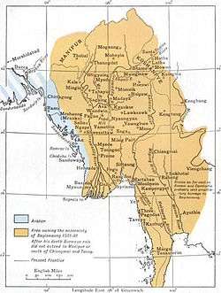
Wanmaw, Manmaw or Banmaw (Bhamo) was a Shan state in what is today Burma. It was an outlying territory, located away from the main Shan State area in present-day Kachin State close to the border with China.
The state existed until 1772. The main town was Man Maw (Bhamo). The name of the state means 'the village of pots (or potters)' in the Shan language.[1]
History
The early history of the state is obscure. But legends tell of a powerful predecessor Tai state having been established in the area previously which had its capital at the now ruined place of Sampenago. The ruins of the old city walls, dating from the fifth Century, are found some 5 km from the modern town of Bhamo. The ancient capital of Sampenago was renowned for its stupas housing relics of the Buddha.
... The Burmese Buddhists know little of Kanishka, but the name of Dhammathawka is well known, and tradition credits him with the foundation of many pagodas with the bones and relics of the Buddha. ... There are many of these shwemōkthos and shwemōkdaws in the Upper Province, and even farther off still, in the tributary Shan States : at Kyaukse, Sampenago, in the Bhamo District ; at Pwela in the Myelat, round the Inle lake, and in many parts of the hills. They are all implicitly credited to Dhammathawka...[2]
In 1668 a saopha of Wanmaw named Sao Ngawk Hpa is said to have instigated an attack by the Chinese against the Kingdom of Burma.[1] Wanmaw was subsequently occupied by Burma between 1669 and 1685 and again in mid 18th century. After regaining independence in 1742 it was again occupied by Burma from 1767 to 1770 after a Chinese invasion was repelled. Finally Wanmaw was annexed by the Burmese Ava Kingdom in 1772.[3] The control of this frontier state by the Burmese Kingdom was loose and at the time of the beginning of British rule in Burma the wun in charge of the administration of the territory was de facto quite independent.[1]
Rulers
The rulers of the state bore the title Saopha. Myowuns or wuns were the administrators of the territory of the former state after annexation by Burma.[4]
Saophas
- 15?? - 1601 Sao Sein
- 1601 - 16?? Sao Seng Long
- 16?? - 16?? Sao Ngawk Hpa
- 1685 - 1706 Sao Pi Hpa
- 1706 - 1719 Sao Tun Hpa
- 1719 - 1720 Hpo U
- 1720 - 1727 Sao Mong Hpa
- 1727 - 1734 Sao Tung Ngai I (d. 1734)
- 1734 - 1735 Vacant
- 1735 - 1742 Kit Haw
- 1742 - 1770 Sao Tung Ngai II
- 1770 - c.1772 Sao Myut Aung (b. 1690 - d. c.1772)
Myowuns
- 1772–17?? Mingyi Wailuthaya (U Shwe Ye)
- 1853–18?? Mingyi Maha Minhtin Yaza
- 1878–18?? U Pho Hla
References
- 1 2 3 Imperial Gazetteer of India, v. 8, p. 47. - Bhamo District, History
- ↑ Buddhism in Burma and Assam by D. J. Gogerly, Colombo, Ceylon 1870
- ↑ Shan (Tai) States
- ↑ Nisbet, John (1901). Burma Under British Rule—and Before. 1. Archbald Constable & Company.
External links
Coordinates: 24°33′N 97°7′E / 24.550°N 97.117°E