Walldürn
| Walldürn | ||
|---|---|---|
| ||
 Walldürn | ||
Location of Walldürn within Neckar-Odenwald-Kreis district  | ||
| Coordinates: 49°34′59″N 9°22′5″E / 49.58306°N 9.36806°ECoordinates: 49°34′59″N 9°22′5″E / 49.58306°N 9.36806°E | ||
| Country | Germany | |
| State | Baden-Württemberg | |
| Admin. region | Karlsruhe | |
| District | Neckar-Odenwald-Kreis | |
| Government | ||
| • Mayor | Markus Günther (CDU) | |
| Area | ||
| • Total | 105.88 km2 (40.88 sq mi) | |
| Population (2015-12-31)[1] | ||
| • Total | 11,506 | |
| • Density | 110/km2 (280/sq mi) | |
| Time zone | CET/CEST (UTC+1/+2) | |
| Postal codes | 74731, 63928 (Spritzenmühle) | |
| Dialling codes | 06282, 06285, 06286 | |
| Vehicle registration | MOS, BCH | |
| Website | www.wallduern.de | |

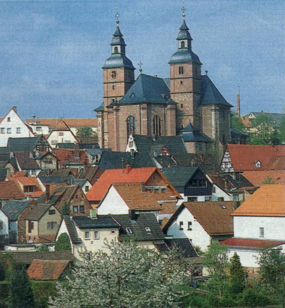
Walldürn is a town in the Neckar-Odenwald district, in Baden-Württemberg, Germany. It is situated 23 km southwest of Wertheim. The town of Walldürn consists of the ten districts Walldürn-Stadt, Altheim, Gerolzahn, Glashofen, Gottersdorf, Hornbach, Kaltenbrunn, Reinhardsachsen, Rippberg and Wettersdorf. Walldürn Basilica:
Mayors
- 1901–1907: Knoth, Hermann
- 1907–1909: Schön, Friederich (temporary)
- 1909–1919: Nimis, Wilhelm
- 1919–1920: Helmling, Peter
- 1920–1925: Scheurich, Otto
- 1925–1930: Trautmann, Arthur
- 1930–1933: Geier, Michael
- 1933: Kaufmann, Josef
- 1933–1940: Kiefer, Karl (appointed)
- 1940–1945: Leiblein, Josef (appointed)
- 1945–1946: Trunk, Heinrich (temporary) und Scheurich, Otto (tempoorary)
- 1946–1948: Schmidt, Hermann
- 1948–1966: Trautmann, Arthur (SPD)
- 1966–1974: Hübner, Alfred
- 1974–1975: Hollerbach, Robert (temporary administrator)
- 1975–1991: Hollerbach, Robert (CDU)
- 1991–2007: Joseph, Karl-Heinz (SPD)
- since 2007: Günther, Markus (CDU)
Sons and daughters of the city
- Walter Zimmermann (1892-1980), biologist and botanist
- Peter Assion (1941-1994), ethnologist and germanist
- Peter Hauk (born 1960), forest manager, politician and Member of Landtag since 1992 (CDU),
- Silvia Neid (born 1964), former footballer and world champion coach of the German women's football team

Walldürn-Town hall

Walldürn-Savings bank
.JPG)
Gottersdorf St. Michael church
See also
| Wikimedia Commons has media related to Walldürn. |
Towns and municipalities in Neckar-Odenwald (district) | ||
|---|---|---|
References
This article is issued from Wikipedia - version of the 11/21/2016. The text is available under the Creative Commons Attribution/Share Alike but additional terms may apply for the media files.