Walker Mountains

Map of Thurston Island.
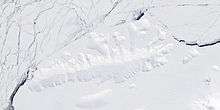
Satellite image of Thurston Island.
Walker Mountains (72°13′S 99°2′W / 72.217°S 99.033°WCoordinates: 72°13′S 99°2′W / 72.217°S 99.033°W) is a range of peaks and nunataks which are fairly well separated but trend east–west to form the axis, or spine, of Thurston Island. They were discovered by Rear Admiral Byrd and members of the US Antarctic Service (USAS) in a flight from the ship Bear on February 27, 1940. Named by US-SCAN for Lt. William M. Walker, captain of the United States Exploring Expedition ship Island on March 23, 1839.
Maps
- Thurston Island – Jones Mountains. 1:500000 Antarctica Sketch Map. US Geological Survey, 1967.
- Antarctic Digital Database (ADD). Scale 1:250000 topographic map of Antarctica. Scientific Committee on Antarctic Research (SCAR), 1993–2016.
![]() This article incorporates public domain material from the United States Geological Survey document "Walker Mountains" (content from the Geographic Names Information System).
This article incorporates public domain material from the United States Geological Survey document "Walker Mountains" (content from the Geographic Names Information System).
This article is issued from Wikipedia - version of the 1/29/2016. The text is available under the Creative Commons Attribution/Share Alike but additional terms may apply for the media files.