Walgreen Coast
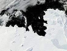
The Walgreen Coast (75°30′S 107°0′W / 75.500°S 107.000°WCoordinates: 75°30′S 107°0′W / 75.500°S 107.000°W) is a portion of the coast of Antarctica between Cape Herlacher and Cape Waite, or between Bakutis Coast in the west, and Eights Coast. It is the easternmost part of Marie Byrd Land. It stretches from 114°12'W to 103°24'W. Eights Coast to the east is already part of Ellsworth Land. It was discovered by Rear Admiral Byrd and members of the US Antarctic Service (USAS) in flights from the USS Bear in February 1940.
The Walgreen Coast was named by Byrd after Charles R. Walgreen, president of Walgreens at the time, who was a supporter of the Byrd Antarctic Expedition, 1933-35, and assisted in equipping the Bear for the USAS, 1939-41. This coast was mapped in detail by United States Geological Survey (USGS) from ground surveys and U.S. Navy air photos, 1959-66.
![]() This article incorporates public domain material from the United States Geological Survey document "Walgreen Coast" (content from the Geographic Names Information System).
This article incorporates public domain material from the United States Geological Survey document "Walgreen Coast" (content from the Geographic Names Information System).