Walden, Colorado
| Town of Walden, Colorado | |
|---|---|
| Town | |
|
Walden, Main Street | |
 Location in Jackson County and the State of Colorado | |
| Coordinates: 40°43′50″N 106°16′55″W / 40.73056°N 106.28194°WCoordinates: 40°43′50″N 106°16′55″W / 40.73056°N 106.28194°W | |
| Country |
|
| State |
|
| County[1] | Jackson County - seat[2] |
| Established | 1889 |
| Incorporated | December 2, 1890[3] |
| Named for | Marcus Aurelius Walden (former postmaster) |
| Government | |
| • Type | Statutory Town[1] |
| Area | |
| • Total | 0.3 sq mi (0.9 km2) |
| • Land | 0.3 sq mi (0.9 km2) |
| • Water | 0 sq mi (0 km2) |
| Elevation | 8,099 ft (2,469 m) |
| Population (2010) | |
| • Total | 608 |
| • Density | 2,446.7/sq mi (815.6/km2) |
| Time zone | Mountain (MST) (UTC-7) |
| • Summer (DST) | MDT (UTC-6) |
| ZIP codes[4] | 80430, 80480 |
| Area code(s) | 970 |
| FIPS code | 08-82130 |
| GNIS feature ID | 0204654 |

The Town of Walden is a Statutory Town that is the county seat of, and the only incorporated municipality in, Jackson County, Colorado, United States.[5] It is situated in the center of a large open valley called North Park. People from Walden and the surrounding area refer to themselves as "North Parkers". The town population was 734 at the 2000 census and reduced to 608 at the[6]2010 census. The town sits at an elevation of 8099 feet (2469 meters) and is the only still incorporated town in the county. It was established in 1889 and was incorporated 2 December 1890.[3] Mark A. Walden, an early postmaster, gave the community his name.[7]
Geography
Walden is located at 40°43′50″N 106°16′55″W / 40.73056°N 106.28194°W (40.730606, -106.281811).[8]
According to the United States Census Bureau, the town has a total area of 0.3 square miles (0.78 km2), all of it land.
Climate
Due to its elevation, Walden has a semi-arid climate (BSk), closely bordering on a subalpine climate (Köppen climate classification Dfc). Frost can occur year-round, although there is a short frost-free period averaging just 42 days.[9]
| Climate data for Walden, Colorado (1981–2010 normals) | |||||||||||||
|---|---|---|---|---|---|---|---|---|---|---|---|---|---|
| Month | Jan | Feb | Mar | Apr | May | Jun | Jul | Aug | Sep | Oct | Nov | Dec | Year |
| Record high °F (°C) | 56 (13) |
54 (12) |
70 (21) |
74 (23) |
84 (29) |
92 (33) |
94 (34) |
94 (34) |
89 (32) |
78 (26) |
65 (18) |
58 (14) |
94 (34) |
| Average high °F (°C) | 30.3 (−0.9) |
33.2 (0.7) |
41.3 (5.2) |
50.7 (10.4) |
61.0 (16.1) |
71.4 (21.9) |
78.6 (25.9) |
76.7 (24.8) |
68.0 (20) |
55.4 (13) |
39.6 (4.2) |
30.6 (−0.8) |
53.1 (11.7) |
| Daily mean °F (°C) | 17.4 (−8.1) |
19.9 (−6.7) |
28.1 (−2.2) |
36.2 (2.3) |
45.2 (7.3) |
53.9 (12.2) |
59.6 (15.3) |
57.7 (14.3) |
49.7 (9.8) |
39.2 (4) |
26.7 (−2.9) |
18.2 (−7.7) |
37.7 (3.2) |
| Average low °F (°C) | 4.4 (−15.3) |
6.6 (−14.1) |
14.9 (−9.5) |
21.7 (−5.7) |
29.3 (−1.5) |
36.4 (2.4) |
40.5 (4.7) |
38.7 (3.7) |
31.4 (−0.3) |
23.0 (−5) |
13.7 (−10.2) |
5.7 (−14.6) |
22.2 (−5.4) |
| Record low °F (°C) | −48 (−44) |
−48 (−44) |
−34 (−37) |
−16 (−27) |
2 (−17) |
20 (−7) |
23 (−5) |
19 (−7) |
5 (−15) |
−12 (−24) |
−32 (−36) |
−39 (−39) |
−48 (−44) |
| Average precipitation inches (mm) | 0.55 (14) |
0.63 (16) |
0.79 (20.1) |
1.11 (28.2) |
1.41 (35.8) |
1.31 (33.3) |
1.41 (35.8) |
1.20 (30.5) |
1.35 (34.3) |
0.99 (25.1) |
0.91 (23.1) |
0.63 (16) |
12.28 (311.9) |
| Average snowfall inches (cm) | 8.0 (20.3) |
8.3 (21.1) |
8.3 (21.1) |
8.4 (21.3) |
3.4 (8.6) |
0.2 (0.5) |
0 (0) |
0 (0) |
1.2 (3) |
4.9 (12.4) |
10.5 (26.7) |
9.3 (23.6) |
61.7 (156.7) |
| Average precipitation days (≥ 0.01 in) | 7 | 7 | 9 | 9 | 10 | 9 | 10 | 10 | 9 | 7 | 9 | 8 | 103 |
| Average snowy days (≥ 0.1 in) | 7 | 7 | 6 | 5 | 2 | 0 | 0 | 0 | 1 | 3 | 7 | 8 | 45 |
| Source: NOAA (extremes 1893–present)[9] | |||||||||||||
Demographics
| Historical population | |||
|---|---|---|---|
| Census | Pop. | %± | |
| 1890 | 64 | — | |
| 1900 | 141 | 120.3% | |
| 1910 | 162 | 14.9% | |
| 1920 | 260 | 60.5% | |
| 1930 | 284 | 9.2% | |
| 1940 | 668 | 135.2% | |
| 1950 | 696 | 4.2% | |
| 1960 | 809 | 16.2% | |
| 1970 | 907 | 12.1% | |
| 1980 | 947 | 4.4% | |
| 1990 | 890 | −6.0% | |
| 2000 | 734 | −17.5% | |
| 2010 | 608 | −17.2% | |
| Est. 2015 | 584 | [10] | −3.9% |
As of the census[12] of 2000, there were 734 people, 330 households, and 207 families residing in the town. The population density was 2,166.9 people per square mile (833.5/km²). There were 397 housing units at an average density of 1,172.0 per square mile (450.8/km²). The racial makeup of the town was 96.32% White, 0.14% African American, 1.36% Native American, 0.14% Asian, 0.82% from other races, and 1.23% from two or more races. Hispanic or Latino of any race were 6.95% of the population.
There were 330 households out of which 29.7% had children under the age of 18 living with them, 44.8% were married couples living together, 12.1% had a female householder with no husband present, and 37.0% were non-families. 34.5% of all households were made up of individuals and 12.1% had someone living alone who was 65 years of age or older. The average household size was 2.21 and the average family size was 2.82.
In the town the population was spread out with 25.9% under the age of 18, 6.8% from 18 to 24, 25.5% from 25 to 44, 26.0% from 45 to 64, and 15.8% who were 65 years of age or older. The median age was 40 years. For every 100 females there were 98.4 males. For every 100 females age 18 and over, there were 99.3 males.
The median income for a household in the town was $29,313, and the median income for a family was $34,423. Males had a median income of $31,111 versus $18,611 for females. The per capita income for the town was $16,964. About 14.2% of families and 20.3% of the population were below the poverty line, including 35.3% of those under age 18 and 8.8% of those age 65 or over.
The 2010 census shows that the population decreased to 608 individuals, 377 households, and 291 families residing in the town. There were 318 males, 290 females, 116 individuals under the age of 18, and 492 individuals over the age of 18, with a distribution as follows: 20-24=29, 25-34=63, 35-49=121, 50-64=151, and 65 and over=113. Ethnically, 82 individuals are Hispanic or Latino and 526 individuals are Non-Hispanic or Latino. The race distribution is as follows: 554 White, 0 African American, 0 Asian, 8 American Indian and Alaska Native, 0 Native Hawaiian and Pacific Islander, 34 Other, and 12 who identified by two or more races.[6]
Transportation
See also
References
- 1 2 "Active Colorado Municipalities". State of Colorado, Department of Local Affairs. Retrieved 2007-09-01.
- ↑ "Colorado County Seats". State of Colorado, Department of Public Health and Environment. Retrieved 2007-12-31.
- 1 2 "Colorado Municipal Incorporations". State of Colorado, Department of Personnel & Administration, Colorado State Archives. 2004-12-01. Retrieved 2007-09-02.
- ↑ "ZIP Code Lookup" (JavaScript/HTML). United States Postal Service. Retrieved 2008-01-08.
- ↑ "Find a County". National Association of Counties. Retrieved 2011-06-07.
- 1 2 http://www.census.gov/popfinder/
- ↑ Dawson, John Frank. Place names in Colorado: why 700 communities were so named, 150 of Spanish or Indian origin. Denver, CO: The J. Frank Dawson Publishing Co. p. 51.
- ↑ "US Gazetteer files: 2010, 2000, and 1990". United States Census Bureau. 2011-02-12. Retrieved 2011-04-23.
- 1 2 "NowData - NOAA Online Weather Data". National Oceanic and Atmospheric Administration. Retrieved May 30, 2016.
- ↑ "Annual Estimates of the Resident Population for Incorporated Places: April 1, 2010 to July 1, 2015". Retrieved July 2, 2016.
- ↑ "Census of Population and Housing". Census.gov. Retrieved June 4, 2015.
- ↑ "American FactFinder". United States Census Bureau. Retrieved 2008-01-31.
External links
| Wikimedia Commons has media related to Walden, Colorado. |
Municipalities and communities of Jackson County, Colorado, United States | ||
|---|---|---|
| Town | 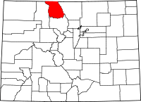 | |
| Unincorporated communities | ||
