Waiotira
| Waiotira | |
|---|---|
 Waiotira | |
| Coordinates: 35°56′12″S 174°11′56″E / 35.93667°S 174.19889°ECoordinates: 35°56′12″S 174°11′56″E / 35.93667°S 174.19889°E | |
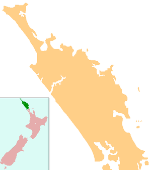
| Country | New Zealand |
| Region | Northland Region |
| District | Whangarei District |
Waiotira is a locality in Northland, New Zealand. Whangarei is to the northeast. Tauraroa is about 9 km northeast. The North Auckland railway line passes through Tauraroa, and the Waiotira Stream flows southwest to join with the Omaru River.[1][2]
Education
Waiotira School is a coeducational contributing primary (years 1-6) school with a decile rating of 7 and a roll of 32.[3]
Recreation
Waiotira contains a nine-hole golf course and a pony club.
Notes
- ↑ Peter Dowling (editor) (2004). Reed New Zealand Atlas. Reed Books. pp. map 7. ISBN 0-7900-0952-8.
- ↑ Roger Smith, GeographX (2005). The Geographic Atlas of New Zealand. Robbie Burton. pp. map 27. ISBN 1-877333-20-4.
- ↑ "Te Kete Ipurangi - Waiotira School". Ministry of Education.
This article is issued from Wikipedia - version of the 8/30/2015. The text is available under the Creative Commons Attribution/Share Alike but additional terms may apply for the media files.