Waal (river)
| Waal | |
| River | |
| Country | Netherlands |
|---|---|
| State | Gelderland |
| Regions | Betuwe, Rijk van Nijmegen, Land van Maas en Waal, Land van Altena |
| Tributaries | |
| - right | Linge |
| Cities | Nijmegen, Tiel, Zaltbommel, Gorinchem |
| Source | River Rhine |
| - location | Millingen aan de Rijn, Gelderland, Netherlands |
| Mouth | River Boven Merwede |
| - location | Gorinchem, Gelderland/South Holland, Netherlands |
| Length | 80 km (50 mi) |
| Discharge | |
| - average | 1,500 m3/s (52,972 cu ft/s) |
 Location of river Waal in dark blue. | |
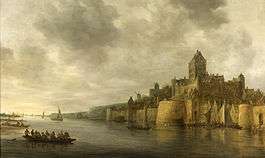
The Waal or Rivier Waal ("Waal River") is the main distributary branch of river Rhine flowing through the Netherlands. Approximately 80 km (50 mi), it is the major waterway connecting the port of Rotterdam to Germany. Before it reaches Rotterdam, it joins with the Afgedamde Maas near Woudrichem to form the Boven Merwede. Along its length, Nijmegen, Tiel, Zaltbommel and Gorinchem are towns of importance with direct access to the river.
The river, which is the main channel in the Rhine–Meuse–Scheldt delta system, carries 65% of the total flow of the Rhine.
History
In 1915, a perfectly preserved iron and bronze Roman cavalry helmet, known as the Nijmegen Helmet, was uncovered on the left bank of the Waal in Nijmegen.
The name Waal, in Roman times called Vacalis, Vahalis or Valis, later Vahal, is of Germanic origin and is named after the many meanders in the river (Old Germanic: wôh = crooked). It is, in turn, thought to have inspired early Dutch settlers of the Hudson Valley region in New York to name the Wallkill River after it (Waalkil = "Waal Creek").
The current river shows little signs of these great bends, since the river has been the subject of numerous normalisation projects carried out in the 18th, 19th and 20th centuries to improve the river as an economically important shipping route. Some of the cut-off bends are still visible near the main river and are sometimes reconnected to it in times of high water levels.
Bend in South Holland
In the Middle Ages, the name "Waal" continued after the confluence with River Meuse. The delta parts now known as Boven Merwede, Beneden Merwede and the upper section of river Noord were also called Waal. Near Hendrik-Ido-Ambacht, the main stream continued west until it flowed into River Oude Maas near Heerjansdam. This last stretch past Hendrik-Ido-Ambacht, which separates the river islands of IJsselmonde and Zwijndrechtse Waard, still is called Waal,[1] but is more commonly known as Waaltje (Dutch for Little Waal). It has been dammed off at both ends.
River crossings
Railroad bridges
Railroad bridges (with nearest train station on the left and right bank):
- between Nijmegen and Nijmegen Lent
- between Zaltbommel and Geldermalsen
Water quality
The Waal has significant adverse water quality due to discharge of raw sewage by France and Germany. A number of pathogens have been monitored to occur in the river waters from such sewage.[2]
References
- ↑ ter Laan, K. et al. ed. (1942). Van Goor's aardrijkskundig woordenboek van Nederland (in Dutch). Den Haag: Van Goor Zonen.
- ↑ Lodder, W J; de Roda Husman; A M (March 2005). "Presence of Noroviruses and Other Enteric Viruses in Sewage and Surface Waters in The Netherlands". Applied and Environmental Microbiology. American Society for Microbiology. 71 (3): 1453–1461. doi:10.1128/AEM.71.3.1453-1461.2005. OCLC 205246645. PMC 1065170
 . PMID 15746348. BL Shelfmark 1571.440000. Retrieved 2008-05-20.
External links
 Media related to Waal at Wikimedia Commons
Coordinates: 51°53′30″N 5°31′15″E / 51.891749°N 5.520716°E