Vráble
| Vráble | |
| Town | |
 | |
| Country | Slovakia |
|---|---|
| Region | Nitra |
| District | Nitra |
| Tourism region | Tekov |
| River | Žitava |
| Elevation | 142 m (466 ft) |
| Coordinates | SK 48°14′27″N 18°18′31″E / 48.24083°N 18.30861°ECoordinates: SK 48°14′27″N 18°18′31″E / 48.24083°N 18.30861°E |
| Area | 38.31 km2 (14.79 sq mi) |
| Population | 9,390 (2006) |
| Density | 245/km2 (635/sq mi) |
| First mentioned | 1265 |
| Mayor | Tibor Tóth |
| Timezone | CET (UTC+1) |
| - summer (DST) | CEST (UTC+2) |
| Postal code | 952 01 |
| Area code | +421-37 |
| Car plate | NR |
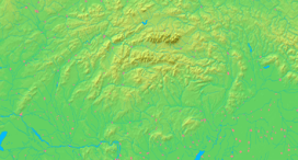  Location of Vráble in Slovakia | |
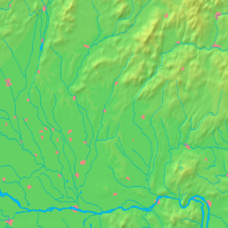  Location of Vráble in the Nitra Region | |
| Statistics: MOŠ/MIS | |
| Website: www.vrable.sk | |
Vráble (Hungarian: Verebély) is a small town in the Nitra District, Nitra Region, western Slovakia.
Geography
It is located in the Danubian Hills on the Žitava river, about 15 kilometres (9.3 miles) south-east-east from Nitra. The cadastral area of the town has an altitude from 140 to 240 metres (460 to 790 feet) ASL. There's a small dam called Vodná nádrž Vráble west of the town.
The town has three parts: Vráble proper, and the former villages of Dyčka and Horný Ohaj (both annexed 1975).
History
The oldest evidence of the settlement of Vráble comes from the Neolithic age (6000-2000 BC). The first written reference is from 1265 as Verebel. In Vráble, there was the oldest post-station. The city kept an agricultural character in the 19th and 20th centuries. Economic development has influenced the architecture of the city. After break-up of Austria-Hungary in 1918, the town became part of Czechoslovakia and received status of the district capital (until 1960). After the First Vienna Award, the town was from 1938 to 1945 part of Hungary.
Demographics
The town had Hungarian majority in the 17th century according to the Turkish tax census.[1]
According to the 2001 census, the town had 9,493 inhabitants. 93.32% of inhabitants were Slovaks, 4.69% Hungarians, 0.78% Roma and 0.55% Czechs.[2] The religious make-up was 88.41% Roman Catholics, 8.53% people with no religious affiliation and 0.62% Lutherans.[2]
Archaeological site
The largest urban agglomeration of the Bronze Age Europe was found in Vráble.[3] The area of 20 hectares makes it larger than the contemporary Mycenae and Troy. A settlement was inhabited by about 1,000 people and buildings were built around streets. Three ditches strengthened the fortifications. The site is also the northernmost known tell in Central Europe. The settlement was attributed to the Maďarovce culture.
International relations
Twin towns — Sister cities
Vráble is twinned with:
-
 Andouillé, France
 -
 Csurgó, Hungary
 -
 Nova Varoš, Serbia
References
- ↑ Károly Kocsis, Eszter Kocsisné Hodosi, Ethnic Geography of the Hungarian Minorities in the Carpathian Basin, Simon Publications LLC, 1998, p. 46
- 1 2 "Municipal Statistics". Statistical Office of the Slovak republic. Archived from the original on 2007-11-16. Retrieved 2007-12-15.
- ↑ SME.sk | Vráble sú unikátom Starého kontinentu
External links
- Official website (Slovak)