Volcanoes of Kamchatka
| Volcanoes of Kamchatka | |
|---|---|
| Name as inscribed on the World Heritage List | |
|
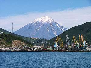
Koryaksky volcano rising above Petropavlovsk-Kamchatsky | |
| Location | Kamchatka Krai |
| Type | Natural |
| Criteria | vii, viii, ix, x |
| Reference | 765 |
| UNESCO region | Asia |
| Coordinates | 55°35′N 158°47′E / 55.583°N 158.783°ECoordinates: 55°35′N 158°47′E / 55.583°N 158.783°E |
| Inscription history | |
| Inscription | 1996 (20th Session) |
| Extensions | 2001 |
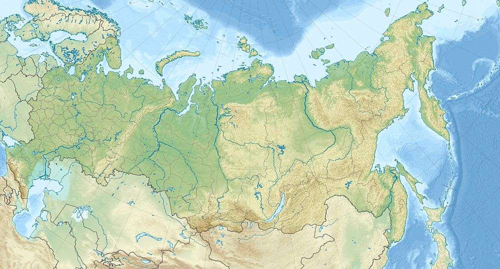 Location of Volcanoes of Kamchatka in Russia. | |
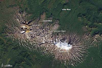
The volcanoes of Kamchatka are a large group of volcanoes situated on the Kamchatka Peninsula. The Kamchatka River and the surrounding central side valley are flanked by large volcanic belts containing around 160 volcanoes, 29 of them still active. The peninsula has a high density of volcanoes and associated volcanic phenomena, with 29 active volcanoes being included in the six UNESCO World Heritage List sites in the Volcanoes of Kamchatka group, most of them on the Kamchatka Peninsula.[1]
The highest volcano is Klyuchevskaya Sopka (4,750 m or 15,584 ft), the largest active volcano in the Northern Hemisphere,[2] while the most striking is Kronotsky, whose perfect cone was said by celebrated volcanologists Robert and Barbara Decker to be a prime candidate for the world's most beautiful volcano. Somewhat more accessible are the three volcanoes visible from Petropavlovsk-Kamchatsky: Koryaksky, Avachinsky, and Kozelsky. In the center of Kamchatka is Eurasia's world famous Geyser Valley which was partly destroyed by a massive mudslide in June 2007.[3]
Owing to the Kuril-Kamchatka Trench, deep-focus seismic events and tsunamis are fairly common. A pair of megathrust earthquakes occurred off the coast on October 16, 1737, and on November 4, 1952, in the magnitude of ~9.3 and 8.2 respectively.[4] A chain of more shallow earthquakes were recorded as recently as April 2006.[5]
List of volcanoes from north to south
- Volcanoes of the central range
- Kluchevskaya group
- Shiveluch, 3307 m
- Klyuchevskaya Sopka
- Avachinskaya group
- Aag
- Arik
- Koryaksky
- Avachinsky
- Kozelsky
- Ksudach
- Ilyinsky (volcano)
- Kambalny
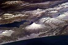
- Karymsky Kamchatka's most active and continuously erupting volcano
See also
References
- ↑ World Heritage (1996). "Volcanoes of Kamchatka". UNESCO. Retrieved 2008-02-20.
- ↑ Press Releases - Public Affairs Office - The University of Nottingham
- ↑ The World Wildlife Fund (2007). "Natural Wonder of the World Transformed within Hours, says World Wildlife Fund". Earth Times. Retrieved 2008-02-20.
- ↑ "The 4 November 1952 Kamchatka Earthquake and Tsunami". Australian Government Bureau of Meteorology. Retrieved 2008-02-20.
- ↑ Earthquake Hazards Program (2006). "Magnitude 7.6 - Koryakia, Russia". US Geological Survey. Retrieved 2008-02-20.
| Wikimedia Commons has media related to Volcanoes of Kamchatka. |