Vlkolínec
| Vlkolínec | |
| Village | |
 Street in Vlkolínec | |
| Country | Slovakia |
|---|---|
| Region | Žilina |
| District | Ružomberok |
| Municipality | Ružomberok |
| Elevation | 718 m (2,356 ft) |
| Coordinates | SK 49°02′30″N 19°16′30″E / 49.04167°N 19.27500°ECoordinates: SK 49°02′30″N 19°16′30″E / 49.04167°N 19.27500°E |
| Area | 7.97 km2 (3.08 sq mi) |
| Population | 13 |
| Density | 2/km2 (5/sq mi) |
| UNESCO World Heritage Site | |
| Name | Vlkolínec |
| Year | 1993 (#17) |
| Number | 622 |
| Region | Europe and North America |
| Criteria | iv, v |
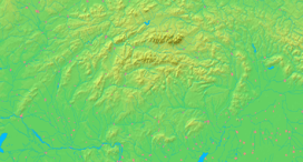  Location of Vlkolínec in Slovakia
| |
  Location of Vlkolínec in the Žilina Region
| |
| Wikimedia Commons: Vlkolínec | |
| Website: www.vlkolinec.sk | |
Vlkolínec, Slovakia, is a picturesque village under the administration of the town of Ružomberok. Historically, however, it was a separate village. The first written mention of the village came from 1376 and after 1882 it became part of Ružomberok. Its name is probably derived from the Slovak word "vlk", i. e. wolf.
Vlkolínec has been listed as a UNESCO World Heritage site since 1993, and is one of ten Slovak villages that have been given the status of a folk architecture reservations. This status was granted because the village is an untouched and complex example of folk countryside architecture of the region of the Northern Carpathians.
Vlkolínec, situated in the centre of Slovakia, is a remarkably intact settlement with the traditional features of a central European village. It is the region’s most complete group of these kinds of traditional log houses, often found in mountainous areas. The village consists of more than 45 log houses each of them made up of two or three rooms. A wooden belfry from the 18th century as well as the baroque chapel has also been preserved. Houses No. 16 and 17 are turned into the folk museum with all the instruments of daily life and work.
See also
- Other historical reservations of folk architecture in Slovakia
- Other similar World Heritage Sites
- Hollókő in Hungary
- Holašovice in Czech Republic
- Gammelstad Church Town in Sweden
Gallery
 Wooden carved sculpture at the entrance to the village
 Typical interior of one of the houses
 House in Vlkolínec
 House No. 47 in Vlkolínec
 Belfry in Vlkolínec
 Street in Vlkolínec
 Street in Vlkolínec
 House in Vlkolínec
Resources
- "Vlkolínec". UNESCO World Heritage Centre. Retrieved 2009-06-29.
| Cultural |
| |
|---|---|---|
| Natural |
| |