Visitacion Valley, San Francisco
| Visitacion Valley | |
|---|---|
| Neighborhood of San Francisco | |
|
Visitacion Valley viewed from the Philosopher's Way at John McLaren Park. | |
| Nickname(s): Viz Valley | |
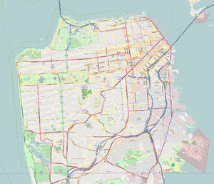 Visitacion Valley Location within San Francisco | |
| Coordinates: 37°43′N 122°24′W / 37.717°N 122.400°WCoordinates: 37°43′N 122°24′W / 37.717°N 122.400°W | |
| Country | United States |
| State | California |
| City | San Francisco |
| Government | |
| • Supervisor | Malia Cohen |
| • CA Assembly | David Chiu (D)[1] |
| • State Senator | Scott Wiener (D)[1] |
| • U.S. Rep. | Nancy Pelosi (D)[2] |
| Area | |
| • Total | 1.582 sq mi (4.10 km2) |
| Population (2008) | |
| • Total | 22,534 |
| • Density | 14,241/sq mi (5,498/km2) |
| Time zone | PST (UTC-8) |
| • Summer (DST) | PDT (UTC-7) |
| ZIP Code | 94134 |
| Area codes | 415/628 |

Visitacion Valley (/ˌvɪzᵻˈteɪʃən/ VIZ-i-TAY-shən, homophone of visitation), colloquially known as Viz Valley, is a neighborhood located in the southeastern quadrant of San Francisco, California.
Location
Visitacion Valley is roughly defined by McLaren Park and Gleneagles Golf Course to the West, Mansell Blvd to the north, Bayview Hill and Candlestick Cove to the east, and the San Francisco / San Mateo County line to the south. The streets of this neighborhood straddle the border between San Francisco and Daly City, hence Visitacion Valley partially blends in with the adjacent Daly City neighborhood of Bayshore. The grounds of the Cow Palace, straddling the San Francisco/Daly City border, are partially within Visitacion Valley.
Visitacion Valley takes its name from Rancho Cañada de Guadalupe la Visitación y Rodeo Viejo, a large tract of land that also included the Bayshore district of Daly City, the city of Brisbane, and San Bruno Mountain.
Attractions and characteristics
The area is a largely family-oriented working-class neighborhood. Average Adjusted Gross Incomes for the area are at $38,802, much lower than the citywide average of $73,798. Median rents in 2007 for the neighborhood at $896 a month are also far below the citywide average at $1,141.
The area was originally settled by Irish and Italian immigrants who worked in the nearby factories. The construction of the nearby Hunters Point Naval Shipyard during World War II, led to a massive influx of African Americans who worked in the shipyards. Many settled in the Sunnydale Projects which were originally constructed as barracks to house workers. After the war ended, more African Americans relocated from the Fillmore District and the Western Addition because redevelopment programs provided inexpensive housing. The area still has a 30% African American population; however, this number has been declining in recent years due to the rising cost of living in San Francisco and black flight to the East Bay area. The Black population is being supplanted by an influx of ethnic Chinese immigrants who now make up more than half of the neighborhood's population.
The former barracks turned housing projects on Sunnydale Avenue, the Sunnydale Projects is the largest in San Francisco[3] and remains one of the most violent areas of the city.[4] The two high-rise apartment buildings, Geneva Towers, originally built as private housing in the 1960s, were converted to public housing in the 1970s. They suffered through dilapidation and poor maintenance throughout the 1980s, and were plagued by gangs and drug activity. The City ordered the destruction of the buildings in 1998,[5] and replaced them with lower-density units.
The Visitacion Valley Redevelopment Area for the area centering at Leland Avenue and Bayshore Boulevard, including the former Schlage Lock Factory, was adopted by the Board of Supervisors in April 2009.[6] A transit-oriented mixed-use development (Visitacion Valley TOD Project) will be constructed on the former Schlage Lock Factory and Southern Pacific Railyard following demolition of existing buildings, except for the Historic Office Building, and brownfield remediation, which started after Remediation Action Plan was approved on November 16, 2009. This project will feature a grocery store, condos, parks, and other new redevelopment designed to revitalize the neighborhood.[7]
Since the crackdown on crack cocaine in the mid-1990s and the demolition of the Geneva Towers public housing complex, crime in the neighborhood has been reduced, though many of the same problems remain. The Chinese American residency has grown and more businesses have opened on Leland Avenue, the location of the Visitacion Valley Street Fair which began in the mid-2000s.
Redevelopment also came in the construction of a new Muni Metro line called the T Third Street, which terminates at Sunnydale Station. The extension into the neighborhood is part of a major project to ultimately extend Muni to the northeast section of the city, thus granting easy and faster access for the neighborhood's Chinese residents to Chinatown, and for future development along Third Street.
The neighborhood was featured in the movie Sucker Free City. One of the gangs featured in the movie called themselves "The V-Dubs" (a.k.a. The V-Dub MAFIA). The word 'Dub' is not an abbreviation of 'W' but means 'double'. San Franciscans may notice the inaccuracy in this part of the film, as the gang in the film was actually located in the Bayview-Hunters Point neighborhood of the city.
The Old Visitacion Valley Branch of San Francisco Public Library used to be at a small storefront located at 45 Leland Ave at Desmond Street. The newer one is now on Leland and Rutland and finished construction in the summer of 2011.
References
- 1 2 "Statewide Database". UC Regents. Retrieved November 9, 2014.
- ↑ "California's 12th Congressional District - Representatives & District Map". Civic Impulse, LLC.
- ↑ Bulwa, Demian (2006-06-06). "Two shot, one dead near S.F.'s Sunnydale projects". Sfgate.com. Retrieved 2009-10-30.
- ↑ "Homicides in San Francisco 2007-2009". Sfgate.com. Archived from the original on September 30, 2009. Retrieved 2009-10-30.
- ↑ 14 maart 2006 (2006-04-15). "Geneva Towers Implosion". YouTube. Retrieved 2009-10-30.
- ↑ "Redevelopment Agency : Home". Sfgov.org. Retrieved 2009-10-30.
- ↑ "Visitacion Valley Redevelopment". Renewvisvalley.com. Retrieved 2009-10-30.
External links
| Wikimedia Commons has media related to Visitacion Valley, San Francisco. |
- Visitacion Valley TOD Project
- Visitacion Valley Community Development Corporation
- San Francisco Visitacion Valley
- Visitacion Valley Branch Library
- Visitacion Valley Facebook Fan's Page
| Downtown | .svg.png) | |
|---|---|---|
| North of Downtown | ||
| Outside Lands | ||
| Western Addition | ||
| Southern | ||
| ||