Visayas
| Native name: <span class="nickname" "> | |
|---|---|
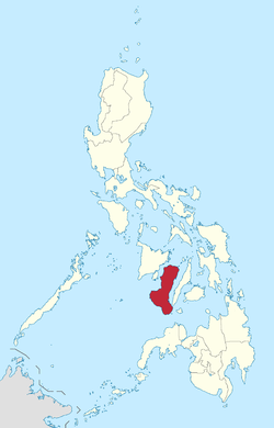
 Location of the Visayas within the Philippines | |
| Geography | |
| Location | Southeast Asia |
| Archipelago | Philippines |
| Major islands | |
| Area | 71,503 km2 (27,607 sq mi) |
| Highest elevation | 2,435 m (7,989 ft) |
| Highest point | Kanlaon Volcano |
| Administration | |
|
Philippines | |
| Regions | |
| Demographics | |
| Demonym |
|
| Population | 19,373,431 (2015)[1] |
| Pop. density | 292 /km2 (756 /sq mi) |
| Ethnic groups | |
The Visayas /vᵻˈsaɪəz/ və-SY-əz or the Visayan Islands[2] (Visayan: Kabisay-an, local pronunciation: [kabiˈsajʔan]; Tagalog: Kabisayaan, [kabiˈsɐjaʔan]), is one of the three principal geographical divisions of the Philippines, along with Luzon and Mindanao. It consists of several islands, primarily surrounding the Visayan Sea, although the Visayas are considered the northeast extremity of the entire Sulu Sea.[3] Its inhabitants are predominantly the Visayans.
The major islands of the Visayas are Panay, Negros, Cebu, Bohol, Leyte and Samar.[4] The region may also include the islands of Romblon and Masbate, whose population identify as Visayan and whose languages are more closely related to other Visayan languages than to the major languages of Luzon.
There are four administrative regions in the Visayas: Western Visayas (4.47 million), Negros Island Region (4.41 million), Central Visayas (6 million), and Eastern Visayas (4.44 million).[7]
Etymology
A theory proposed by some scholars[8] states that the term Visayas was derived from the name of the 7th-century thalassocratic Srivijaya Empire in Sumatra. In Sanskrit, sri (श्री) means "fortunate," "prosperous," or "happy" and vijaya (विजय) means "victorious" or "excellence". In the 12th century, parts of the Sulu Archipelago and the Visayas Islands were either subject or tributaries of the empire.[9]
History
The early people in the Visayas region were the Austronesians and Negritos who migrated to the islands about 6,000 to 30,000 years ago.[10] These early settlers were animist tribal groups. In the 12th century, settlers from the collapsing Hindu-Buddhist Srivijaya Empire led by Datu Putih and his retinue, settled in the island of Panay and its surrounding islands.[11] It was also during the 12th century that Visayans are said to have made a series of raids along the coast of China. They were said to have a fearsome reputation, and the mention of their name would cause many to flee in terror.[12] By the 14th century, Arab traders and their followers, venturing into Maritime Southeast Asia, converted some of these tribal groups to Islam. These tribes practiced a mixture of Hinduism, Buddhism, Islam and Animism beliefs. There is evidence of trade among other Asian people. The Visayans were thought to have kept close diplomatic relations with Malaysian and Indonesian kingdoms since the tribal groups of Cebu were able to converse with Enrique of Malacca using the Malay language when the Portuguese explorer Ferdinand Magellan arrived in 1521. The Visayas is subsequently home to several Prehispanic kingdoms like the Rajahnate of Cebu, the Kedatuan of Bohol and the Kedatuan of Madja-as.[13] Among the archaeological proofs of the existence of this Hiligaynon nation are the artifacts found in pre-Hispanic tombs from many parts of the island, which are now in display at Iloilo Museum. There are also recent discoveries of burial artifacts of eight-foot inhabitants of Isla de Gigantes, including extra-large Lungon (wooden coffins) and pre-Hispanic potteries.[14]
After the Magellan expedition, King Philip II of Spain sent Miguel López de Legazpi in 1543 and 1565 and claimed the islands for Spain. The Visayas region and many tribes began converting to Christianity and adopting western culture. By the 18th and 19th centuries, the effects of colonization on various ethnic groups soon turned sour and revolutions such as those of Francisco Dagohoy began to emerge.
Various personalities who fought against Spanish Colonial Government arose from the islands. Among the notable ones are Graciano Lopez Jaena from Iloilo,[15] León Kilat, from Negros Oriental, Venancio Jakosalem Fernandez, from Cebu,[16] and two personalities from Bohol by the name of Tamblot, who led the Tamblot Uprising in 1621 to 1622 and Francisco Dagohoy, the leader of the Bohol Rebellion that lasted from 1744 to 1829.[17] Negros briefly had a state in the Visayas in the form of the Cantonal Republic of Negros before it was dissolved because of the American invasion of the Philippines.[18]
In 2005, Palawan Island was transferred to Region VI (Western Visayas) by Executive Order 429.[19] However this planned reorganization was held in abeyance.[20] Hence, Palawan currently remains (as of June 2013) part of Region IV-B.
Historical legends and hypotheses
Historical documents written in 1907 by Visayan historian Pedro Alcántara Monteclaro in his book Maragtas tell the story of the ten leaders (Datus) who escaped from the tyranny of Rajah Makatunaw from Borneo and came to the islands of Panay. The chiefs and followers were said to be the ancestors (from the collapsing empires of Srivijaya and Majapahit) of the Visayan people. The documents were accepted by Filipino historians and found their way into the history of the Philippines. As a result, the arrival of Bornean tribal groups in the Visayas is celebrated in the festivals of the Ati-Atihan in Kalibo, Aklan and Binirayan in San José, Antique. Foreign historians such as William Scott maintains that the book contains a Visayan folk tradition.[21] Panay boasts of the Hinilawod as its oldest and longest epic.
A contemporary theory based on a study of genetic markers in present-day populations is that Austronesian people from Taiwan populated the region of Luzon and headed south to the Visayas, Borneo, Indonesia, then to Pacific islands and to the east of the Indian Ocean.[22] The study, though, may not explain inter-island migrations, which are also possible, such as Filipinos migrating to any other Philippine provinces.

According to Visayan folk traditions, the Visayas were populated by Malays from the collapsing empires of Srivijaya and Majapahit migrating from Borneo to Mindanao and to the Visayas, while other Malays crossed to Palawan through Sabah. Other Malays were suggested to have crossed from Samar island to the Bicol region in Luzon. The theory suggests that those ancient tribal groups who passed through Palawan may have migrated to what is now the island of Luzon.
A supplementary theory was that at that period, the Malay people were moving north from Mindanao to the Visayas and to Luzon.
Administrative divisions
Administratively, the Visayas is divided into 4 regions, namely (from west to east): Western Visayas, Negros Island Region, Central Visayas and Eastern Visayas.
The Visayas is composed of 16 provinces, each headed by a Governor. A governor is elected by popular vote and can serve a maximum of three terms consisting of three years each.
As for representation in the House of Representatives, the Visayas is represented by 44 congressmen elected in the same manner as the governors.
| Location | Region (designation) |
PSGC[23] | Regional center |
Component local government units |
Area[A] | Population (2015)[1] |
Density | ||
|---|---|---|---|---|---|---|---|---|---|
 |
Western Visayas (Region VI) |
06 | Iloilo City | 12,828.97 km2 (4,953.29 sq mi) |
4,477,247 (4.4%) |
350/km2 (910/sq mi) | |||
 |
Negros Island Region (NIR / Region XVIII) |
18 | Bacolod City & Dumaguete City (interim)[B] |
13,350.74 km2 (5,154.75 sq mi) |
4,414,131 (4.4%) |
330/km2 (850/sq mi) | |||
 |
Central Visayas (Region VII) |
07 | Cebu City | 10,102.16 km2 (3,900.47 sq mi) |
6,041,903 (6.0%) |
600/km2 (1,600/sq mi) | |||
 |
Eastern Visayas (Region VIII) |
08 | Tacloban City | 23,251.10 km2 (8,977.30 sq mi) |
4,440,150 (4.4%) |
190/km2 (490/sq mi) | |||
| |||||||||
Cities and municipalities
Below is a list of cities and major towns in the Visayas by population.
| City or municipality |
Population (2010)[lower-roman 1] |
Area[lower-roman 2] | Density | Province[lower-roman 3] | Region | Legal class[lower-roman 4] |
Income class[lower-roman 4] |
Notes | ||
|---|---|---|---|---|---|---|---|---|---|---|
| Cebu City | 866,171 | 315.00 | 121.62 | 2,700 | 7,000 | Cebu | VII | HUC | 1st | Capital of Cebu; regional center of Region 7 |
| Bacolod | 511,820 | 162.67 | 62.81 | 3,100 | 8,000 | Negros Occidental | NIR | HUC | 1st | Capital of Negros Occidental; de facto interim/temporary regional center of Region 18 (joint with Dumaguete) |
| Iloilo City | 424,619 | 78.34 | 30.25 | 6,200 | 16,000 | Iloilo | VI | HUC | 1st | Capital of Iloilo; regional center of Region 6 |
| Lapu-Lapu | 350,467 | 58.10 | 22.43 | 6,000 | 16,000 | Cebu | VII | HUC | 1st | |
| Mandaue | 331,320 | 25.18 | 9.72 | 13,000 | 34,000 | Cebu | VII | HUC | 1st | |
| Tacloban | 221,174 | 201.72 | 77.88 | 1,100 | 2,800 | Leyte | VIII | HUC | 1st | Capital of Leyte; regional center of Region 8 |
| Talisay | 200,772 | 39.87 | 15.39 | 5,000 | 13,000 | Cebu | VII | CC | 1st | |
| Ormoc | 191,200 | 613.60 | 236.91 | 310 | 800 | Leyte | VIII | ICC | 1st | |
| Kabankalan | 167,666 | 697.35 | 269.25 | 240 | 620 | Negros Occidental | NIR | CC | 1st | |
| Bago | 163,045 | 401.20 | 154.90 | 410 | 1,100 | Negros Occidental | NIR | CC | 1st | |
| Toledo | 157,078 | 216.28 | 83.51 | 730 | 1,900 | Cebu | VII | CC | 1st | |
| Roxas | 156,197 | 95.07 | 36.71 | 1,600 | 4,100 | Capiz | VI | CC | 1st | Capital of Capiz |
| Cadiz | 151,500 | 542.57 | 209.49 | 280 | 730 | Negros Occidental | NIR | CC | 1st | |
| Sagay | 140,740 | 330.34 | 127.54 | 430 | 1,100 | Negros Occidental | NIR | CC | 1st | |
| San Carlos | 129,981 | 451.50 | 174.33 | 290 | 750 | Negros Occidental | NIR | CC | 1st | |
| Silay | 120,999 | 214.80 | 82.93 | 560 | 1,500 | Negros Occidental | NIR | CC | 1st | |
| Dumaguete | 120,883 | 33.62 | 12.98 | 3,600 | 9,300 | Negros Oriental | NIR | CC | 1st | Capital of Negros Oriental; de facto interim/temporary regional center of Region 18 (joint with Bacolod) |
| Danao | 119,252 | 107.30 | 41.43 | 1,100 | 2,800 | Cebu | VII | CC | 1st | |
| Bayawan | 114,074 | 699.08 | 269.92 | 160 | 410 | Negros Oriental | NIR | CC | 1st | |
| Carcar | 107,323 | 116.78 | 45.09 | 920 | 2,400 | Cebu | VII | CC | 1st | |
| Himamaylan | 103,006 | 367.04 | 141.71 | 280 | 730 | Negros Occidental | NIR | CC | 1st | |
| Baybay | 102,841 | 459.30 | 177.34 | 220 | 570 | Leyte | VIII | CC | ||
| Naga | 101,571 | 101.97 | 39.37 | 1,000 | 2,600 | Cebu | VII | CC | ||
| Talisay | 97,571 | 223.73 | 86.38 | 440 | 1,100 | Negros Occidental | NIR | CC | 1st | |
| Tagbilaran | 96,792 | 331.80 | 128.11 | 290 | 750 | Bohol | VII | CC | 1st | Capital of Bohol |
| Catbalogan | 94,317 | 274.22 | 105.88 | 340 | 880 | Samar | VIII | CC | ||
| Guihulngan | 93,675 | 388.56 | 150.02 | 240 | 620 | Negros Oriental | NIR | CC | ||
| Escalante | 93,005 | 192.76 | 74.43 | 480 | 1,200 | Negros Occidental | NIR | CC | ||
| Victorias | 88,299 | 133.92 | 51.71 | 660 | 1,700 | Negros Occidental | NIR | CC | 1st | |
| Catarman | 84,833 | 464.43 | 179.32 | 180 | 470 | Northern Samar | VIII | Municipality | 1st | Capital of Northern Samar |
| Maasin | 81,250 | 211.71 | 81.74 | 380 | 980 | Southern Leyte | VIII | CC | 1st | Capital of Southern Leyte |
| Passi | 79,633 | 251.39 | 97.06 | 320 | 830 | Iloilo | VI | CC | 1st | |
| Tanjay | 79,098 | 267.05 | 103.11 | 300 | 780 | Negros Oriental | NIR | CC | 1st | |
| Kalibo | 74,619 | 45.75 | 17.66 | 1,600 | 4,100 | Aklan | VI | Municipality | 1st | Capital of Aklan |
| Bais | 74,722 | 319.64 | 123.41 | 230 | 600 | Negros Oriental | NIR | CC | 1st | |
| Bogo | 69,911 | 103.52 | 39.97 | 680 | 1,800 | Cebu | VII | CC | 1st | |
| Sipalay | 67,403 | 379.78 | 146.63 | 180 | 470 | Negros Occidental | NIR | CC | 1st | |
| Borongan | 64,457 | 475.00 | 183.40 | 140 | 360 | Eastern Samar | VIII | CC | Capital of Eastern Samar | |
| La Carlota | 63,852 | 137.29 | 53.01 | 470 | 1,200 | Negros Occidental | NIR | CC | 1st | |
| Canlaon | 50,627 | 170.93 | 66.00 | 300 | 780 | Negros Oriental | NIR | CC | 1st | |
| San Jose de Buenavista | 63,852 | 137.29 | 53.01 | 470 | 1,200 | Antique | VI | Municipality | 1st | Capital of Antique |
| Mabinay | 74,187 | 319.44 | 123.34 | 230 | 600 | Negros Oriental | NIR | Municipality | 1st | |
| Naval | 48,799 | 108.24 | 41.79 | 450 | 1,200 | Biliran | VIII | Municipality | 1st | Capital of Biliran |
| Jordan | 34,791 | 126.11 | 48.69 | 280 | 730 | Guimaras | VI | Municipality | 1st | Capital of Guimaras |
| Siquijor | 25,231 | 82.06 | 31.68 | 310 | 800 | Siquijor | VII | Municipality | 1st | Capital of Siquijor |
| ||||||||||
Language
Languages spoken at home are primarily Visayan languages despite the usual misconception that these are dialects of a single macrolanguage. Major languages include Hiligaynon or Ilonggo in much of Western Visayas and Negros Occidental, Cebuano in Central Visayas and Negros Oriental, and Waray in Eastern Visayas. Other dominant languages are Aklanon, Kinaray-a and Capiznon. Filipino, the 'national language' based on Tagalog, is widely understood but seldom used. English, another official language, is more widely known and is preferred as the second language most especially among urbanized Visayans. For instance, English rather than Tagalog is frequently used in schools, public signs and mass media.
See also
Notes
- 1 2 Census of Population (2015): Highlights of the Philippine Population 2015 Census of Population (Report). PSA. Retrieved 20 June 2016.
- ↑ "Visayan Islands" Merriam-Webster Dictionary. http://www.merriam-webster.com/concise/visayan%20islands
- ↑ C.Michael Hogan. 2011. Sulu Sea. Encyclopedia of Earth. Eds. P.Saundry & C.J.Cleveland. Washington DC
- ↑ On May 23, 2005, Palawan and Puerto Princesa City were moved to Western Visayas by Executive Order No. 429.[5] However, on August 19, 2005, President Arroyo issued Administrative Order No. 129 to hold the earlier EO 429 in abeyance pending a review.[6] As of 2010, Palawan and the highly urbanized city of Puerto Princesa still remain a part of the MIMAROPA region.
- ↑ "Executive Order No. 429". President of the Philippines. Retrieved 2009-05-18.
- ↑ "Administrative Order No. 129". President of the Philippines. Retrieved 2009-05-18.
- ↑ "PSA Makati ActiveStats - PSGC Interactive - List of Regions". Philippine Statistics Authority. June 30, 2015. Retrieved September 18, 2015.
- ↑ Jovito S. Abellana, "Bisaya Patronymesis Sri Visjaya" (Ms., Cebuano Studies Center, ca. 1960)
- ↑ Rasul, Jainal D. (2003). Agonies and Dreams: The Filipino Muslims and Other Minorities. Quezon City: CARE Minorities. pp. 77.
- ↑ Gray, RD; Drummond, AJ; Greenhill, SJ (2009). "Language Phylogenies Reveal Expansion Pulses and Pauses in Pacific Settlement". Science. 323 (5913): 479–483. doi:10.1126/science.1166858. PMID 19164742.
- ↑ G. Nye Steiger, H. Otley Beyer, Conrado Benitez, A History of the Orient, Oxford: 1929, Ginn and Company, p. 120.
- ↑ Scott, William Henry (1984). Prehispanic Source Materials. p. 74.
- ↑ In Panay, the existence of highly developed and independent principalities of Ogtong (Oton) and Araut (Dumangas) was well known to early Spanish settlers in the Philippines. The Augustinian historian Gaspar de San Agustin, for example, wrote about the existence of an ancient and illustrious nobility in Araut, in his book Conquistas de las Islas Filipinas (1565–1615). He said: "También fundó convento el Padre Fray Martin de Rada en Araut- que ahora se llama el convento de Dumangas- con la advocación de nuestro Padre San Agustín...Está fundado este pueblo casi a los fines del río de Halaur, que naciendo en unos altos montes en el centro de esta isla (Panay)...Es el pueblo muy hermoso, ameno y muy lleno de palmares de cocos. Antiguamente era el emporio y corte de la más lucida nobleza de toda aquella isla." Gaspar de San Agustin, O.S.A., Conquistas de las Islas Filipinas (1565-1615), Manuel Merino, O.S.A., ed., Consejo Superior de Investigaciones Cientificas: Madrid 1975, pp. 374-375.
- ↑ https://www.facebook.com/photo.php?fbid=491869557572311&set=a.216088591817077.50089.112008012225136&type=1&theater
- ↑ Dr. Robert L. Yoder, FAPC."Graciano López Jaena". Universitat Wien. Retrieved 2013-07-26.
- ↑ "Venancio's Leon Kilat". Inquirer.net. Retrieved 2013-07-26.
- ↑ "The Dagohoy Rebellion". Watawat.net. Retrieved 2013-07-26.
- ↑ WorldStatesmen. "Philippines - Republic of Negros". Retrieved 10 August 2010.
- ↑ President of the Philippines. "Executive order No. 429". Office of the Press Secretary. Archived from the original on 2007-03-18. Retrieved 2007-05-18.
- ↑ President of the Philippines (August 19, 2005). "Administrative Order No. 129". Office of the Press Secretary.
- ↑ Scott 1984, pp. 81–103.
- ↑ Cristian Capelli; et al. (2001). "A Predominantly Indigenous Paternal Heritage for the Austronesian-Speaking Peoples of Insular Southeast Asia and Oceania" (PDF). American Journal of Human Genetics. 68 (2): 432–443. doi:10.1086/318205. PMC 1235276
 . PMID 11170891.
 - ↑ "Philippine Standard Geographic Codes as of 31 December 2015". PSGC Interactive. Philippine Statistics Authority. Retrieved 15 March 2016.
- 1 2 3 4 5 6 A highly urbanized city, independent from any province.
- ↑ An independent component city, not under the jurisdiction of any provincial government.
- ↑ "PSGC Interactive; List of Provinces". Philippine Statistics Authority. Retrieved 3 April 2016.
- ↑ "PSGC Interactive; List of Cities". Philippine Statistics Authority. Retrieved 7 April 2016.
- ↑ "Aquino OKs creation of Negros Island Region". Philippine Daily Inquirer. Jun 5, 2015. Retrieved 2015-06-05.
References
- Scott, William Henry (1984). Prehispanic Source Materials for the study of Philippine History. New Day Publishers. ISBN 971-10-0226-4.
External links
-
 Media related to Visayas at Wikimedia Commons
 -
 Visayas travel guide from Wikivoyage
 -
 The dictionary definition of visayas at Wiktionary


Coordinates: 11°00′N 123°30′E / 11.000°N 123.500°E