Vincent Fayks Airport
| Vincent Fayks Airport | |||||||||||
|---|---|---|---|---|---|---|---|---|---|---|---|
| IATA: OEM – ICAO: SMPA | |||||||||||
| Summary | |||||||||||
| Airport type | Public | ||||||||||
| Operator | Luchtvaartdienst Suriname | ||||||||||
| Location | Paloemeu, Suriname | ||||||||||
| Elevation AMSL | 10 ft / 3 m | ||||||||||
| Coordinates | 3°20′45″N 55°26′30″W / 3.34583°N 55.44167°WCoordinates: 3°20′45″N 55°26′30″W / 3.34583°N 55.44167°W | ||||||||||
| Map | |||||||||||
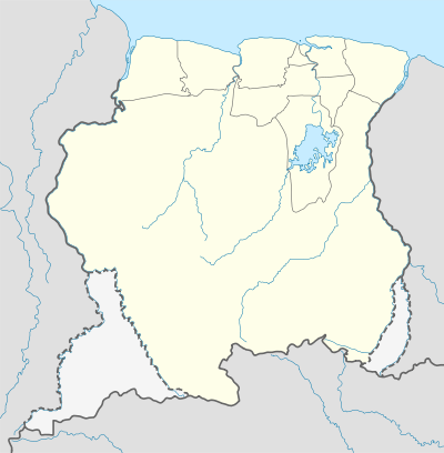 OEM Location in Suriname | |||||||||||
| Runways | |||||||||||
| |||||||||||
Vincent Fayks Airport (IATA: OEM, ICAO: SMPA), in Pepejoe near Paloemeu, Suriname. The airport was constructed as part of Operation Grasshopper. It was named after the Polish pilot Vincent Fajks who crashed with co-pilot Ronald Kappel with their Aero Commander AC 520 (PZ-TAG) airplane at the site in October 1959, while trying to deliver building materials for the airport.[3] They both received a state funeral in Paramaribo on October 10th, 1959. Paloemeu is a popular jungle resort on the Tapanahony River.
Charters and destinations
Charter Airlines serving this airport are:
| Airlines | Destinations |
|---|---|
| Blue Wing Airlines | Paramaribo, Zorg en Hoop Airport[4] |
| Caricom Airways | Paramaribo, Zorg en Hoop Airport[5] |
| Gum Air | Paramaribo, Zorg en Hoop Airport[6] |
| Hi-Jet Helicopter Services | Paramaribo, Zorg en Hoop Airport |
| Suriname Air Force / Surinaamse Luchtmacht | Paramaribo, Zorg en Hoop Airport |
See also
 Suriname portal
 Aviation portal
- List of airports in Suriname
- Transport in Suriname
References
- ↑ Airport information for OEM at Great Circle Mapper.
- ↑ Google Maps - Vincent Fayks
- ↑ http://aviation-safety.net/wikibase/wiki.php?id=163559
- ↑ Blue Wings schedule
- ↑ Caricom destinations Archived March 15, 2013, at the Wayback Machine.
- ↑ Gum Air destinations
External links
This article is issued from Wikipedia - version of the 12/4/2016. The text is available under the Creative Commons Attribution/Share Alike but additional terms may apply for the media files.