Vila de Rei
| Vila de Rei | |||
|---|---|---|---|
| Municipality | |||
| |||
 | |||
| Coordinates: 39°40′N 8°08′W / 39.667°N 8.133°WCoordinates: 39°40′N 8°08′W / 39.667°N 8.133°W | |||
| Country |
| ||
| Region | Centro | ||
| Subregion | Pinhal Interior Sul | ||
| Intermunic. comm. | Médio Tejo | ||
| District | Castelo Branco | ||
| Parishes | 3 | ||
| Government | |||
| • President | Ricardo Jorge Martins Aires (PSD) | ||
| Area | |||
| • Total | 191.55 km2 (73.96 sq mi) | ||
| Population (2011) | |||
| • Total | 3,452 | ||
| • Density | 18/km2 (47/sq mi) | ||
| Time zone | WET/WEST (UTC+0/+1) | ||
| Website | http://www.cm-viladerei.pt/ | ||


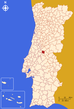
Vila de Rei (Portuguese pronunciation: [ˈvilɐ ðɨ ˈʁɐj]) is a municipality in the district of Castelo Branco in Portugal. The population in 2011 was 3,452,[1] in an area of 191.55 km².[2]
A small municipality covered with pinewoods, located precisely at the centre of Portugal, as the Milriça Peak, one of its most interesting monuments, is the tower rising at an altitude of 600 metres (2,000 feet) and built to mark the Mainland Portugal's geodesic centre. In addition, the site offers a spectacular panoramic view over a vast territory and includes a small Geodesy Museum.
The present mayor is Ricardo Jorge Martins Aires, elected by the Social Democratic Party. The municipal holiday is September 19.
Monuments and landmarks
At the small town of Vila de Rei, it is worth admiring the 18th century Parish Church and the Miserichord Chapel. A natural curiosity of Vila de Rei is the Penedo Furado (pierced boulder), which has been adapted to shelter two belvederes, set on a rocky platform surrounded by woods and small water-falls. The Saint Michael Castro, on the top of the Ladeira mountains, at an altitude of about 493 metres (1,600 ft), is a fortified and walled settlement considered to be of Celtic origin and dates from the Iron Age, having been classified as a National Monument. Vila de Rei is also on the route of shale villages having one of the most beautiful examples is the Água Formosa.
Gastronomy
Typical gastronomy in the region includes dishes such as fish soup, roast kid or bucho recheado (stuffed pig's stomach), besides typical honey cakes and rice pudding.
Parishes
Administratively, the municipality is divided into 3 civil parishes (freguesias):[3]
- Fundada (638 inhabitants - 2011 Census)[4]
- São João do Peso (204 inhabitants - 2011 Census)[5]
- Vila de Rei (2,610 inhabitants - 2011 Census)
Notes
- ↑ Instituto Nacional de Estatística
- ↑ Direção-Geral do Território
- ↑ Diário da República. "Law nr. 11-A/2013, page 552 129" (pdf) (in Portuguese). Retrieved 4 August 2014.
- ↑ Includes the locations of Abrunheiro Grande, Abrunheiro Pequeno, Cabeça do Poço, Fonte das Eiras, Fouto, Lagoa Cimeira, Lagoa Fundeira, Monte Novo, Relva do Boi, Ribeira, Silveira, Sobreiras Altas and Vilar do Ruivo.
- ↑ Includes the locations of Algar, Cimo de Valongo, S. João do Peso, Portela dos Colos and Sesmarias.
External links
![]() Media related to Vila de Rei at Wikimedia Commons
Media related to Vila de Rei at Wikimedia Commons