Victory Boulevard (Staten Island)
| Victory Boulevard | ||||
|---|---|---|---|---|
|
Map of Staten Island with Victory Boulevard highlighted in red | ||||
| Route information | ||||
| Length: |
8.06 mi[1] (12.97 km) Former NY 439A: 4.42 miles (7.11 km)[1] | |||
| Existed: | 1816[2] – present | |||
| Major junctions | ||||
| West end: | Dead end at Arthur Kill in Travis | |||
|
| ||||
| East end: | Bay Street Landing in St. George | |||
| Location | ||||
| Counties: | Richmond | |||
| Highway system | ||||
| ||||
_map.png)
Victory Boulevard is a major thoroughfare on Staten Island, measuring approximately 8.0 miles (12.87 km) and stretching from the west shore community of Travis to the upper east shore communities of St. George and Tompkinsville. In the late 1940s, the portion of Victory Boulevard between Richmond Avenue and Forest Avenue was designated as New York State Route 439A (NY 439A). The section between Forest Avenue and Bay Street became part of NY 439 at the same time. Both designations were removed in the late 1960s.
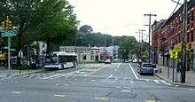
Route description
The street follows a path similar to the Staten Island Expressway, an integral Staten Island traffic route. Both roadways intersect Clove Road, Slosson Avenue, Todt Hill Road, Bradley Avenue, the Dr. Martin Luther King, Jr. Expressway, Richmond Avenue and the West Shore Expressway, as well as each other. Forest Avenue, too, is intersected by both roads; however, Forest and the Staten Island Expressway are on the opposite extremities of the island.
Incidentally, the boulevard is the only street on Staten Island that meets three different expressways by way of interchanges. It is exit 7 for the West Shore Expressway, exit 10 for the Staten Island Expressway westbound (exit 8 eastbound) and exit 11 for the Dr. Martin Luther King, Jr. Expressway.

A number of prominent Staten Island sites and events are located along Victory Boulevard. Among these are the Travis Independence Day Parade, the Sylvan Grove Cemetery, the Mid-Island Little League field and CSI (College of Staten Island), formerly the Willowbrook State School. The Bulls' Head Tavern, a pub known for its Tory meetings during the American Revolution, also stood on Victory Boulevard, on the corner with Richmond Avenue.
History
Victory Boulevard was established in 1816 by the Richmond Turnpike Company as the Richmond Turnpike. The toll road was owned by Daniel D. Tompkins, a prominent Staten Islander who, a year later, became Vice President of the United States. The route was "promoted as the fastest...from New York to Philadelphia."[2] Ferries from Manhattan and Brooklyn would dock at the eastern end of the turnpike, at Bay Street. Horse-drawn carriages would carry passengers to Travis, known at the time as Long Neck or the New Blazing Star Ferry, whence a ferry would carry people over the Arthur Kill to Woodbridge Township, New Jersey. From the 1860s to 1930, Travis was known as Linoleumville, the home of America's first Linoleum factory.[3]
After World War I, the Richmond Turnpike was renamed Victory Boulevard in honor of the allied victory. The segment of Victory Boulevard from Richmond Avenue (then-NY 440) in Bulls Head to Forest Avenue (then-NY 439) in Silver Lake was designated as NY 439A in the late 1940s. East of Forest Avenue, Victory Boulevard was designated as part of NY 439 down to Bay Street.[4][5] Both designations were removed from Victory Boulevard c. 1968.[6][7]
Major intersections
The entire route is in Richmond County.
| Location | mi[1] | km | Destinations | Notes | |
|---|---|---|---|---|---|
| Travis | 0.00 | 0.00 | Dead end at Arthur Kill | ||
| 0.58 | 0.93 | Exit 7 (NY 440) | |||
| Willowbrook | 2.66 | 4.28 | Richmond Avenue | Former routing of NY 440; former western terminus of NY 439A | |
| 3.31 | 5.33 | Exits 8 and 10 (I-278) | |||
| Tompkinsville | 7.08 | 11.39 | Forest Avenue | Former routing of NY 439; former eastern terminus of NY 439A | |
| St. George | 8.06 | 12.97 | Bay Street | ||
| 1.000 mi = 1.609 km; 1.000 km = 0.621 mi | |||||
See also
.svg.png) New York Roads portal
New York Roads portal
References
- 1 2 3 "National Highway Planning Network GIS data". Federal Highway Administration. version 2005.08. Retrieved February 24, 2008. Check date values in:
|date=(help) - 1 2 "Staten Island Timeline – 1800s". New York Public Library. Archived from the original on March 11, 2007. Retrieved February 3, 2010.
- ↑ "William T. Davis Wildlife Refuge Historical Sign". New York City Department of Parks & Recreation. Retrieved January 25, 2010.
- ↑ Official Highway Map of New York State (Map) (1947–48 ed.). Cartography by General Drafting. State of New York Department of Public Works.
- ↑ New York (Map). Cartography by Rand McNally and Company. Socony-Vacuum Oil Company. 1950.
- ↑ Gousha Road Atlas – New York and vicinity (Map). H.M. Gousha Company. 1967. Retrieved February 29, 2008.
- ↑ New York City and Vicinity including Long Island (Map) (1968–69 ed.). American Automobile Association. 1968.
External links
- New York State Route 439A at New York Routes