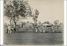
Victoria River Downs Station


Victoria River Downs Station also often called Victoria Downs and often referred to as The Big Run[1] is a pastoral lease that operates as a cattle station.
Location
It is located about 102 kilometres (63 mi) south east of Timber Creek and 252 kilometres (157 mi) west of Daly Waters in the Northern Territory. The property abuts the Daguragu Aboriginal Land Trust to the south, Camfield Station, Montejinni and Killarney Stations to the east, Delamere to the north and Humbert River Station and the Bilinarra-Jutpurra Aboriginal Land Trsut to the west. The Auvergne and Wave Hills Stock routes both pass through the station as does the Buntine Highway that passes through the south east corner.[2]
Description
Currently Victoria River Downs has an area of 8,900 square kilometres (3,436 sq mi) The property was once the world's largest pastoral property with an area of 41,000 square kilometres (15,830 sq mi), but following much of the land being resumed it is now less than half its former size, and less than half the size of the current largest, Anna Creek station.[3]
Several watercourses pass through the property including the Wickham River, Camfield River, Townsend River, Humbert River, Gill Creek, Blackskin Creek, Depot Creek, Jasper Creek and Battle Creek.[2]
The property is composed of several land types including ridges and plateaus on sandstone or dolomite, gently undulating plains of dolomite overlaid with loamy soils, limestone outcrops and alluvial floodplains with cracking clays. Vegetation includes wire grass, white grass and black spear grass on the red earth country with stands of ribbon grass, flinders grass, blue grass and feathertop wire grass on the clay country.[4]
The station has been operating for over 100 years and is currently owned by Heytesbury Pty. Ltd..[5] The eastern boundary of Victoria River Downs adjoins Killarney Station, Killarney was exised from Victoria Downs when the station exceeded 10,000 square miles (25,900 km2) in size.[6] The much smaller 1,000 square kilometres (386 sq mi) Humbert River station is on the western boundary.[7]
Camfield Station was also once an outstation of Victoria Downs which is now owned by the Australian Agricultural Company. This station occupies an area of 2,790 square kilometres (1,077 sq mi) and was won in a ballot in 1952 by Paul Vanderleer before having a series of owners, then was finally acquired by AACo. in 2004.[8]
History
The station was originally established in 1880 by Charles Fisher and Maurice Lyons, who also owned nearby Glencoe Station. The men stocked the property with 20,000 head of cattle that had been overlanded from Wilmot by Nat Buchanan.[9] The lease had been granted by the South Australian government in December 1879 for an area of land 15,890 square miles (41,155 km2). Fisher ran into monetary problems and following legal battles the property was awarded to Goldsbrough Mort & Co. Ltd in 1889. In early 1900 Goldsbrough sold the lease and the stock for £27,500 to a syndicate consisting of Forrest, Emmanuel & Company and the Kidman Brothers.
In 1893 the station was carrying an estimated herd of 23,000 cattle[10] and by 1894 the station occupied an area of 21,000 square kilometres (8,108 sq mi), carried 30,000 head of cattle and some 500 horses.[11] The station was shipping cattle at this time to Batavia via Singapore along with other stations in the area, in 1894 the station shipped 2,205 head for which they were paid £7717.[12]
By 1901 the station was carrying about 30,000 head of cattle.[13] and by 1907 Victoria River Downs was stocked with an estimated 69.350 head of cattle.[14]
In 1902 a partnership between Sidney Kidman and the Emanuel brothers[15] acquired the property which occupied an area of 10,954 square miles (28,371 km2) and was regarded as one of the largest cattle stations in the world.[16]
Sidney Kidman sold Victoria River Downs to Bovril Australian Estates in 1909 along with another two stations, one being Northcote and the other in Western Australia near Wyndham called Carlton Hill for a total of £200,000.[17]
By 1923 the size of the property was estimated at 13,100 square miles (33,929 km2) making it the largest property in the Northern Territory at the time.[18] In 1949 the Surveyor General of the Northern Territory, R. Miller, arrived to resume an area of 3,000 square miles (7,770 km2) from the eastern side of the property.[19] Parts of the property have since been carved up leaving an area of 12,000 square kilometres (4,633 sq mi).
William Buckland, a Melbourne businessman, purchased the property in 1955 and then sold again in 1960 to Hooker Corporation. When changes were made to the lease in 1961 the Animal Production Branch approached the Hooker Pastoral Company to excise a small portion of the lease to establish a research station. The 314 square kilometres (121 sq mi) area was surrendered in 1963. It was named the Victoria river Research Station in 1965 but is commonly referred to as Kidman Springs. The research station commenced operations 1969.[4] in In 1984 the station was sold again, this time to Peter Sherwin for A$11.6 million. Kerry Packer had sought to buy the property and had negotiated the sale agreement with Hooker but the Northern Territory government invoked its right of veto sale of large parcels of land and instead gave Sherwin approval. Packer acquired Newcastle Waters instead.[7]
Sherwin was subject to a takeover bid by Elders in 1988 and Elders gave a 17.4% share in the property to Robert Holmes a Court, by 1989 Holmes a Court owned all of Victoria River Downs which today trades as Heytesbury Beef.[20]
The station and surrounding areas were pounded with heavy rains in February 2010, receiving 747 millimetres (29 in) over the course of the month. This figure was the highest monthly total ever in the 120 years that rainfall has been recorded at Victoria River Downs, and smashed the previous record set in 2004.[21]
The station is served by the Victoria River Downs Airport, also owned by Heytesbury.
See also
References
- ↑ Jock Makin, The Big Run: The story of Victoria River Downs Station, Marleston, South Australia: JB Books 1999 (ISBN 9781876622008).
- 1 2 "Northern Territory Pastoral Properties" (PDF). Northern Territory Government. 2003. Retrieved 6 April 2015.
- ↑ "Victoria River". The Sydney Morning Herald. July 2011. Retrieved 17 December 2012.
- 1 2 "Victoria River Research Station (Kidman Springs)". Northern Territory Government. Retrieved 6 April 2015.
- ↑ "Victoria River Downs Station". 2010. Retrieved 17 December 2012.
- ↑ "Property: Killarney auction adds to VRD grazing land shift". Beef Central. July 2011. Retrieved 17 December 2012.
- 1 2 "End of an era as Packer quits bush". The Australian. Melbourne, Victoria: News Limited. 3 January 2009. Retrieved 18 December 2012.
- ↑ "AACo – Camfield Station". Beef Central. 2012. Retrieved 17 December 2012.
- ↑ "Historical Society of the NT's Field Trip to Victoria River Downs Station" (PDF). July 2011. Retrieved 17 December 2012.
- ↑ "Correspondence". South Australian Register. Adelaide: National Library of Australia. 22 April 1893. p. 4. Retrieved 18 December 2012.
- ↑ "Victoria River Downs – The Big Run". Flinders Range research. 2012. Retrieved 17 December 2012.
- ↑ "The cattle service". The Northern Territory Times. Darwin, Northern Territory: National Library of Australia. 23 February 1894. p. 3. Retrieved 19 December 2012.
- ↑ "The North-West Blacks". The West Australian. Perth: National Library of Australia. 29 May 1901. p. 2. Retrieved 16 February 2013.
- ↑ "The Territory". The Advertiser. Adelaide: National Library of Australia. 5 December 1908. p. 18. Retrieved 14 January 2013.
- ↑ G. C. Bolton (1981). "Emanuel, Isadore Samuel (1860–1954)". Australian Dictionary of Biography. Retrieved 9 November 2013.
- ↑ "Sale of Cattle Station". The Sydney Morning Herald. National Library of Australia. 17 March 1909. p. 6. Retrieved 10 November 2013.
- ↑ "Australian Cattle stations". South Australian Register. Adelaide: National Library of Australia. 31 March 1909. p. 5. Retrieved 18 December 2012.
- ↑ "Making it good for a few. Million acre leases of the Territory". The Northern Standard. Darwin, Northern Territory: National Library of Australia. 18 September 1923. p. 1. Retrieved 16 March 2013.
- ↑ "Around The Territory.". The Northern Standard. Darwin, Northern Territory: National Library of Australia. 22 July 1949. p. 8. Retrieved 28 November 2013.
- ↑ Jack Drake, The Wild West in Australia and America, Salisbury, Queensland: Boolarong Press 2012 (ISBN 9781921920479).
- ↑ "Top End pounded by record rains". Australian Broadcasting Corporation. 4 March 2012. Retrieved 5 January 2013.
Coordinates: 16°24′15″S 131°00′49″E / 16.40417°S 131.01361°E