Viborg, South Dakota
| Viborg, South Dakota | |
|---|---|
| City | |
 Location in Turner County and the state of South Dakota | |
| Coordinates: 43°10′22″N 97°4′51″W / 43.17278°N 97.08083°WCoordinates: 43°10′22″N 97°4′51″W / 43.17278°N 97.08083°W | |
| Country | United States |
| State | South Dakota |
| County | Turner |
| Incorporated | 1903[1] |
| Area[2] | |
| • Total | 0.40 sq mi (1.04 km2) |
| • Land | 0.40 sq mi (1.04 km2) |
| • Water | 0 sq mi (0 km2) |
| Elevation | 1,306 ft (398 m) |
| Population (2010)[3] | |
| • Total | 782 |
| • Estimate (2015)[4] | 762 |
| • Density | 1,955.0/sq mi (754.8/km2) |
| Time zone | Central (CST) (UTC-6) |
| • Summer (DST) | CDT (UTC-5) |
| ZIP code | 57070 |
| Area code(s) | 605 |
| FIPS code | 46-67020[5] |
| GNIS feature ID | 1265707[6] |
Viborg (pronounced VY'-burg[7]) is a city in Turner County, South Dakota, United States. The population was 782 at the 2010 census.
History
Founded by Danish-Americans, the city is named after the Danish city of Viborg.[8] The area was first settled by Danish migrants in the 1860s, founding a community known as Daneville. With the advent of the railway in 1893, a new settlement closer to the railway was created as Viborg. Viborg was incorporated as a city on August 25, 1903.[9]
Geography
Viborg is located at 43°10′22″N 97°4′51″W / 43.17278°N 97.08083°W (43.172664, -97.080757).[10]
According to the United States Census Bureau, the city has a total area of 0.40 square miles (1.04 km2), all of it land.[2]
Viborg has been assigned the ZIP code 57070 and the FIPS place code 67020.
Demographics
| Historical population | |||
|---|---|---|---|
| Census | Pop. | %± | |
| 1900 | 222 | — | |
| 1910 | 410 | 84.7% | |
| 1920 | 618 | 50.7% | |
| 1930 | 719 | 16.3% | |
| 1940 | 659 | −8.3% | |
| 1950 | 644 | −2.3% | |
| 1960 | 699 | 8.5% | |
| 1970 | 662 | −5.3% | |
| 1980 | 812 | 22.7% | |
| 1990 | 763 | −6.0% | |
| 2000 | 832 | 9.0% | |
| 2010 | 782 | −6.0% | |
| Est. 2015 | 762 | [11] | −2.6% |
| U.S. Decennial Census[12] 2015 Estimate[4] | |||
2010 census
As of the census[3] of 2010, there were 782 people, 360 households, and 189 families residing in the city. The population density was 1,955.0 inhabitants per square mile (754.8/km2). There were 429 housing units at an average density of 1,072.5 per square mile (414.1/km2). The racial makeup of the city was 98.6% White, 0.8% Native American, and 0.6% from two or more races. Hispanic or Latino of any race were 0.6% of the population.
There were 360 households of which 21.1% had children under the age of 18 living with them, 39.7% were married couples living together, 9.2% had a female householder with no husband present, 3.6% had a male householder with no wife present, and 47.5% were non-families. 43.6% of all households were made up of individuals and 21.9% had someone living alone who was 65 years of age or older. The average household size was 1.98 and the average family size was 2.69.
The median age in the city was 51.3 years. 18.9% of residents were under the age of 18; 6.7% were between the ages of 18 and 24; 16.9% were from 25 to 44; 24.9% were from 45 to 64; and 32.5% were 65 years of age or older. The gender makeup of the city was 46.2% male and 53.8% female.
2000 census
At the 2000 census,[5] there were 832 people, 366 households and 211 families residing in the city. The population density was 2,147.1 per square mile (823.7/km²). There were 403 housing units at an average density of 1,040.0 per square mile (399.0/km²). The racial makeup of the city was 99.40% White, 0.24% Native American, 0.12% Asian, and 0.24% from two or more races. Hispanic or Latino of any race were 0.12% of the population.
There were 366 households of which 22.7% had children under the age of 18 living with them, 48.9% were married couples living together, 6.0% had a female householder with no husband present, and 42.1% were non-families. 39.6% of all households were made up of individuals and 24.3% had someone living alone who was 65 years of age or older. The average household size was 2.11 and the average family size was 2.85.
20.0% of the population were under the age of 18, 6.6% from 18 to 24, 20.3% from 25 to 44, 18.4% from 45 to 64, and 34.7% who were 65 years of age or older. The median age was 47 years. For every 100 females there were 79.3 males. For every 100 females age 18 and over, there were 76.2 males.
The median household income was $29,231 and the median family income was $39,327. Males had a median income of $27,337 versus $20,625 for females. The per capita income for the city was $17,738. About 5.2% of families and 6.4% of the population were below the poverty line, including 3.2% of those under age 18 and 10.5% of those age 65 or over.
Notable people
- Max Gors, American jurist, former Associate Justice of the South Dakota Supreme Court
- Alvin Hansen, former professor of Economics at Harvard University, namesake of the Alvin Hansen Symposium on Public Policy
- Emmett Nelson, former pitcher of the Cincinnati Reds
References
- ↑ "SD Towns" (PDF). South Dakota State Historical Society. Retrieved 2010-02-16.
- 1 2 "US Gazetteer files 2010". United States Census Bureau. Archived from the original on January 24, 2012. Retrieved 2012-06-21.
- 1 2 "American FactFinder". United States Census Bureau. Retrieved 2012-06-21.
- 1 2 "Population Estimates". United States Census Bureau. Retrieved June 12, 2016.
- 1 2 "American FactFinder". United States Census Bureau. Archived from the original on September 11, 2013. Retrieved 2008-01-31.
- ↑ "US Board on Geographic Names". United States Geological Survey. 2007-10-25. Retrieved 2008-01-31.
- ↑ "Broadcast Pronunciation Guide and South Dakota Pronunciations". Associated Press. Retrieved 2009-11-10.
- ↑ Federal Writers' Project (1940). South Dakota place-names, v.1-3. University of South Dakota. p. 65.
- ↑ "Archived copy". Archived from the original on January 15, 2012. Retrieved December 31, 2011.
- ↑ "US Gazetteer files: 2010, 2000, and 1990". United States Census Bureau. 2011-02-12. Retrieved 2011-04-23.
- ↑ "Annual Estimates of the Resident Population for Incorporated Places: April 1, 2010 to July 1, 2015". Retrieved July 2, 2016.
- ↑ United States Census Bureau. "Census of Population and Housing". Archived from the original on May 11, 2015. Retrieved June 12, 2016.
External links
Municipalities and communities of Turner County, South Dakota, United States | ||
|---|---|---|
| Cities | 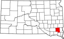 | |
| Towns | ||
| Townships | ||
| Unincorporated community | ||
| Footnotes | ‡This populated place also has portions in an adjacent county or counties | |