Vas County (former)
| Vas County Comitatus Castriferreus Vas vármegye | |||||
| County of the Kingdom of Hungary | |||||
| |||||
|
Coat of arms | |||||
 | |||||
| Capital | Szombathely 47°14′N 16°37′E / 47.233°N 16.617°ECoordinates: 47°14′N 16°37′E / 47.233°N 16.617°E | ||||
| History | |||||
| • | Established | 12th century | |||
| • | Treaty of Trianon | June 4, 1920 | |||
| Area | |||||
| • | 1910 | 5,474 km2 (2,114 sq mi) | |||
| Population | |||||
| • | 1910 | 435,793 | |||
| Density | 79.6 /km2 (206.2 /sq mi) | ||||
| Today part of | Slovenia, Austria, Hungary | ||||

Vas (German: Eisenburg, Slovene: Železna županija or Železna) was an administrative county (comitatus) of the Kingdom of Hungary. Its territory is now in western Hungary, eastern Austria and eastern Slovenia (Prekmurje). The capital of the county was Szombathely.
Geography
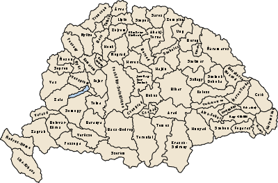
Vas County shared borders with the Austrian lands Lower Austria and Styria and the Hungarian counties Sopron, Veszprém and Zala. It stretched between the river Mura in the south, the foothills of the Alps in the west and the river Marcal in the east. The Rába River flowed through the county. Its area was 5472 km² around 1910.
History
Vas County arose as one of the first comitatus of the Kingdom of Hungary.
In 1920 by the Treaty of Trianon, the western part of the county became part of the new Austrian land Burgenland, and a small part in the southwest became part of the newly formed Kingdom of Serbs, Croats and Slovenes (from 1929 as Yugoslavia). The remainder stayed in Hungary, as the present Hungarian Vas County. A small part of former Sopron county went to Vas county. Some villages north of Zalaegerszeg went to Zala County, and a small region west of Pápa went to Veszprém County. Yugoslavian part of the county was occupied and annexed by Hungary between 1941 and 1945 during World War II.
Since 1991, when Slovenia became independent from Yugoslavia, the Yugoslavian part of former Vas county (known in Slovenian as Prekmurje) has been part of the Republic of Slovenia. In 1919 there was briefly proclaimed the Republic of Prekmurje, but it existed only 6 days, alike the Lajtabánság.
Demographics
1900
In 1900, the county had a population of 418,905 people and was composed of the following linguistic communities:[1]
Total:
- Hungarian: 222,474 (53.0%)
- German: 125,570 (30.0%)
- Croatian: 17,896 (4.3%)
- Slovak: 284 (0.1%)
- Romanian: 43 (0.0%)
- Serbian: 21 (0.0%)
- Ruthenian: 4 (0.0%)
- Other or unknown: 52,613 (12.6%)
According to the census of 1900, the county was composed of the following religious communities:[2]
Total:
- Roman Catholic: 313,858 (74.9%)
- Lutheran: 83,340 (19.9%)
- Calvinist: 12,151 (2.9%)
- Jewish: 9,429 (2.3%)
- Greek Catholic: 47 (0.0%)
- Greek Orthodox: 47 (0.0%)
- Unitarian: 15 (0.0%)
- Other or unknown: 18 (0.0%)
1910

In 1910, the county had a population of 435,793 people and was composed of the following linguistic communities:[3]
Total:
- Hungarian: 247,985 (56.9%)
- German: 117,169 (26.9%)
- Croatian: 16,230 (3.7%)
- Slovak: 288 (0.1%)
- Ruthenian: 48 (0.0%)
- Serbian: 23 (0.0%)
- Romanian: 14 (0.0%)
- Other or unknown: 54,036 (12.4%)
According to the census of 1910, the county was composed of the following religious communities:[4]
Total:
- Roman Catholic: 331,269 (76.0%)
- Lutheran: 82,027 (18.8%)
- Calvinist: 12,597 (3.0%)
- Jewish: 9,649 (2.9%)
- Greek Catholic: 151 (0.0%)
- Greek Orthodox: 71 (0.0%)
- Unitarian: 19 (0.0%)
- Other or unknown: 10 (0.0%)
Subdivisions
In the early 20th century, the subdivisions of Vas county were:
| Districts (járás) | |
|---|---|
| District | Capital |
| Celldömölk | Celldömölk |
| Felsőőr | Felsőőr, AT Oberwart |
| Körmend | Körmend |
| Kőszeg | Kőszeg |
| Muraszombat | Muraszombat, SI Murska Sobota |
| Németújvár | Németújvár, AT Güssing |
| Sárvár | Sárvár |
| Szentgotthárd | Szentgotthárd |
| Szombathely | Szombathely |
| Vasvár | Vasvár |
| Urban districts (rendezett tanácsú város) | |
| Kőszeg | |
| Szombathely | |
The towns of Oberwart and Güssing are now in Austria; Murska Sobota is now in Slovenia.
References
- ↑ "KlimoTheca :: Könyvtár". Kt.lib.pte.hu. Retrieved 2012-06-24.
- ↑ "KlimoTheca :: Könyvtár". Kt.lib.pte.hu. Retrieved 2012-06-24.
- ↑ "KlimoTheca :: Könyvtár". Kt.lib.pte.hu. Retrieved 2012-06-24.
- ↑ "KlimoTheca :: Könyvtár". Kt.lib.pte.hu. Retrieved 2012-06-24.