Vanrhynsdorp
| Vanrhynsdorp | |
|---|---|
|
Dutch Reformed Church in Vanrhynsdorp | |
 Vanrhynsdorp  Vanrhynsdorp  Vanrhynsdorp
| |
| Coordinates: 31°37′S 18°44′E / 31.617°S 18.733°ECoordinates: 31°37′S 18°44′E / 31.617°S 18.733°E | |
| Country | South Africa |
| Province | Western Cape |
| District | West Coast |
| Municipality | Matzikama |
| Established | 1751 |
| Area[1] | |
| • Total | 5.99 km2 (2.31 sq mi) |
| Population (2011)[1] | |
| • Total | 6,272 |
| • Density | 1,000/km2 (2,700/sq mi) |
| Racial makeup (2011)[1] | |
| • Black African | 6.9% |
| • Coloured | 71.9% |
| • Indian/Asian | 0.4% |
| • White | 19.7% |
| • Other | 1.0% |
| First languages (2011)[1] | |
| • Afrikaans | 95.3% |
| • English | 1.6% |
| • Xhosa | 1.2% |
| • Other | 1.8% |
| Postal code (street) | 8170 |
| PO box | 8170 |
| Area code | 027 |
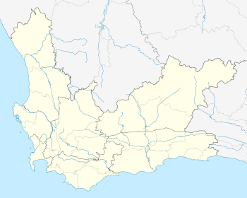
Vanrhynsdorp is a settlement in West Coast District Municipality in the Western Cape province of South Africa.
Vanrhynsdorp was founded as Trutro ("TroeTroe") after the area was first explored by Europeans in 1661 by Pieter van Meerhoff.[2] The Troe-Troe Zending ("Mission") dates to the 1751 completion of the Trutro Homestead which is still standing at Vanrhynsdorp.[2] The name of the town was changed to Vanrhynsdorp in 1881.[2]
The town is located at the edge of the Nama Karoo, an area of semi-desert succulent vegetation.[3] The mountains around the town were populated by the San people, a group of late stone age hunter-gatherers. Examples of rock art exist dating from this period exist in the area.[2]
The Steenkampskraal rare earth mineral deposit lies 80km to the north east of the town in nearby Namaqualand.[4]
References
- 1 2 3 4 "Main Place Vanrhynsdorp". Census 2011.
- 1 2 3 4 Vanrhynsdorp, SA Places. Retrieved 2012-05-06.
- ↑ Vanrhynsdorp, Cape West Coast, SA venues. Retrieved 2012-05-06.
- ↑ "'Steenkampskraal deposit". Retrieved 21 January 2011.

.svg.png)