Van Buren, New York
| Van Buren, New York | |
|---|---|
| Town | |
 Location in Onondaga County and the state of New York. | |
| Coordinates: 43°7′23″N 76°20′30″W / 43.12306°N 76.34167°WCoordinates: 43°7′23″N 76°20′30″W / 43.12306°N 76.34167°W | |
| Country | United States |
| State | New York |
| County | Onondaga |
| Government | |
| • Type | Town Council |
| • Town Supervisor | Claude E. Sykes (R) |
| • Town Council |
Members' List
|
| Area | |
| • Total | 36.1 sq mi (93.5 km2) |
| • Land | 35.6 sq mi (92.1 km2) |
| • Water | 0.6 sq mi (1.4 km2) |
| Elevation | 620 ft (189 m) |
| Population (2010) | |
| • Total | 13,185 |
| Time zone | Eastern (EST) (UTC-5) |
| • Summer (DST) | EDT (UTC-4) |
| ZIP code | 13027 |
| Area code(s) | 315 |
| FIPS code | 36-76760 |
| GNIS feature ID | 0979576 |
| Website |
www |
Van Buren is a town located in Onondaga County, New York, United States. As of the 2010 census, the town had a population of 13,185. The town is named after future President Martin van Buren, who was then governor of the state.
The town of Van Buren is located northwest of the city of Syracuse and is in the northwest part of the county. The portion of the town north and east of New York State Route 690 and south of the Seneca River is suburban in character, consisting primarily of single-family tract housing, some low-rise apartment buildings, park land, and some light industry. The balance of the town (south and west of NY 690) is primarily rural.
History

The town was part of the Central New York Military Tract of 1789 used to pay off soldiers. Most of the soldiers chose to sell their allotments for cash so that the town was briefly in the hands of land speculators until the actual residents purchased lots. Settlement began around 1791.
The Town of Van Buren was formed in 1829 from the Town of Camillus.
Geography
According to the United States Census Bureau, the town has a total area of 36.1 square miles (93 km2), of which, 35.6 square miles (92 km2) of it is land and 0.6 square miles (1.6 km2) of it (1.52%) is water.
The west town line is the border of Cayuga County.
Van Buren is south of the Seneca River/Erie Canal. The town is also west of Onondaga Lake. Cross Lake is located at the west town line.
The New York State Thruway (Interstate 90) crosses the south part of the town. Interstate 690 is a major highway intersecting the Thruway in the eastern part of Van Buren. New York State Route 31 is a north-south highway in the middle of Van Buren, and New York State Route 173 is an east-west highway in the south part of the town. New York State Route 48 follows the course of the Seneca River in the eastern part of Van Buren.
Demographics
| Historical population | |||
|---|---|---|---|
| Census | Pop. | %± | |
| 1830 | 2,890 | — | |
| 1840 | 3,021 | 4.5% | |
| 1850 | 3,873 | 28.2% | |
| 1860 | 3,037 | −21.6% | |
| 1870 | 3,038 | 0.0% | |
| 1880 | 3,091 | 1.7% | |
| 1890 | 3,444 | 11.4% | |
| 1900 | 3,297 | −4.3% | |
| 1910 | 3,260 | −1.1% | |
| 1920 | 3,425 | 5.1% | |
| 1930 | 3,814 | 11.4% | |
| 1940 | 3,691 | −3.2% | |
| 1950 | 4,900 | 32.8% | |
| 1960 | 8,754 | 78.7% | |
| 1970 | 11,859 | 35.5% | |
| 1980 | 12,585 | 6.1% | |
| 1990 | 13,367 | 6.2% | |
| 2000 | 12,667 | −5.2% | |
| 2010 | 13,185 | 4.1% | |
| Est. 2014 | 13,372 | [1] | 1.4% |
As of the census[3] of 2000, there were 12,667 people, 5,288 households, and 3,384 families residing in the town. The population density was 356.2 people per square mile (137.5/km²). There were 5,618 housing units at an average density of 158.0 per square mile (61.0/km²). The racial makeup of the town was 97.05% White, 0.80% African American, 0.51% Native American, 0.41% Asian, 0.02% Pacific Islander, 0.17% from other races, and 1.06% from two or more races. Hispanic or Latino of any race were 0.75% of the population.
There were 5,288 households out of which 29.0% had children under the age of 18 living with them, 50.6% were married couples living together, 9.7% had a female householder with no husband present, and 36.0% were non-families. 30.0% of all households were made up of individuals and 11.4% had someone living alone who was 65 years of age or older. The average household size was 2.37 and the average family size was 2.95.

In the town the population was spread out with 23.6% under the age of 18, 6.2% from 18 to 24, 30.2% from 25 to 44, 25.1% from 45 to 64, and 14.9% who were 65 years of age or older. The median age was 39 years. For every 100 females there were 91.6 males. For every 100 females age 18 and over, there were 88.3 males.
The median income for a household in the town was $43,003, and the median income for a family was $50,724. Males had a median income of $37,230 versus $26,842 for females. The per capita income for the town was $20,997. About 4.9% of families and 6.6% of the population were below the poverty line, including 7.6% of those under age 18 and 6.2% of those age 65 or over.
Communities and locations in Van Buren
- Bangall —- A hamlet north of Ionia. It was called "Sand Spring" when the first sawmill in the town was built there in 1815.
- Baldwinsville —- The south part of the Village of Baldwinsville.
- Crows Hollow —- A location northeast of Ionia.
- Daboll Corners – A location east of Jack's Reef.
- Ionia (formerly "Barns Corners") – A hamlet near the south town line on NY-173. Ionia was the site of the first significant settlement.
- Jack's Reef – A hamlet in the western part of the town by the Seneca River.
- Jones Point – A location west of Jack's Reef on the south shore of Cross Lake.
- Memphis —- A hamlet at the south town line, south of Ionia. It was formerly called "Canton."
- Seneca Knolls —- A hamlet
- Stiles —- A hamlet near the east town line and southeast of Seneca Knolls.
- Van Buren —- The hamlet of Van Buren is in the eastern part of the town near Seneca Knolls.
- Village Green —- A hamlet southeast of Baldwinsville.
- Warners —- A hamlet at the south town line on NY-173 near the Thruway.
References
- ↑ "Annual Estimates of the Resident Population for Incorporated Places: April 1, 2010 to July 1, 2014". Retrieved June 4, 2015.
- ↑ "Census of Population and Housing". Census.gov. Retrieved June 4, 2015.
- ↑ "American FactFinder". United States Census Bureau. Retrieved 2008-01-31.
External links
Municipalities and communities of Onondaga County, New York, United States | ||
|---|---|---|
| City | 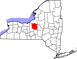 | |
| Towns | ||
| Villages | ||
| CDPs | ||
| Other hamlets |
| |
| Indian reservation | ||
| Footnotes | ‡This populated place also has portions in an adjacent county or counties | |