Valle, Arizona
| Valle, Arizona | |
|---|---|
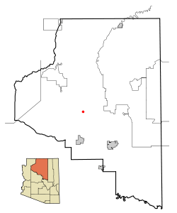 Location in Coconino County and the state of Arizona | |
 Valle, Arizona Location in the United States | |
| Coordinates: 35°39′13″N 112°08′19″W / 35.65361°N 112.13861°WCoordinates: 35°39′13″N 112°08′19″W / 35.65361°N 112.13861°W | |
| Country | United States |
| State | Arizona |
| Counties | Coconino |
| Elevation | 5,993 ft (1,827 m) |
| Population | |
| • Total | 832 |
| Time zone | MST (UTC-7) |
Valle is a census-designated place in Coconino County, Arizona, United States. As of the 2010 US Census the population of Valle was 832. It lies at an altitude of 5,994 feet (1,827 m),[1] at the junction of U.S. Route 180 and State Route 64. Its attractions include the Valle Airport (40G), the Planes of Fame Air Museum, and Flintstones Bedrock City. Drivers often stop at the town on their way to the Grand Canyon from either Williams or Flagstaff, as it is approximately at the halfway point.
Description
Valle is not shown on the Rand McNally Road Atlas annual series.[2] The town sits to the west of the highway intersections, with some streets to the east of US 180. The area is subdivided by roads for a planned community in which 1-acre (4,000 m2) lots were sold during the early 1960s. These roads are all dirt with the exception of the two main highways (US 180 and AZ 64). With the exception of a few property owners who have set up camp on their land, the area has not been developed.
Valle maintains no website. It has two main gas stations, several gift shops, and a small post office.
References
- ↑ U.S. Geological Survey Geographic Names Information System: Valle, Arizona
- ↑ Rand McNally. The Road Atlas '08. Chicago: Rand McNally, 2008, p. 7-8.
External links
Municipalities and communities of Coconino County, Arizona, United States | ||
|---|---|---|
| Cities | 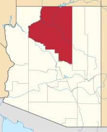 | |
| Towns | ||
| CDPs | ||
| Unincorporated communities |
| |
| Indian reservations | ||
| Ghost town | ||
| Footnotes | ‡This populated place also has portions in an adjacent county or counties | |