Valencia, Santa Clarita, California
| Valencia, Santa Clarita, California | |
|---|---|
| Neighborhood of Santa Clarita | |
|
Welcome Sign | |
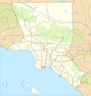 Valencia, Santa Clarita, California Position in Los Angeles and Orange Counties. | |
| Coordinates: 34°27′16.1496″N 118°34′16.1934″W / 34.454486000°N 118.571164833°WCoordinates: 34°27′16.1496″N 118°34′16.1934″W / 34.454486000°N 118.571164833°W | |
| Country |
|
| State |
|
| County |
|
| City |
|
| Elevation[1] | 1,017 ft (310 m) |
| Population (2010) | |
| • Total | 61,327 |
| Time zone | Pacific (PST) (UTC-8) |
| • Summer (DST) | PDT (UTC-7) |
| ZIP Code | 91354, 91355, 91385 |
| Area code(s) | 661 |
| GNIS feature ID | 2583151 |
| U.S. Geological Survey Geographic Names Information System: Valencia, Santa Clarita, California | |


Valencia is a neighborhood in Santa Clarita located within Los Angeles County, California. It is in the northwestern corner of the Santa Clarita Valley, generally west of Interstate 5, although Six Flags Magic Mountain, outside the city limits, is generally considered part of Valencia. Most of Valencia is part of a planned community; it was one of the four unincorporated communities (along with Saugus, Newhall, and Canyon Country) that merged to create the city of Santa Clarita, California, in 1987.[2] Valencia is home to the Six Flags Magic Mountain theme park and the adjacent Six Flags Hurricane Harbor water park.
History
In 1769, the Spanish Portola expedition, first Europeans to see inland areas of California, came up and over the pass from the San Fernando Valley and camped near the river on August 8–9. They found a large native village there and witnessed a wedding celebration. Fray Juan Crespi, a Franciscan missionary travelling with the expedition, named the river Santa Clara and noted in his diary that the place would be a good location for a mission. On the return trip, however, the party found a less strenuous trail through Conejo Valley. Later travelers also preferred that route, and Mission San Fernando Rey de España was established down in the valley.[3]
The master planned portion of Valencia was first planned in the 1960s by the Newhall Land and Farming Company. Development began in 1967, continues to the present day, and is nearing completion. Valencia is notable for its landscaped boulevards connecting a mix of apartment buildings, single-family detached homes, shopping centers, office parks and industrial warehouses. Major schools in Valencia include California Institute of the Arts, College of the Canyons, West Ranch High School, and Valencia High School.
Community
Valencia's residential areas are separated into villages, each with its own lifestyle (see List of Valencia, California residential villages). Almost all of Valencia's villages are close to schools, shopping, etc. In many of the villages, homeowner associations oversee the quality and upkeep of housing developments ranging in size from a few dozen homes to over a thousand. Many villages also have a Neighborhood Watch program in force.
Valencia also has a system of paved pathways over or under the streets and boulevards. The pathways are called paseos. They connect the entire community, making it possible to travel throughout nearly all of Valencia on foot or by bicycle without crossing a street at grade level. The paseo network is connected to the Santa Clara River Trail which runs east along the Santa Clara River to Canyon Country. Landowners in the Valencia area pay special taxes to maintain landscaping and the paseo system.
As of 2010, the estimated population of the 91354 ZIP code was 28,722 and the estimated median household income was $111,098; the estimated population of the 91355 ZIP code was 32,605 and the estimated median household income was $89,596. ZIP code 91385 is a Post Office box ZIP and has no population or median income. [4]
Notable people
- Annett Davis, beach volleyball player[5]
- Taylor Lautner, actor[6]
- Mychal Rivera, professional football player
- Naya Rivera, actress[7]
- Michael Trevino, actor[8]
- Shane Vereen, professional football player[9]
- Tamara Witmer, model[10]
See also
-
 Greater Los Angeles portal
References
| Wikivoyage has a travel guide for Valencia (California). |
| Wikimedia Commons has media related to Valencia, California. |
- ↑ U.S. Geological Survey Geographic Names Information System: Valencia, Santa Clarita, California
- ↑ Boston, John; Santa Clarita Valley Historical Society (2009). Santa Clarita Valley. Charleston, SC: Arcadia Publishing. p. 124. ISBN 9780738569383. Retrieved August 20, 2016.
- ↑ Bolton, Herbert E. (1927). Fray Juan Crespi: Missionary Explorer on the Pacific Coast, 1769-1774. HathiTrust Digital Library. pp. 152–155. Retrieved April 8, 2014.
- ↑ "Community Facts" American FactFinder, United States Census Bureau
- ↑ Beach volleyball information page
- ↑ "Taylor Lautner Wants to Go Back to School". Extratv.warnerbros.com. June 29, 2010.
- ↑ "Naya Rivera Bio". UsMagazine.com.
- ↑ "Michael Trevino Biography". Mostbeautifulman.com.
- ↑ Berry, Zuri (April 29, 2011). "Patriots select RB Shane Vereen with the 56th pick". NY Times Co.
- ↑ "Playmate data".