Vale of Holmesdale
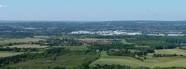


The Vale of Holmesdale is a comparatively narrow valley lying at the foot of the North Downs in Surrey and Kent, England. It is a relatively recent term compared to the many historic towns and villages that are in it. It stretches from Sugar Loaf Hill in Folkestone on the Kent coast through Ashford, Harrietsham, Maidstone, Riverhead/Sevenoaks, Oxted, Godstone, Redhill, Reigate, Dorking, Gomshall, Chilworth, Shalford and ending in Guildford.
Geology
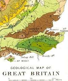
Its composition is mainly Gault Clay and Upper Greensand, although the Lower Chalk area at the foot of the Downs is included in the area. The vale ascends and descends many times to allow for different headwaters to rise before they pass through the North Downs of its east-west flowing rivers, four times rising gently towards Lenham and Westerham (Kent), Reigate and Wotton (Surrey). Geologically it makes sense to study the whole as a unit.
Rivers
The headwaters of the River Stour flows along the vale as does the River Medway for part of its length, further to the west,[1] then do the River Darent, River Mole and River Tillingbourne.
The name of the vale comes from the Holm Oak (Quercus ilex), a non-indigenous evergreen oak, which was once common in the area.[2][3] The Guildford-Redhill railway line runs along the Vale of Holmesdale between Gomshall and Reigate.
Transport
The M25 runs along the Vale of Holmesdale from its descent into the vale just before Sevenoaks at Junction 5 clockwise, running past Clackett Lane, before ascending up the downs at Reigate however the A25 road continues on to Guildford in the vale itself.
Usage of the term
Owing to its separate rivers, it is not in general usage however there is the Holmesdale Building Society founded in Reigate, Holmesdale Community Infants' School (formerly on Holmesdale Road, Reigate) and The Holmesdale School in Snodland. The general alternative terms used are simply the gault clay belt mixed with (eroded) upper greensand, or the separate river valleys, see North Downs and Greensand Ridge for more studied geological concepts. Historically the Pilgrims' Way towns and villages may have been a term used.
References
- ↑ Britain's Structure and Scenery, L.Dudley Stamp, Pub Sept 1946, Collins New Naturalist Series.
- ↑ J Timbs (1823) A picturesque promenade round Dorking, in Surrey 2nd ed.
- ↑ Encyclopaedia Perthensis; Or Universal Dictionary of the Arts, Sciences, Literature (1816) 2nd ed.
Coordinates: 51°14′N 0°20′W / 51.233°N 0.333°W