Valatie, New York
| Valatie, New York | |
|---|---|
| Village | |
|
Beaver Mill Falls, also known as Valatie Kill Falls | |
| Nickname(s): Vaaltje ("Little Falls") | |
| Motto: "What a Village Should Be" | |
 Location of Valatie, New York | |
| Coordinates: 42°24′50″N 73°40′39″W / 42.41389°N 73.67750°WCoordinates: 42°24′50″N 73°40′39″W / 42.41389°N 73.67750°W | |
| Country | United States |
| State | New York |
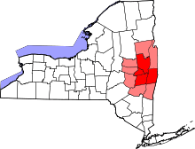
| County | Columbia |
| Town | Kinderhook |
| Settled | 1665 |
| Area | |
| • Total | 1.27 sq mi (3.28 km2) |
| • Land | 1.25 sq mi (3.25 km2) |
| • Water | 0.01 sq mi (0.03 km2) |
| Elevation | 240 ft (73 m) |
| Population (2010) | |
| • Total | 1,819 |
| • Density | 1,450/sq mi (560.0/km2) |
| Time zone | Eastern (EST) (UTC-5) |
| • Summer (DST) | EDT (UTC-4) |
| ZIP code | 12184 |
| Area code(s) | 518 |
| FIPS code | 36-76617 |
| GNIS feature ID | 0968342 |
| Website |
www |

Valatie (/vəˈleɪʃə/; və-LAY-shə) is a village with several waterfalls in Columbia County, New York, United States. The population was 1,819 at the 2010 census.[1] The village is at the center of the town of Kinderhook on US 9.
History
.jpg)

Valatie was first named Pachaquak, meaning "cleared meadow", by the earliest Native American settlers—Algonquian Mohicans—who lived along the banks of Valatie's two waterways now referred to as Valatie Kill and Kinderhook Creek.
Part of the original New Netherland, the first European settlers were the Dutch who settled Kinderhook around 1665, and named this area "Vaaltje", which means "little falls".[2] The first post office was established in 1832. By the early 19th century there were nine cotton mills in Valatje operating on power derived from the famous waterfalls; the village was incorporated in 1856. With a bustling Main Street, Valatie was considered the center of commerce in northern Columbia County throughout the 19th century.
Prominent architectural landmarks include the First Presbyterian Church of Valatie. This congregation formed in 1835; the high Victorian Gothic Revival-style building designed by Ogden & Wright Architects was built in 1878 of red brick with limestone trim, slate roof and slate dormer windows. It features a porte-cochère and open bell tower. It is listed on the National Register of Historic Places.
In 1923, Beaver Mill Falls in Valatie was a location for Haldane of the Secret Service, a film produced, directed by, and starring the famed escape artist Harry Houdini.
Valatie is home to the nation's first "Santa Claus Club", founded in 1946 after World War II by fifteen village veterans to provide holiday gifts for several critically ill children. Since that time the scope has widened. Every Christmas Eve, Santa travels throughout the village, personally visiting every child under age ten.
A Winter Walk parade and festival is hosted annually in mid-December by the Valatie Economic Redevelopment Association, in collaboration with the village. The parade is populated by the Kinderhook, Valatie, Niverville, and Stuyvesant fire trucks and rescue vehicles, as well as marching bands from the Ichabod Crane High School and marchers from the Girl Scouts, Cub Scouts, and the Valatie Free Library. Elves and marionettes march along with the vintage and new vehicles. Hay rides stop at various venues along the parade route. A highlight of this winter parade is Santa Claus riding (and waving) in a sleigh. After the parade, Santa parks his sleigh at the historic Valatie Community Theatre, and holds court inside, listening to kids' requests.
The Valatie Free Library was begun in 1928 as a casual circulation of books. It was incorporated in 1931 and moved to a small 600-square-foot (56 m2) 19th-century cottage on Church Street, where it continues to operate. In December 2011, the Board of Trustees selected building designer David Bienn to design a new library in the historic Kinderhook Railroad Freight Barn located on Kinderhook Street. In June 2012, Bienn's proposed library was highlighted with international status by the United Nations at the 2012 "Rio+20" Earth Day Summit in Rio de Janeiro as an iconic sustainable community template that can be replicated across the globe, preserving the ability for libraries and communities to thrive in the future.
Recent immigrants to Valatie include members of the creative class, with musicians, authors, artists, and designers resettling from the NY metro area, as well as Albany commuters. The backdrop of waterfalls at both ends of Main Street is a daily presence that changes with the seasonal rain and snowfall.
In September 2006 the village of Valatie celebrated the 150th anniversary of its incorporation with two parades and a carnival followed by fireworks and live music by the StringMasters, held at Callan Park.
The First Presbyterian Church, Wild's Mill Complex, and Nathan Wild House are listed on the National Register of Historic Places.[3]
Geography
Valatie is located in the center of the town of Kinderhook in northern Columbia County. It is part of the Hudson Valley region of New York State. It is 21 miles (34 km) south of Albany, the state capital, and 15 miles (24 km) northeast of Hudson.
According to the United States Census Bureau, the village has a total area of 1.27 square miles (3.28 km2), of which 1.25 square miles (3.25 km2) is land and 0.01 square miles (0.03 km2), or 0.95%, is surface water.[1] The village is located at the juncture of Valatie Kill with Kinderhook Creek, a tributary of the Hudson River. There are three waterfalls in the village, all along Main Street: Valatie Kill Falls/Wild's Falls, Little Falls Creek/Beaver Mill Falls, and Kinderhook Creek.
Nearby communities within the town of Kinderhook
- Niverville – A hamlet south of Kinderhook Lake on Routes 28B and 203, 2 miles (3 km) northeast of Valatie.
- Kinderhook – A village on U.S. Route 9, 2 miles (3 km) southwest of Valatie.
Demographics
| Historical population | |||
|---|---|---|---|
| Census | Pop. | %± | |
| 1880 | 1,775 | — | |
| 1890 | 1,437 | −19.0% | |
| 1900 | 1,300 | −9.5% | |
| 1910 | 1,219 | −6.2% | |
| 1920 | 1,301 | 6.7% | |
| 1930 | 1,246 | −4.2% | |
| 1940 | 1,208 | −3.0% | |
| 1950 | 1,225 | 1.4% | |
| 1960 | 1,237 | 1.0% | |
| 1970 | 1,288 | 4.1% | |
| 1980 | 1,620 | 25.8% | |
| 1990 | 1,487 | −8.2% | |
| 2000 | 1,712 | 15.1% | |
| 2010 | 1,819 | 6.3% | |
| Est. 2015 | 1,911 | [4] | 5.1% |
As of the census[6] of 2010, the total population of Valatie is 1,819, which is 6.25% more than it was in 2000. The population density was 1,388.3 people per square mile (537.4/km²). There were 627 housing units at an average density of 508.4 per square mile (196.8/km²). The racial makeup of the village was 93.84% White, 2.14% Native American, 1.37% African American, 0.49% Asian, 0.35% from other races, and 1.70% from two or more races. Hispanic or Latino of any race were 10.23% of the population.
Valatie's median household income was $60,365 in 2006-2010 and has grown by 36.03% since 2000. The income growth rate is higher than the state average rate of 24.79% and nearly twice the national average rate of 19.17%. The per capita income for the village was $16,650. About 7.94% of families and 8.68% of the population were below the poverty line, including 13.0% of those under age 18 and 15.6% of those age 65 or over.
There were 584 households out of which 36.8% had children under the age of 18 living with them, 49.0% were married couples living together, 12.3% had a female householder with no husband present, and 33.9% were non-families. 28.3% of all households were made up of individuals and 14.4% had someone living alone who was 65 years of age or older. The average household size was 2.51 and the average family size was 3.09.
In the village the population was spread out with 24.4% under the age of 18, 4.8% from 18 to 24, 27.5% from 25 to 44, 19.5% from 45 to 64, and 23.8% who were 65 years of age or older. The median age was 41 years. For every 100 females there were 80.6 males. For every 100 females age 18 and over, there were 73.6 males.
Filmography
- Haldane of the Secret Service (1924), directed by and starring Harry Houdini, co-starring Gladys Leslie; also starring Adele Ormsby and Edward Ormsby, filmed at Beaver Kill Falls in Valatie.
- Meskada (2009) starring Nick Stahl, Rachel Nichols, and Kellan Lutz, shot partially in Valatie.
Notable people
- Martin H. Glynn, 40th Governor of New York, from 1913 to 1914.[7]
- Virginia O'Hanlon, her 1897 letter to the New York Sun asking whether there really was a Santa Claus was the inspiration for the 1947 film, Miracle on 34th Street; the editorial response by the NY Sun to her letter has become one of the most popular holiday quotes, "Yes, Virginia, There Is A Santa Claus". Virginia O'Hanlon Douglas spent her final years in a nursing home in Valatie and is buried in the nearby village of Chatham.[8]
References
- 1 2 "Geographic Identifiers: 2010 Demographic Profile Data (G001): Valatie village, New York". U.S. Census Bureau, American Factfinder. Retrieved December 11, 2014.
- ↑ Lizzi, Dominick C. Valatie: The Forgotten History, A Rural Mill Village-- Microcosm of America. Valatie: Valatie Press. p. 8.
- ↑ National Park Service (2010-07-09). "National Register Information System". National Register of Historic Places. National Park Service.
- ↑ "Annual Estimates of the Resident Population for Incorporated Places: April 1, 2010 to July 1, 2015". Retrieved July 2, 2016.
- ↑ "Census of Population and Housing". Census.gov. Retrieved June 4, 2015.
- ↑ "American FactFinder". United States Census Bureau. Retrieved 2008-01-31.
- ↑ Bailey, Frankie Y.; Green, Alice P. (2009). Wicked Albany: Lawlessness & Liquor in the Prohibition Era. History Press. p. 14.
- ↑ Bellaver, Richard F. (2011). Characters of the Information and Communication Industry: 2nd Edition. AuthorHouse. p. 49.
External links
- Village of Valatie official website
- Valatie Economic Redevelopment Association (VERA)
- Town of Kinderhook
Municipalities and communities of Columbia County, New York, United States | ||
|---|---|---|
| City | 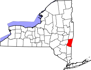 | |
| Towns | ||
| Villages | ||
| CDPs | ||
| Other hamlets | ||
| Footnotes | ‡This populated place also has portions in an adjacent county or counties | |