Urzhar District
| Urzhar | |
|---|---|
| District | |
| Үржар ауданы | |
 | |
| Country |
|
| Region | East Kazakhstan Region |
| Administrative center | Urzhar |
| Founded | 1928 |
| Area | |
| • Total | 23,400 km2 (9,000 sq mi) |
| Population (2013)[1] | |
| • Total | 81,008 |
| Time zone | East (UTC+6) |
Uerzhar (Kazakh: Үржар ауданы, Ürjar awdanı, ٷرجار اۋدانى) is a district of East Kazakhstan Region in the eastern part of Kazakhstan, which borders with China. The administrative center of the district is the selo of Urzhar.[2] Population: 81,008 (2013 estimate);[1] 83,174 (2009 Census results);[3] 95,312 (1999 Census results).[3]
References
- 1 2 "Население Республики Казахстан" (in Russian). Департамент социальной и демографической статистики. Retrieved 27 December 2013.
- ↑ www.geonames.de Subdivisions of Kazakhstan in local languages
- 1 2 "Население Республики Казахстан" (in Russian). Департамент социальной и демографической статистики. Retrieved 8 December 2013.
Capital: Oskemen | ||
| Districts | 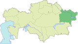 | |
| Major cities | ||
Coordinates: 47°05′34″N 81°37′40″E / 47.09278°N 81.62778°E
This article is issued from Wikipedia - version of the 9/19/2016. The text is available under the Creative Commons Attribution/Share Alike but additional terms may apply for the media files.